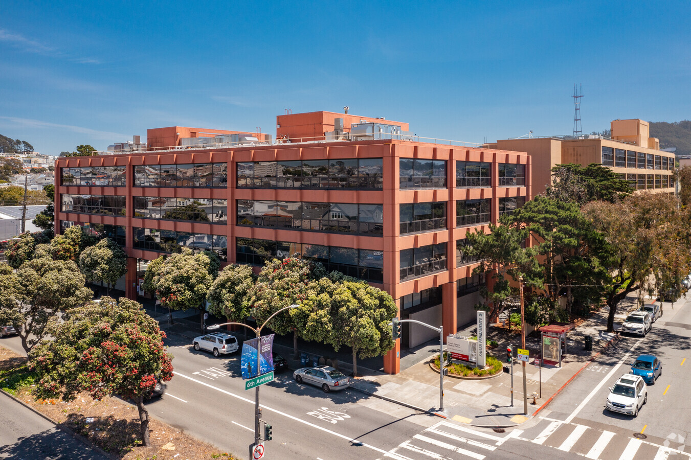
Property Record
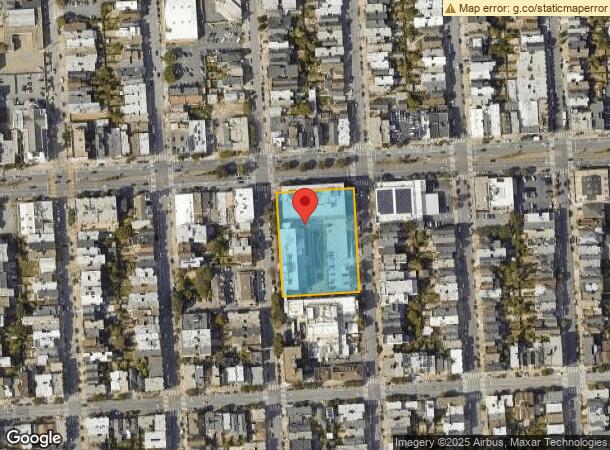
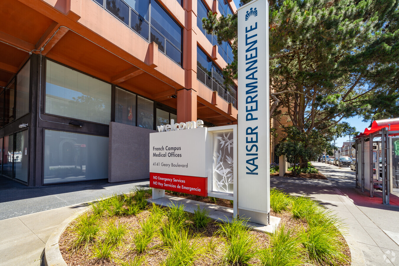
4141 Geary Blvd, San Francisco, CA 94118
NEARBY LISTINGS FOR SALE OR LEASE
Property Detail
4141 Geary Blvd
San Francisco-Redwood City-South San Francisco, CA
San Francisco
1539-003
California
Hospitalprivate
3
2023
1.76 AC
2023
West of Van Ness
045100
San Francisco
119,316 SF
DEMOGRAPHICS near 4141 Geary Blvd
1 Mile
3 Mile
5 Mile
2024 Total Population
51,704
434,906
738,122
2029 Population
48,200
403,591
683,085
Pop Growth 2024-2029
(6.78%)
(7.20%)
(7.46%)
Average Age
41
43
43
2024 Total Households
21,397
201,709
321,460
HH Growth 2024-2029
(7.33%)
(7.69%)
(7.79%)
Median Household Inc
$138,512
$130,063
$129,676
Avg Household Size
2.30
2.00
2.20
2024 Avg HH Vehicles
1.00
1.00
1.00
Median Home Value
$1,116,237
$1,112,420
$1,104,303
Median Year Built
1947
1948
1948
Nearby Places
- Restaurants
- Banks
- Shops
- Fitness
- Groceries
PUBLIC TRANSPORTATION
COMMUTER RAIL
San Francisco 4Th & King (Caltrain - Caltrain (Caltrain))
DRIVE
WALK
Distance
San Francisco 4Th & King (Caltrain - Caltrain (Caltrain))
12 min
5.3 mi
22Nd Street (Caltrain - Caltrain (Caltrain))
DRIVE
WALK
Distance
22Nd Street (Caltrain - Caltrain (Caltrain))
14 min
5.8 mi
AIRPORT
San Francisco International
DRIVE
WALK
Distance
San Francisco International
28 min
16.2 mi
Metro Oakland International
DRIVE
WALK
Distance
Metro Oakland International
39 min
23.7 mi
Freight Ports
Port of San Francisco
DRIVE
WALK
Distance
Port of San Francisco
12 min
4.7 mi
Nearby Properties
Address
Land Use
TOTAL SIZE
Lot Size
Zoning
Address
Land Use
TOTAL SIZE
Lot Size
Zoning
1,424,230 SF
2.60 AC
C3G
Address
Land Use
TOTAL SIZE
Lot Size
Zoning
1.52 AC
C3G
Address
Land Use
TOTAL SIZE
Lot Size
Zoning
291,522 SF
6.66 AC
CM
Address
Land Use
TOTAL SIZE
Lot Size
Zoning
24.37 AC
Address
Land Use
TOTAL SIZE
Lot Size
Zoning
342,727 SF
1.36 AC
C3G
Address
Land Use
TOTAL SIZE
Lot Size
Zoning
2.93 AC
Address
Land Use
TOTAL SIZE
Lot Size
Zoning
718 SF
18.55 AC
RH2
Address
Land Use
TOTAL SIZE
Lot Size
Zoning
496,104 SF
0.83 AC
Address
Land Use
TOTAL SIZE
Lot Size
Zoning
332,221 SF
1.17 AC
Address
Land Use
TOTAL SIZE
Lot Size
Zoning
4.41 AC
RH-3/RM-2
Address
Land Use
TOTAL SIZE
Lot Size
Zoning
450,000 SF
1.07 AC
C3G
Address
Land Use
TOTAL SIZE
Lot Size
Zoning
337,664 SF
0.36 AC
C3G
Address
Land Use
TOTAL SIZE
Lot Size
Zoning
409,895 SF
7.20 AC
RH3
Address
Land Use
TOTAL SIZE
Lot Size
Zoning
297,170 SF
0.43 AC
C3G
Address
Land Use
TOTAL SIZE
Lot Size
Zoning
213,553 SF
0.46 AC
C3G
Address
Land Use
TOTAL SIZE
Lot Size
Zoning
741,667 SF
1.96 AC
C3G
Address
Land Use
TOTAL SIZE
Lot Size
Zoning
2.40 AC
NC3
Address
Land Use
TOTAL SIZE
Lot Size
Zoning
241,907 SF
0.82 AC
C3G
Address
Land Use
TOTAL SIZE
Lot Size
Zoning
1,320,000 SF
3.01 AC
C3G
Address
Land Use
TOTAL SIZE
Lot Size
Zoning
250,843 SF
6.62 AC
NC3
Address
Land Use
TOTAL SIZE
Lot Size
Zoning
1.35 AC
Address
Land Use
TOTAL SIZE
Lot Size
Zoning
1.68 AC
RM2
Address
Land Use
TOTAL SIZE
Lot Size
Zoning
400,598 SF
1.59 AC
RC4
Address
Land Use
TOTAL SIZE
Lot Size
Zoning
3 AC
C3G
Address
Land Use
TOTAL SIZE
Lot Size
Zoning
Address
Land Use
TOTAL SIZE
Lot Size
Zoning
194,031 SF
0.63 AC
C3G
Address
Land Use
TOTAL SIZE
Lot Size
Zoning
225,851 SF
1.19 AC
NCT1
Address
Land Use
TOTAL SIZE
Lot Size
Zoning
271,387 SF
0.43 AC
C3G
Address
Land Use
TOTAL SIZE
Lot Size
Zoning
314,600 SF
0.62 AC
C3G
Address
Land Use
TOTAL SIZE
Lot Size
Zoning
162,220 SF
0.51 AC
C3G
The World's #1 Commercial Real Estate Marketplace
Connect with us
© 2025 CoStar Group
The information above has been obtained from sources believed reliable. While we do not doubt its accuracy we have not verified it and make no guarantee, warranty or representation about it. It is your responsibility to independently confirm its accuracy and completeness. Any projections, opinions, assumptions, or estimates used are for example only and do not represent the current or future performance of the property. The value of this transaction to you depends on tax and other factors which should be evaluated by your tax, financial, and legal advisors. You and your advisors should conduct a careful, independent investigation of the property to determine to your satisfaction the suitability of the property for your needs.