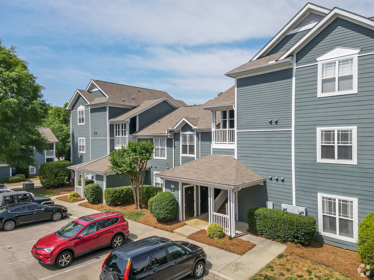
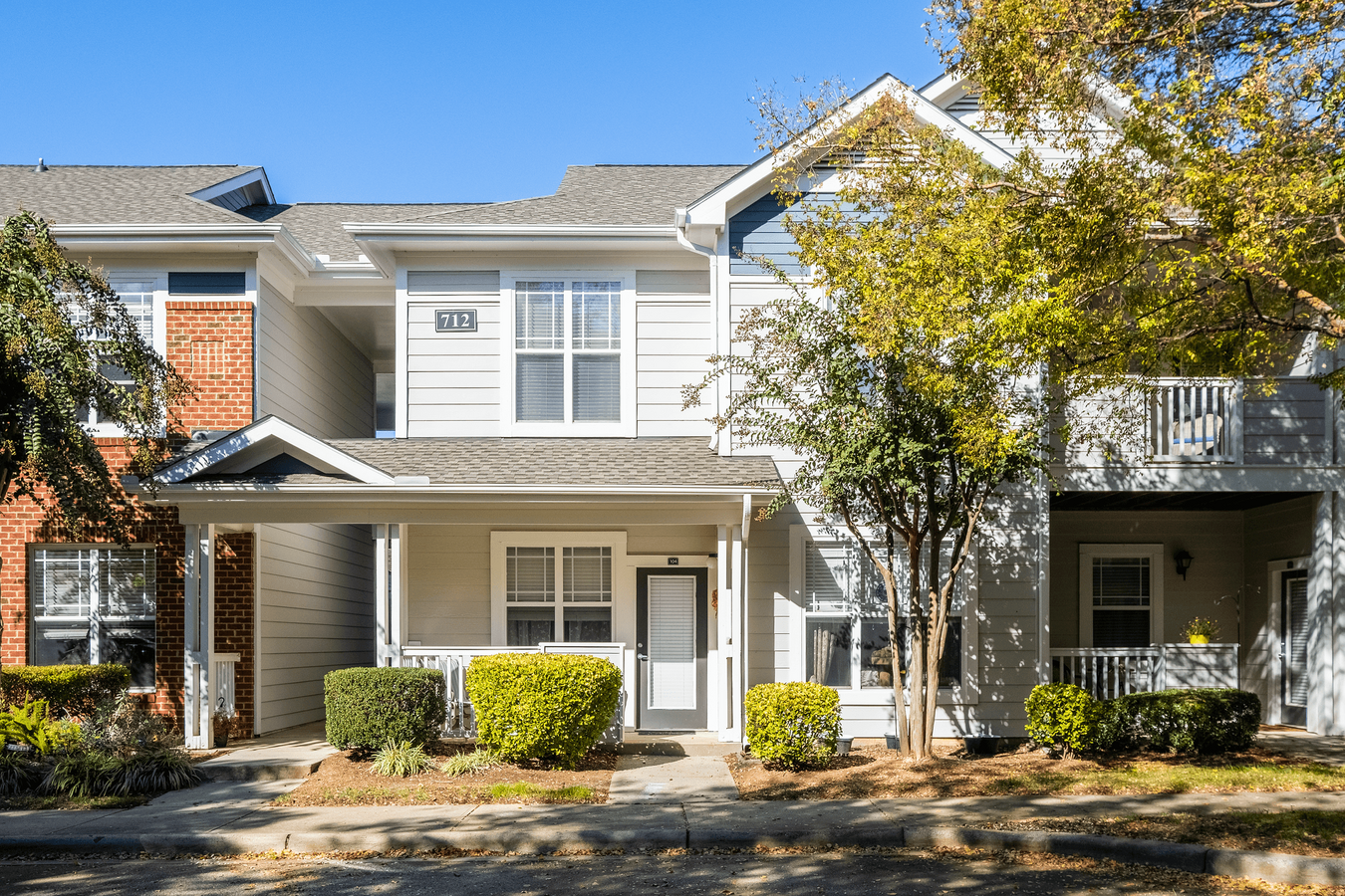
Property Record
415 Davidson Gateway Dr, Davidson, NC 28036

NEARBY LISTINGS FOR SALE OR LEASE
-
-
View all Davidson listings for sale on LoopNet.com
Property Detail
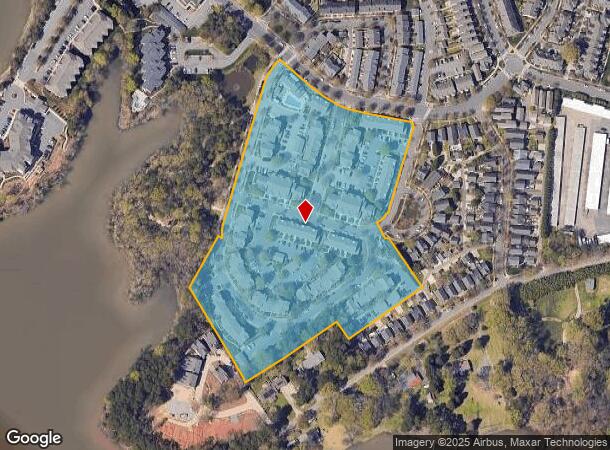
415 Davidson Gateway Dr
Charlotte-Concord-Gastonia, NC-SC
Ambleside Map 1
003-211-81
SEE 321181
Multifamilydwelling
Mecklenburg
AE
North Carolina
3710464400K
81
2023
10.03 AC
2023
Outer Huntersville/Cornelius
0064051016
Charlotte
194,079 SF
DEMOGRAPHICS near 415 Davidson Gateway Dr
1 Mile
3 Mile
5 Mile
2024 Total Population
6,731
39,275
88,107
2029 Population
7,061
41,878
95,086
Pop Growth 2024-2029
+ 4.90%
+ 6.63%
+ 7.92%
Average Age
43
42
41
2024 Total Households
3,107
16,129
35,299
HH Growth 2024-2029
+ 4.83%
+ 6.80%
+ 7.95%
Median Household Inc
$99,526
$106,400
$111,692
Avg Household Size
2.10
2.30
2.40
2024 Avg HH Vehicles
2.00
2.00
2.00
Median Home Value
$467,187
$466,162
$458,623
Median Year Built
1997
2000
2001
Nearby Places
- Restaurants
- Banks
- Shops
- Fitness
- Groceries
PUBLIC TRANSPORTATION
AIRPORT
Concord-Padgett Regional
DRIVE
WALK
Distance
Concord-Padgett Regional
27 min
19.2 mi
Charlotte/Douglas International
DRIVE
WALK
Distance
Charlotte/Douglas International
38 min
27.2 mi
Freight Ports
North Charleston Terminal
DRIVE
WALK
Distance
North Charleston Terminal
250 min
219.3 mi
Nearby Properties
Address
Land Use
TOTAL SIZE
Lot Size
Zoning
Address
Land Use
TOTAL SIZE
Lot Size
Zoning
1,664,047 SF
221.21 AC
CC
Address
Land Use
TOTAL SIZE
Lot Size
Zoning
78,336 SF
14.60 AC
CM
Address
Land Use
TOTAL SIZE
Lot Size
Zoning
320,754 SF
40.54 AC
NR
Address
Land Use
TOTAL SIZE
Lot Size
Zoning
569,776 SF
49.01 AC
VIP
Address
Land Use
TOTAL SIZE
Lot Size
Zoning
222,382 SF
31.90 AC
NR
Address
Land Use
TOTAL SIZE
Lot Size
Zoning
223,720 SF
18.42 AC
VC
Address
Land Use
TOTAL SIZE
Lot Size
Zoning
187,250 SF
22.35 AC
NR
Address
Land Use
TOTAL SIZE
Lot Size
Zoning
245,990 SF
5.21 AC
Address
Land Use
TOTAL SIZE
Lot Size
Zoning
13,985 SF
4.40 AC
CM
Address
Land Use
TOTAL SIZE
Lot Size
Zoning
239,596 SF
19.24 AC
NMX
Address
Land Use
TOTAL SIZE
Lot Size
Zoning
247,940 SF
32.28 AC
RP
Address
Land Use
TOTAL SIZE
Lot Size
Zoning
163,432 SF
3.40 AC
LPA
Address
Land Use
TOTAL SIZE
Lot Size
Zoning
166,340 SF
14.67 AC
C
Address
Land Use
TOTAL SIZE
Lot Size
Zoning
139,665 SF
14.37 AC
HC
Address
Land Use
TOTAL SIZE
Lot Size
Zoning
14,824 SF
5.76 AC
CM
Address
Land Use
TOTAL SIZE
Lot Size
Zoning
20,000 SF
23.91 AC
RLI
Address
Land Use
TOTAL SIZE
Lot Size
Zoning
109,316 SF
7.03 AC
NR
Address
Land Use
TOTAL SIZE
Lot Size
Zoning
85,617 SF
12.36 AC
VC
Address
Land Use
TOTAL SIZE
Lot Size
Zoning
96,656 SF
2.45 AC
CZ(MPD)
Address
Land Use
TOTAL SIZE
Lot Size
Zoning
81,162 SF
41.09 AC
NR
Address
Land Use
TOTAL SIZE
Lot Size
Zoning
72,450 SF
14.50 AC
C
Address
Land Use
TOTAL SIZE
Lot Size
Zoning
83,520 SF
3.98 AC
NR
Address
Land Use
TOTAL SIZE
Lot Size
Zoning
118,395 SF
4.25 AC
C
Address
Land Use
TOTAL SIZE
Lot Size
Zoning
71 AC
CC
Address
Land Use
TOTAL SIZE
Lot Size
Zoning
4,552 SF
96.84 AC
HC(CD)
Address
Land Use
TOTAL SIZE
Lot Size
Zoning
132,319 SF
16.64 AC
Address
Land Use
TOTAL SIZE
Lot Size
Zoning
142,187 SF
18.88 AC
VIP
Address
Land Use
TOTAL SIZE
Lot Size
Zoning
92,768 SF
10.66 AC
PD
Address
Land Use
TOTAL SIZE
Lot Size
Zoning
38,161 SF
2.57 AC
CM
The World's #1 Commercial Real Estate Marketplace
Connect with us
© 2025 CoStar Group
The information above has been obtained from sources believed reliable. While we do not doubt its accuracy we have not verified it and make no guarantee, warranty or representation about it. It is your responsibility to independently confirm its accuracy and completeness. Any projections, opinions, assumptions, or estimates used are for example only and do not represent the current or future performance of the property. The value of this transaction to you depends on tax and other factors which should be evaluated by your tax, financial, and legal advisors. You and your advisors should conduct a careful, independent investigation of the property to determine to your satisfaction the suitability of the property for your needs.