Property Record
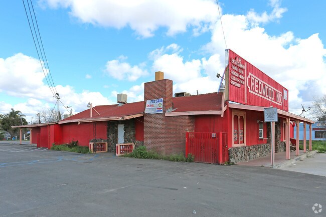
41617 Sultana Rd, Sultana, CA 93666


NEARBY LISTINGS FOR SALE OR LEASE
Property Detail
41617 Sultana Rd
Visalia-Porterville, CA
Sultana
021-153-009-000
SULTANA LT 10 BLK 4
Commercialnec
Tulare
X
California
06107C0340E
10
2024
0.38 AC
2025
NW Outlying Tulare County
000304
Visalia/Porterville
DEMOGRAPHICS near 41617 Sultana Rd
1 Mile
3 Mile
5 Mile
2024 Total Population
697
24,920
44,798
2029 Population
679
25,475
45,774
Pop Growth 2024-2029
(2.58%)
+ 2.23%
+ 2.18%
Average Age
34
34
33
2024 Total Households
177
6,660
11,864
HH Growth 2024-2029
(2.82%)
+ 2.19%
+ 2.13%
Median Household Inc
$50,869
$51,658
$53,203
Avg Household Size
3.50
3.70
3.70
2024 Avg HH Vehicles
2.00
2.00
2.00
Median Home Value
$430,555
$239,881
$250,181
Median Year Built
1981
1976
1977
Nearby Places
Map Layers
Map Styles
 Street
 Aerial
- Restaurants
- Banks
- Shops
- Fitness
- Groceries
PUBLIC TRANSPORTATION
AIRPORT
Fresno Yosemite International
DRIVE
WALK
Distance
Fresno Yosemite International
48 min
33.3 mi
Freight Ports
Port of Stockton
DRIVE
WALK
Distance
Port of Stockton
189 min
158.3 mi
SALE & LEASE HISTORY
LISTING DATE
SALE/LEASE

Sep 23, 2016
For Sale
May 15, 2017
For Sale
Mar 03, 2017
For Sale
Nearby Properties
Address
Land Use
TOTAL SIZE
Lot Size
Zoning
Address
Land Use
TOTAL SIZE
Lot Size
Zoning
371,216 SF
45.02 AC
M-1
Address
Land Use
TOTAL SIZE
Lot Size
Zoning
81,771 SF
5.37 AC
RM-2
Address
Land Use
TOTAL SIZE
Lot Size
Zoning
92,923 SF
12.33 AC
M-1
Address
Land Use
TOTAL SIZE
Lot Size
Zoning
26,692 SF
1.50 AC
Address
Land Use
TOTAL SIZE
Lot Size
Zoning
5.08 AC
Address
Land Use
TOTAL SIZE
Lot Size
Zoning
9.42 AC
Address
Land Use
TOTAL SIZE
Lot Size
Zoning
3,079 SF
18.99 AC
AE-20
Address
Land Use
TOTAL SIZE
Lot Size
Zoning
2.22 AC
Address
Land Use
TOTAL SIZE
Lot Size
Zoning
2,900 SF
4.95 AC
Address
Land Use
TOTAL SIZE
Lot Size
Zoning
5.91 AC
Address
Land Use
TOTAL SIZE
Lot Size
Zoning
2.63 AC
Address
Land Use
TOTAL SIZE
Lot Size
Zoning
58,804 SF
4.15 AC
Address
Land Use
TOTAL SIZE
Lot Size
Zoning
0.26 AC
Address
Land Use
TOTAL SIZE
Lot Size
Zoning
37,618 SF
3.64 AC
C-3
Address
Land Use
TOTAL SIZE
Lot Size
Zoning
16.44 AC
AE-20
Address
Land Use
TOTAL SIZE
Lot Size
Zoning
5.15 AC
Address
Land Use
TOTAL SIZE
Lot Size
Zoning
2,204 SF
0.49 AC
Address
Land Use
TOTAL SIZE
Lot Size
Zoning
86,579 SF
8.35 AC
C-2
Address
Land Use
TOTAL SIZE
Lot Size
Zoning
9,006 SF
1.08 AC
RCO
Address
Land Use
TOTAL SIZE
Lot Size
Zoning
8.21 AC
Address
Land Use
TOTAL SIZE
Lot Size
Zoning
155 AC
AE20
Address
Land Use
TOTAL SIZE
Lot Size
Zoning
29,211 SF
1.23 AC
RM-2
Address
Land Use
TOTAL SIZE
Lot Size
Zoning
2,830 SF
0.95 AC
C-3
Address
Land Use
TOTAL SIZE
Lot Size
Zoning
15,320 SF
0.94 AC
C-2
Address
Land Use
TOTAL SIZE
Lot Size
Zoning
24,722 SF
1.74 AC
Address
Land Use
TOTAL SIZE
Lot Size
Zoning
9,541 SF
1.75 AC
PO-SR
Address
Land Use
TOTAL SIZE
Lot Size
Zoning
82,547 SF
12.05 AC
AE-20
Address
Land Use
TOTAL SIZE
Lot Size
Zoning
4,975 SF
1.75 AC
M-1
The World's #1 Commercial Real Estate Marketplace
Connect with us
© 2025 CoStar Group
The information above has been obtained from sources believed reliable. While we do not doubt its accuracy we have not verified it and make no guarantee, warranty or representation about it. It is your responsibility to independently confirm its accuracy and completeness. Any projections, opinions, assumptions, or estimates used are for example only and do not represent the current or future performance of the property. The value of this transaction to you depends on tax and other factors which should be evaluated by your tax, financial, and legal advisors. You and your advisors should conduct a careful, independent investigation of the property to determine to your satisfaction the suitability of the property for your needs.