Property Record
417 Washington St, Coventry, RI 02816


NEARBY LISTINGS FOR SALE OR LEASE
Property Detail
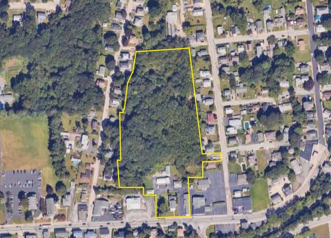
417 Washington St
COVE-000056-000000-000038
Kent
Commercialnec
Rhode Island
X
38
44003C0108H
6.09 AC
2024
Coventry/West Greenwich
2024
Providence
020604
Providence-Warwick, RI-MA
2,310 SF
DEMOGRAPHICS near 417 Washington St
1 Mile
3 Mile
5 Mile
2024 Total Population
14,124
62,459
116,856
2029 Population
14,253
63,165
118,174
Pop Growth 2024-2029
+ 0.91%
+ 1.13%
+ 1.13%
Average Age
40
43
43
2024 Total Households
6,074
26,918
48,307
HH Growth 2024-2029
+ 0.92%
+ 1.14%
+ 1.19%
Median Household Inc
$54,367
$65,814
$74,808
Avg Household Size
2.30
2.30
2.30
2024 Avg HH Vehicles
2.00
2.00
2.00
Median Home Value
$241,840
$279,814
$331,539
Median Year Built
1953
1968
1970
Nearby Places
Map Layers
Map Styles
 Street
 Aerial
- Restaurants
- Banks
- Shops
- Fitness
- Groceries
PUBLIC TRANSPORTATION
COMMUTER RAIL
Tf Green Airport (Providence/Stoughton Line - MBTA)
DRIVE
WALK
Distance
Tf Green Airport (Providence/Stoughton Line - MBTA)
11 min
6.3 mi
AIRPORT
Rhode Island Tf Green International
DRIVE
WALK
Distance
Rhode Island Tf Green International
16 min
8.6 mi
Freight Ports
Port of Davisville, RI
DRIVE
WALK
Distance
Port of Davisville, RI
24 min
12.7 mi
SALE & LEASE HISTORY
LISTING DATE
SALE/LEASE

Oct 07, 2020
For Sale
Nearby Properties
Address
Land Use
TOTAL SIZE
Lot Size
Zoning
Address
Land Use
TOTAL SIZE
Lot Size
Zoning
31,158 SF
20.36 AC
SMD
Address
Land Use
TOTAL SIZE
Lot Size
Zoning
24,276 SF
0.01 AC
A15
Address
Land Use
TOTAL SIZE
Lot Size
Zoning
83,747 SF
20.32 AC
GB
Address
Land Use
TOTAL SIZE
Lot Size
Zoning
171,576 SF
0.70 AC
O
Address
Land Use
TOTAL SIZE
Lot Size
Zoning
283,536 SF
97.97 AC
O
Address
Land Use
TOTAL SIZE
Lot Size
Zoning
11.48 AC
R-10
Address
Land Use
TOTAL SIZE
Lot Size
Zoning
18,720 SF
15 AC
PDR
Address
Land Use
TOTAL SIZE
Lot Size
Zoning
3,743 SF
A15
Address
Land Use
TOTAL SIZE
Lot Size
Zoning
Address
Land Use
TOTAL SIZE
Lot Size
Zoning
11.63 AC
R-10
Address
Land Use
TOTAL SIZE
Lot Size
Zoning
212,745 SF
19 AC
9239
Address
Land Use
TOTAL SIZE
Lot Size
Zoning
541,370 SF
34.08 AC
CI
Address
Land Use
TOTAL SIZE
Lot Size
Zoning
283,451 SF
51 AC
R-20
Address
Land Use
TOTAL SIZE
Lot Size
Zoning
25,632 SF
A15
Address
Land Use
TOTAL SIZE
Lot Size
Zoning
19.65 AC
BP
Address
Land Use
TOTAL SIZE
Lot Size
Zoning
240,425 SF
104.76 AC
R-10
Address
Land Use
TOTAL SIZE
Lot Size
Zoning
183,087 SF
4.29 AC
6000
Address
Land Use
TOTAL SIZE
Lot Size
Zoning
118,798 SF
25.61 AC
GB
Address
Land Use
TOTAL SIZE
Lot Size
Zoning
169,035 SF
4 AC
6000
Address
Land Use
TOTAL SIZE
Lot Size
Zoning
131,136 SF
32.78 AC
GB
Address
Land Use
TOTAL SIZE
Lot Size
Zoning
160,971 SF
175 AC
A15
Address
Land Use
TOTAL SIZE
Lot Size
Zoning
103,712 SF
12.20 AC
5314
Address
Land Use
TOTAL SIZE
Lot Size
Zoning
123,035 SF
99 AC
R-20
Address
Land Use
TOTAL SIZE
Lot Size
Zoning
102,720 SF
4.10 AC
Address
Land Use
TOTAL SIZE
Lot Size
Zoning
137,992 SF
1.30 AC
B
Address
Land Use
TOTAL SIZE
Lot Size
Zoning
147,866 SF
6.08 AC
A7
Address
Land Use
TOTAL SIZE
Lot Size
Zoning
147,866 SF
A7
Address
Land Use
TOTAL SIZE
Lot Size
Zoning
164,592 SF
3.02 AC
O
Address
Land Use
TOTAL SIZE
Lot Size
Zoning
112,360 SF
9.29 AC
4046
Address
Land Use
TOTAL SIZE
Lot Size
Zoning
6.36 AC
CI
The World's #1 Commercial Real Estate Marketplace
Connect with us
© 2025 CoStar Group
The information above has been obtained from sources believed reliable. While we do not doubt its accuracy we have not verified it and make no guarantee, warranty or representation about it. It is your responsibility to independently confirm its accuracy and completeness. Any projections, opinions, assumptions, or estimates used are for example only and do not represent the current or future performance of the property. The value of this transaction to you depends on tax and other factors which should be evaluated by your tax, financial, and legal advisors. You and your advisors should conduct a careful, independent investigation of the property to determine to your satisfaction the suitability of the property for your needs.