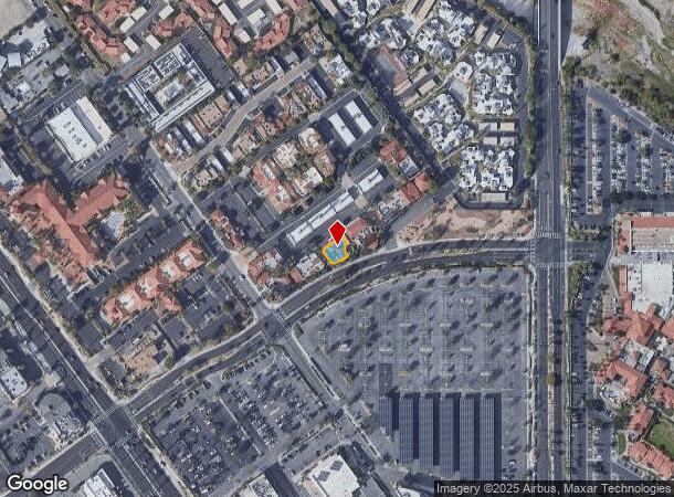
Property Record
41740 Rancho Las Palmas Dr, Rancho Mirage, CA 92270


NEARBY LISTINGS FOR SALE OR LEASE
Property Detail
41740 Rancho Las Palmas Dr
684-161-001
UNIT 1 CM 129/160
Officebuilding
Riverside
X
California
06065C2206G
1
2023
0.09 AC
2023
Coachella Valley
044917
Inland Empire (California)
3,664 SF
Riverside-San Bernardino-Ontario, CA
DEMOGRAPHICS near 41740 Rancho Las Palmas Dr
1 Mile
3 Mile
5 Mile
2024 Total Population
5,576
48,725
107,908
2029 Population
6,256
53,815
119,867
Pop Growth 2024-2029
+ 12.20%
+ 10.45%
+ 11.08%
Average Age
58
53
54
2024 Total Households
2,956
23,766
52,661
HH Growth 2024-2029
+ 11.94%
+ 10.28%
+ 10.92%
Median Household Inc
$98,250
$75,851
$81,121
Avg Household Size
1.80
2.00
2.00
2024 Avg HH Vehicles
2.00
2.00
2.00
Median Home Value
$626,546
$561,700
$622,432
Median Year Built
1977
1982
1985
Nearby Places
- Restaurants
- Banks
- Shops
- Fitness
- Groceries
PUBLIC TRANSPORTATION
AIRPORT
Palm Springs International
DRIVE
WALK
Distance
Palm Springs International
18 min
9.7 mi
Freight Ports
Port of San Diego
DRIVE
WALK
Distance
Port of San Diego
165 min
124.2 mi
SALE & LEASE HISTORY
LISTING DATE
SALE/LEASE

May 09, 2023
For Sale
Apr 05, 2017
For Lease
Nearby Properties
Address
Land Use
TOTAL SIZE
Lot Size
Zoning
Address
Land Use
TOTAL SIZE
Lot Size
Zoning
52,981 SF
16.98 AC
Address
Land Use
TOTAL SIZE
Lot Size
Zoning
400,240 SF
9.40 AC
PR060
Address
Land Use
TOTAL SIZE
Lot Size
Zoning
488,725 SF
24.17 AC
C1
Address
Land Use
TOTAL SIZE
Lot Size
Zoning
445,569 SF
17.55 AC
PUDC
Address
Land Use
TOTAL SIZE
Lot Size
Zoning
68.20 AC
Address
Land Use
TOTAL SIZE
Lot Size
Zoning
15,606 SF
162.93 AC
Address
Land Use
TOTAL SIZE
Lot Size
Zoning
214,678 SF
6.43 AC
Address
Land Use
TOTAL SIZE
Lot Size
Zoning
217,730 SF
8.64 AC
R1010
Address
Land Use
TOTAL SIZE
Lot Size
Zoning
306,484 SF
17.64 AC
OS
Address
Land Use
TOTAL SIZE
Lot Size
Zoning
164,751 SF
8.25 AC
Address
Land Use
TOTAL SIZE
Lot Size
Zoning
168,038 SF
6 AC
Address
Land Use
TOTAL SIZE
Lot Size
Zoning
103,940 SF
4.56 AC
Address
Land Use
TOTAL SIZE
Lot Size
Zoning
146,996 SF
6.75 AC
R1010
Address
Land Use
TOTAL SIZE
Lot Size
Zoning
179,685 SF
9.36 AC
Address
Land Use
TOTAL SIZE
Lot Size
Zoning
Address
Land Use
TOTAL SIZE
Lot Size
Zoning
137,962 SF
8.90 AC
Address
Land Use
TOTAL SIZE
Lot Size
Zoning
136,875 SF
8.87 AC
O
Address
Land Use
TOTAL SIZE
Lot Size
Zoning
150,818 SF
2.02 AC
R3
Address
Land Use
TOTAL SIZE
Lot Size
Zoning
58,823 SF
5.87 AC
C-N
Address
Land Use
TOTAL SIZE
Lot Size
Zoning
122,738 SF
16.13 AC
R1
Address
Land Use
TOTAL SIZE
Lot Size
Zoning
41,533 SF
1.38 AC
C1SP
Address
Land Use
TOTAL SIZE
Lot Size
Zoning
209,000 SF
7.12 AC
Address
Land Use
TOTAL SIZE
Lot Size
Zoning
82,028 SF
8.32 AC
PR6
Address
Land Use
TOTAL SIZE
Lot Size
Zoning
44,823 SF
12.07 AC
CG
Address
Land Use
TOTAL SIZE
Lot Size
Zoning
65,000 SF
9.51 AC
Address
Land Use
TOTAL SIZE
Lot Size
Zoning
86,064 SF
6.95 AC
Address
Land Use
TOTAL SIZE
Lot Size
Zoning
50,318 SF
0.87 AC
PR060
Address
Land Use
TOTAL SIZE
Lot Size
Zoning
66,156 SF
5.85 AC
Address
Land Use
TOTAL SIZE
Lot Size
Zoning
36,514 SF
2.10 AC
PUDA
The World's #1 Commercial Real Estate Marketplace
Connect with us
© 2025 CoStar Group
The information above has been obtained from sources believed reliable. While we do not doubt its accuracy we have not verified it and make no guarantee, warranty or representation about it. It is your responsibility to independently confirm its accuracy and completeness. Any projections, opinions, assumptions, or estimates used are for example only and do not represent the current or future performance of the property. The value of this transaction to you depends on tax and other factors which should be evaluated by your tax, financial, and legal advisors. You and your advisors should conduct a careful, independent investigation of the property to determine to your satisfaction the suitability of the property for your needs.