Property Record
4188 S Indianapolis Rd, Lebanon, IN 46052
NEARBY LISTINGS FOR SALE OR LEASE
Property Detail
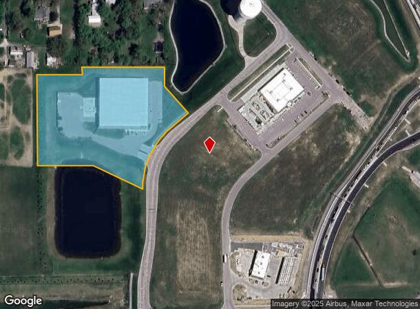
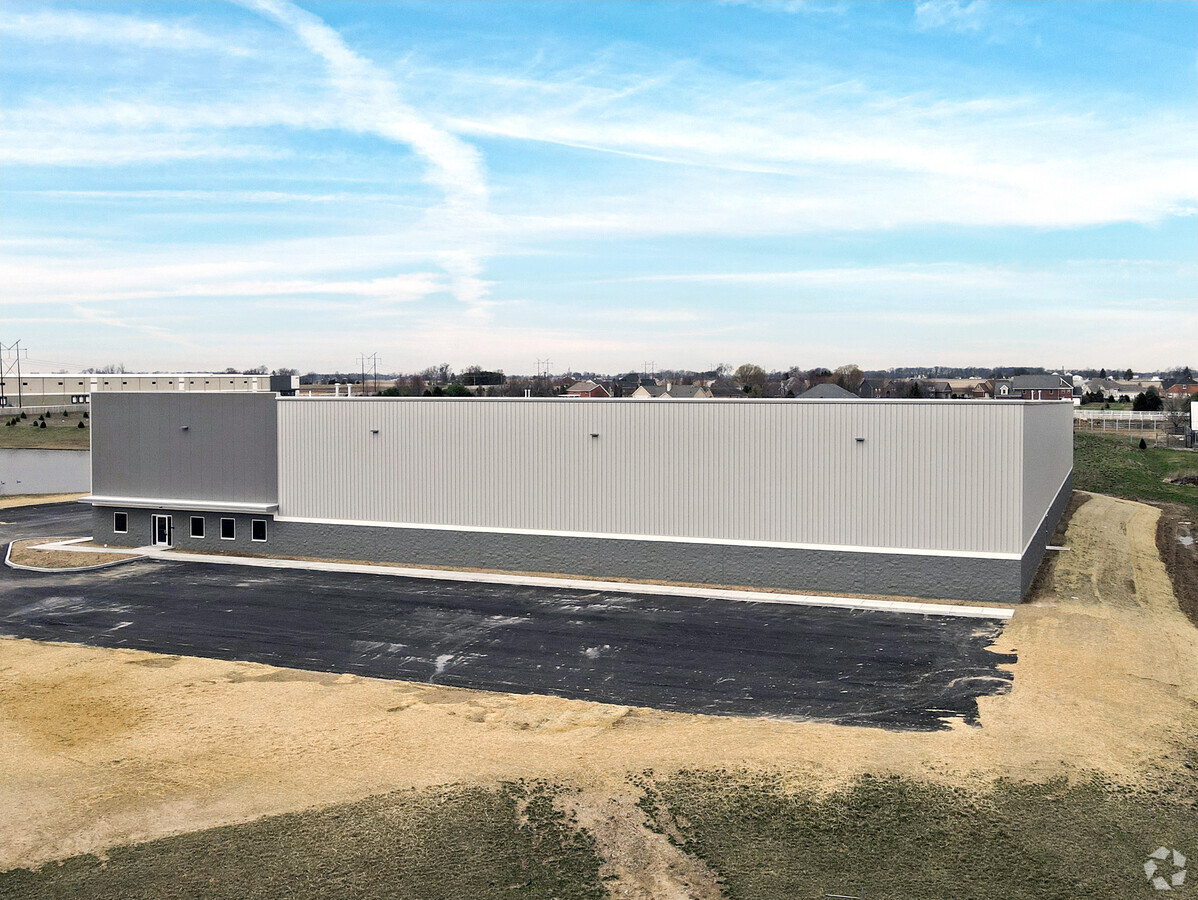
4188 S Indianapolis Rd
06-07-27-000-018.002-020
THE CROSSING AT WHITESTOWN PHASE II BLOCK D 4.87A
Warehouse
Boone
X
Indiana
18011C0307E
4.87 AC
2023
Far Boone County
2024
Indianapolis
810700
Indianapolis-Carmel-Anderson, IN
44,100 SF
DEMOGRAPHICS near 4188 S Indianapolis Rd
1 Mile
3 Mile
5 Mile
2024 Total Population
247
6,355
22,021
2029 Population
288
7,329
25,004
Pop Growth 2024-2029
+ 16.60%
+ 15.33%
+ 13.55%
Average Age
40
37
36
2024 Total Households
106
2,461
7,881
HH Growth 2024-2029
+ 16.98%
+ 15.68%
+ 13.91%
Median Household Inc
$89,772
$105,761
$110,240
Avg Household Size
2.30
2.60
2.80
2024 Avg HH Vehicles
2.00
2.00
2.00
Median Home Value
$269,736
$263,238
$315,309
Median Year Built
2009
2010
2010
Nearby Places
- Restaurants
- Banks
- Shops
- Fitness
- Groceries
PUBLIC TRANSPORTATION
AIRPORT
Indianapolis International
DRIVE
WALK
Distance
Indianapolis International
42 min
26.7 mi
Freight Ports
Port of Toledo
DRIVE
WALK
Distance
Port of Toledo
279 min
235.3 mi
SALE & LEASE HISTORY
LISTING DATE
SALE/LEASE

Feb 26, 2020
For Lease
Nearby Properties
Address
Land Use
TOTAL SIZE
Lot Size
Zoning
Address
Land Use
TOTAL SIZE
Lot Size
Zoning
336 SF
52.76 AC
ZO01
Address
Land Use
TOTAL SIZE
Lot Size
Zoning
518 SF
95.61 AC
ZO01
Address
Land Use
TOTAL SIZE
Lot Size
Zoning
632,788 SF
59.27 AC
ZO01
Address
Land Use
TOTAL SIZE
Lot Size
Zoning
62.07 AC
ZO01
Address
Land Use
TOTAL SIZE
Lot Size
Zoning
44.11 AC
ZO01
Address
Land Use
TOTAL SIZE
Lot Size
Zoning
846,720 SF
58.21 AC
ZO01
Address
Land Use
TOTAL SIZE
Lot Size
Zoning
672,180 SF
32.90 AC
ZO01
Address
Land Use
TOTAL SIZE
Lot Size
Zoning
736,560 SF
55.22 AC
ZO01
Address
Land Use
TOTAL SIZE
Lot Size
Zoning
705,024 SF
39.27 AC
ZO01
Address
Land Use
TOTAL SIZE
Lot Size
Zoning
1,338 SF
51.66 AC
ZO01
Address
Land Use
TOTAL SIZE
Lot Size
Zoning
400,145 SF
31.94 AC
ZO01
Address
Land Use
TOTAL SIZE
Lot Size
Zoning
628,206 SF
31.89 AC
ZO01
Address
Land Use
TOTAL SIZE
Lot Size
Zoning
529,200 SF
19.46 AC
ZO01
Address
Land Use
TOTAL SIZE
Lot Size
Zoning
600,672 SF
33.21 AC
ZO01
Address
Land Use
TOTAL SIZE
Lot Size
Zoning
570,344 SF
33.79 AC
ZO01
Address
Land Use
TOTAL SIZE
Lot Size
Zoning
565,560 SF
35.19 AC
ZO01
Address
Land Use
TOTAL SIZE
Lot Size
Zoning
3,913 SF
13.09 AC
ZO01
Address
Land Use
TOTAL SIZE
Lot Size
Zoning
604,200 SF
42.93 AC
ZO01
Address
Land Use
TOTAL SIZE
Lot Size
Zoning
460,177 SF
27.85 AC
ZO01
Address
Land Use
TOTAL SIZE
Lot Size
Zoning
400,576 SF
39.22 AC
ZO01
Address
Land Use
TOTAL SIZE
Lot Size
Zoning
505,728 SF
33.61 AC
ZO01
Address
Land Use
TOTAL SIZE
Lot Size
Zoning
4,876 SF
10.60 AC
ZO01
Address
Land Use
TOTAL SIZE
Lot Size
Zoning
501,120 SF
27.32 AC
ZO01
Address
Land Use
TOTAL SIZE
Lot Size
Zoning
498,750 SF
23.97 AC
ZO01
Address
Land Use
TOTAL SIZE
Lot Size
Zoning
120 SF
29.31 AC
ZO01
Address
Land Use
TOTAL SIZE
Lot Size
Zoning
280,000 SF
16.88 AC
ZO01
Address
Land Use
TOTAL SIZE
Lot Size
Zoning
457,704 SF
28.48 AC
ZO01
Address
Land Use
TOTAL SIZE
Lot Size
Zoning
420,848 SF
22.51 AC
ZO01
Address
Land Use
TOTAL SIZE
Lot Size
Zoning
26.08 AC
ZO01
Address
Land Use
TOTAL SIZE
Lot Size
Zoning
319,052 SF
17.36 AC
ZO01
The World's #1 Commercial Real Estate Marketplace
Connect with us
© 2025 CoStar Group
The information above has been obtained from sources believed reliable. While we do not doubt its accuracy we have not verified it and make no guarantee, warranty or representation about it. It is your responsibility to independently confirm its accuracy and completeness. Any projections, opinions, assumptions, or estimates used are for example only and do not represent the current or future performance of the property. The value of this transaction to you depends on tax and other factors which should be evaluated by your tax, financial, and legal advisors. You and your advisors should conduct a careful, independent investigation of the property to determine to your satisfaction the suitability of the property for your needs.