Property Record
4190 Parris Bridge Rd, Boiling Springs, SC 29316

NEARBY LISTINGS FOR SALE OR LEASE
Property Detail
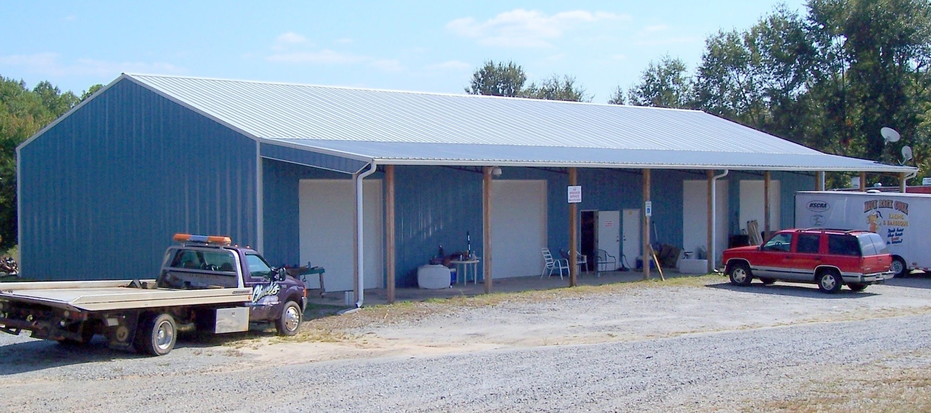
4190 Parris Bridge Rd
2-45-00-009.04
H Wayne Sanders
Realpropertynec
E SIDE PARRIS BRIDGE RD N OF SEEDHOUSE RD PB100-599
X
Spartanburg
45083C0162D
South Carolina
2024
8.02 AC
2023
North Side/Rt 9 Corr
022411
Greenville/Spartanburg
2,000 SF
Spartanburg, SC
DEMOGRAPHICS near 4190 Parris Bridge Rd
1 Mile
3 Mile
5 Mile
2024 Total Population
2,433
25,241
60,882
2029 Population
2,741
28,581
69,021
Pop Growth 2024-2029
+ 12.66%
+ 13.23%
+ 13.37%
Average Age
38
38
38
2024 Total Households
904
9,491
22,771
HH Growth 2024-2029
+ 12.94%
+ 13.43%
+ 13.69%
Median Household Inc
$67,609
$69,590
$63,617
Avg Household Size
2.70
2.60
2.50
2024 Avg HH Vehicles
2.00
2.00
2.00
Median Home Value
$181,087
$194,324
$183,815
Median Year Built
1999
1998
1995
Nearby Places
- Restaurants
- Banks
- Shops
- Fitness
- Groceries
PUBLIC TRANSPORTATION
COMMUTER RAIL
Spartanburg Amtrak Station (Crescent - Amtrak)
DRIVE
WALK
Distance
Spartanburg Amtrak Station (Crescent - Amtrak)
15 min
6.9 mi
AIRPORT
Greenville Spartanburg International
DRIVE
WALK
Distance
Greenville Spartanburg International
34 min
22.2 mi
Freight Ports
North Charleston Terminal
DRIVE
WALK
Distance
North Charleston Terminal
231 min
202.7 mi
Nearby Properties
Address
Land Use
TOTAL SIZE
Lot Size
Zoning
Address
Land Use
TOTAL SIZE
Lot Size
Zoning
22,955 SF
5.05 AC
Address
Land Use
TOTAL SIZE
Lot Size
Zoning
4,494 SF
17.60 AC
Address
Land Use
TOTAL SIZE
Lot Size
Zoning
2,647 SF
20.17 AC
Address
Land Use
TOTAL SIZE
Lot Size
Zoning
8,224 SF
9.67 AC
Address
Land Use
TOTAL SIZE
Lot Size
Zoning
184,015 SF
19.23 AC
Address
Land Use
TOTAL SIZE
Lot Size
Zoning
641,891 SF
16.26 AC
Address
Land Use
TOTAL SIZE
Lot Size
Zoning
108,060 SF
2.95 AC
Address
Land Use
TOTAL SIZE
Lot Size
Zoning
53,066 SF
8.39 AC
Address
Land Use
TOTAL SIZE
Lot Size
Zoning
23,836 SF
4.48 AC
Address
Land Use
TOTAL SIZE
Lot Size
Zoning
4,426 SF
Address
Land Use
TOTAL SIZE
Lot Size
Zoning
3,683 SF
0.21 AC
Address
Land Use
TOTAL SIZE
Lot Size
Zoning
Address
Land Use
TOTAL SIZE
Lot Size
Zoning
84,091 SF
39.12 AC
Address
Land Use
TOTAL SIZE
Lot Size
Zoning
76,375 SF
14.23 AC
Address
Land Use
TOTAL SIZE
Lot Size
Zoning
3,663 SF
11.40 AC
Address
Land Use
TOTAL SIZE
Lot Size
Zoning
3,501 SF
0.25 AC
Address
Land Use
TOTAL SIZE
Lot Size
Zoning
1,704 SF
3.46 AC
Address
Land Use
TOTAL SIZE
Lot Size
Zoning
62,284 SF
9.96 AC
Address
Land Use
TOTAL SIZE
Lot Size
Zoning
3,529 SF
0.22 AC
Address
Land Use
TOTAL SIZE
Lot Size
Zoning
3,801 SF
0.51 AC
Address
Land Use
TOTAL SIZE
Lot Size
Zoning
3,148 SF
0.41 AC
Address
Land Use
TOTAL SIZE
Lot Size
Zoning
135.52 AC
Address
Land Use
TOTAL SIZE
Lot Size
Zoning
13,191 SF
3.37 AC
Address
Land Use
TOTAL SIZE
Lot Size
Zoning
3,112 SF
0.57 AC
Address
Land Use
TOTAL SIZE
Lot Size
Zoning
2,652 SF
0.21 AC
Address
Land Use
TOTAL SIZE
Lot Size
Zoning
117,860 SF
8.52 AC
Address
Land Use
TOTAL SIZE
Lot Size
Zoning
2,290 SF
0.57 AC
Address
Land Use
TOTAL SIZE
Lot Size
Zoning
2,952 SF
0.14 AC
Address
Land Use
TOTAL SIZE
Lot Size
Zoning
1,968 SF
0.56 AC
Address
Land Use
TOTAL SIZE
Lot Size
Zoning
2,160 SF
0.88 AC
The World's #1 Commercial Real Estate Marketplace
Connect with us
© 2025 CoStar Group
The information above has been obtained from sources believed reliable. While we do not doubt its accuracy we have not verified it and make no guarantee, warranty or representation about it. It is your responsibility to independently confirm its accuracy and completeness. Any projections, opinions, assumptions, or estimates used are for example only and do not represent the current or future performance of the property. The value of this transaction to you depends on tax and other factors which should be evaluated by your tax, financial, and legal advisors. You and your advisors should conduct a careful, independent investigation of the property to determine to your satisfaction the suitability of the property for your needs.