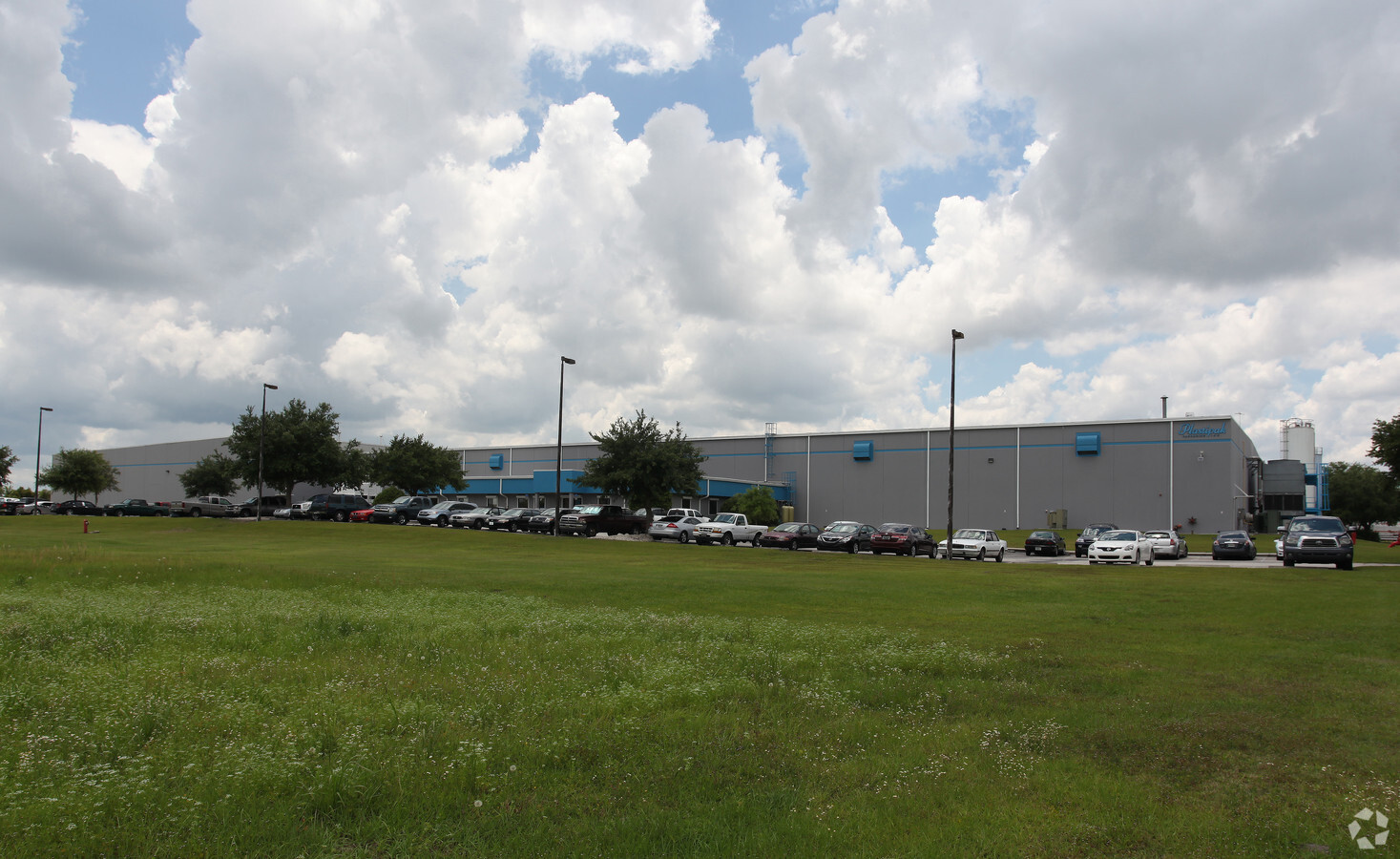
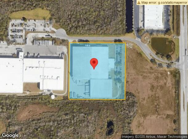
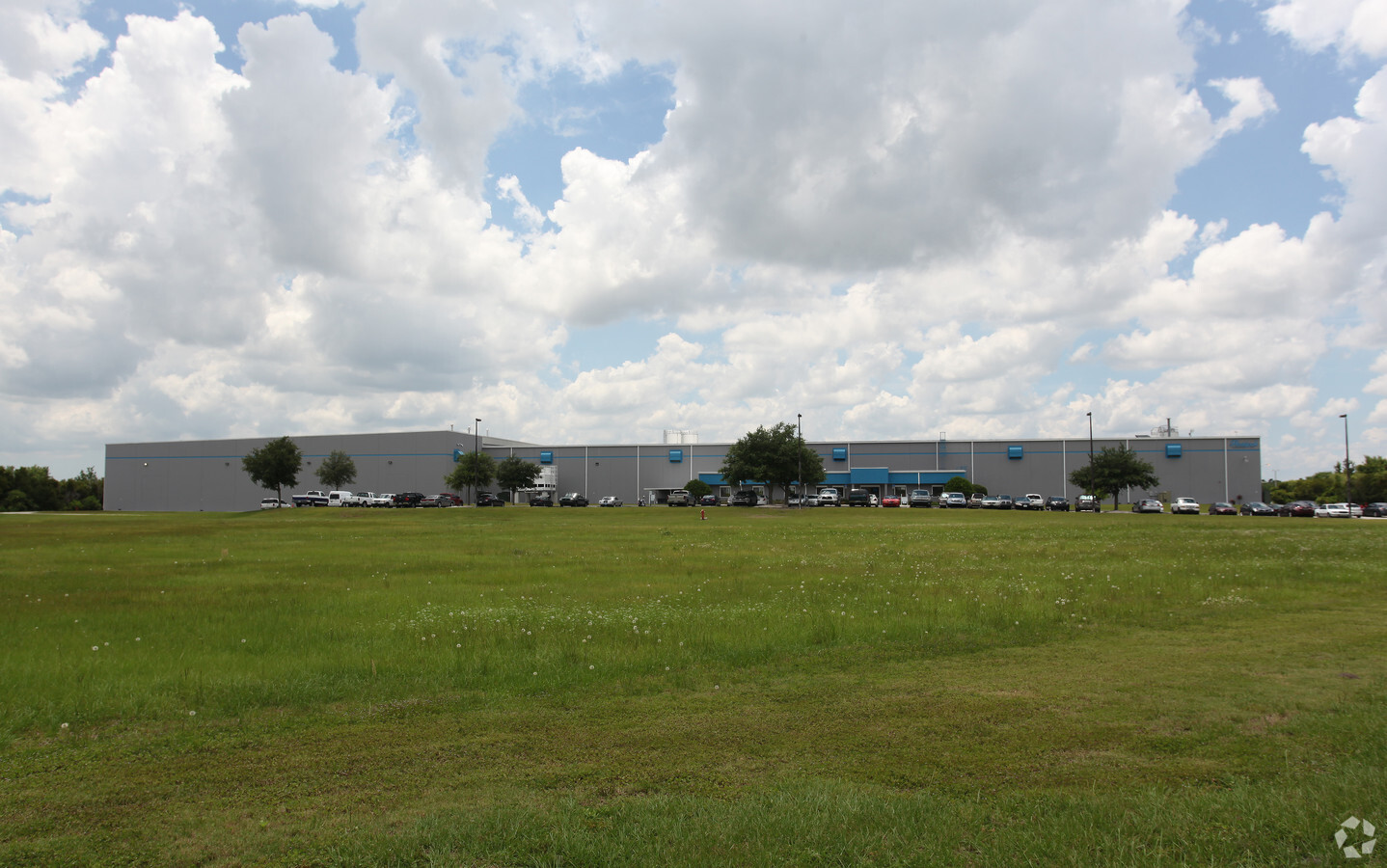
Property Record
4211 Amberjack Blvd, Plant City, FL 33566

NEARBY LISTINGS FOR SALE OR LEASE
Property Detail
4211 Amberjack Blvd
Tampa-St. Petersburg-Clearwater, FL
Plant City Commerce Center Phase 1
P-25-28-22-39M-000000-00008.0
PLANT CITY COMMERCE CENTER PHASE 1 LOT 8
Lightindustrial
Hillsborough
X
Florida
12105C0293G
8
2023
9.11 AC
2023
E Hillsborough/Plant
013001
Tampa/St Petersburg
201,410 SF
DEMOGRAPHICS near 4211 Amberjack Blvd
1 Mile
3 Mile
5 Mile
2024 Total Population
1,046
12,646
68,807
2029 Population
1,150
14,411
78,894
Pop Growth 2024-2029
+ 9.94%
+ 13.96%
+ 14.66%
Average Age
39
41
40
2024 Total Households
348
4,627
25,733
HH Growth 2024-2029
+ 10.06%
+ 14.59%
+ 15.17%
Median Household Inc
$63,646
$64,017
$54,189
Avg Household Size
2.90
2.60
2.60
2024 Avg HH Vehicles
2.00
2.00
2.00
Median Home Value
$219,608
$241,162
$204,614
Median Year Built
1994
1989
1985
Nearby Places
- Restaurants
- Banks
- Shops
- Fitness
- Groceries
PUBLIC TRANSPORTATION
COMMUTER RAIL
Lakeland (Silver Star - Amtrak)
DRIVE
WALK
Distance
Lakeland (Silver Star - Amtrak)
14 min
7.4 mi
AIRPORT
Tampa International
DRIVE
WALK
Distance
Tampa International
46 min
35.6 mi
Freight Ports
Port of Tampa Bay
DRIVE
WALK
Distance
Port of Tampa Bay
39 min
29.1 mi
Nearby Properties
Address
Land Use
TOTAL SIZE
Lot Size
Zoning
Address
Land Use
TOTAL SIZE
Lot Size
Zoning
2,095,234 SF
102.45 AC
PUD
Address
Land Use
TOTAL SIZE
Lot Size
Zoning
1,055,503 SF
112.72 AC
PD
Address
Land Use
TOTAL SIZE
Lot Size
Zoning
1,494,080 SF
116.77 AC
Address
Land Use
TOTAL SIZE
Lot Size
Zoning
1,210,880 SF
405.82 AC
PUD
Address
Land Use
TOTAL SIZE
Lot Size
Zoning
595,473 SF
47.29 AC
Address
Land Use
TOTAL SIZE
Lot Size
Zoning
805,336 SF
52.50 AC
PD
Address
Land Use
TOTAL SIZE
Lot Size
Zoning
779,760 SF
67.03 AC
PD
Address
Land Use
TOTAL SIZE
Lot Size
Zoning
711,568 SF
43.33 AC
PD
Address
Land Use
TOTAL SIZE
Lot Size
Zoning
508,310 SF
37.34 AC
M-1A
Address
Land Use
TOTAL SIZE
Lot Size
Zoning
505,506 SF
50.60 AC
PD
Address
Land Use
TOTAL SIZE
Lot Size
Zoning
655,123 SF
45.28 AC
Address
Land Use
TOTAL SIZE
Lot Size
Zoning
492,960 SF
22.09 AC
Address
Land Use
TOTAL SIZE
Lot Size
Zoning
599,280 SF
35.27 AC
GI
Address
Land Use
TOTAL SIZE
Lot Size
Zoning
519,750 SF
25.62 AC
Address
Land Use
TOTAL SIZE
Lot Size
Zoning
602,125 SF
43.97 AC
Address
Land Use
TOTAL SIZE
Lot Size
Zoning
417,250 SF
14.59 AC
Address
Land Use
TOTAL SIZE
Lot Size
Zoning
566,274 SF
33.79 AC
GI
Address
Land Use
TOTAL SIZE
Lot Size
Zoning
333,718 SF
28.99 AC
M-1
Address
Land Use
TOTAL SIZE
Lot Size
Zoning
243,294 SF
19.80 AC
R-20
Address
Land Use
TOTAL SIZE
Lot Size
Zoning
387,165 SF
37 AC
I2
Address
Land Use
TOTAL SIZE
Lot Size
Zoning
220,510 SF
37.15 AC
PD
Address
Land Use
TOTAL SIZE
Lot Size
Zoning
349,920 SF
22.21 AC
Address
Land Use
TOTAL SIZE
Lot Size
Zoning
492,180 SF
32.58 AC
PD
Address
Land Use
TOTAL SIZE
Lot Size
Zoning
300,411 SF
18.77 AC
PD
Address
Land Use
TOTAL SIZE
Lot Size
Zoning
328,863 SF
38.93 AC
M-1A
Address
Land Use
TOTAL SIZE
Lot Size
Zoning
441,480 SF
24.28 AC
Address
Land Use
TOTAL SIZE
Lot Size
Zoning
132,285 SF
30.77 AC
PD
Address
Land Use
TOTAL SIZE
Lot Size
Zoning
451,505 SF
30.12 AC
GI
Address
Land Use
TOTAL SIZE
Lot Size
Zoning
213,188 SF
16.10 AC
PD
Address
Land Use
TOTAL SIZE
Lot Size
Zoning
139,392 SF
73.31 AC
CC
The World's #1 Commercial Real Estate Marketplace
Connect with us
© 2025 CoStar Group
The information above has been obtained from sources believed reliable. While we do not doubt its accuracy we have not verified it and make no guarantee, warranty or representation about it. It is your responsibility to independently confirm its accuracy and completeness. Any projections, opinions, assumptions, or estimates used are for example only and do not represent the current or future performance of the property. The value of this transaction to you depends on tax and other factors which should be evaluated by your tax, financial, and legal advisors. You and your advisors should conduct a careful, independent investigation of the property to determine to your satisfaction the suitability of the property for your needs.