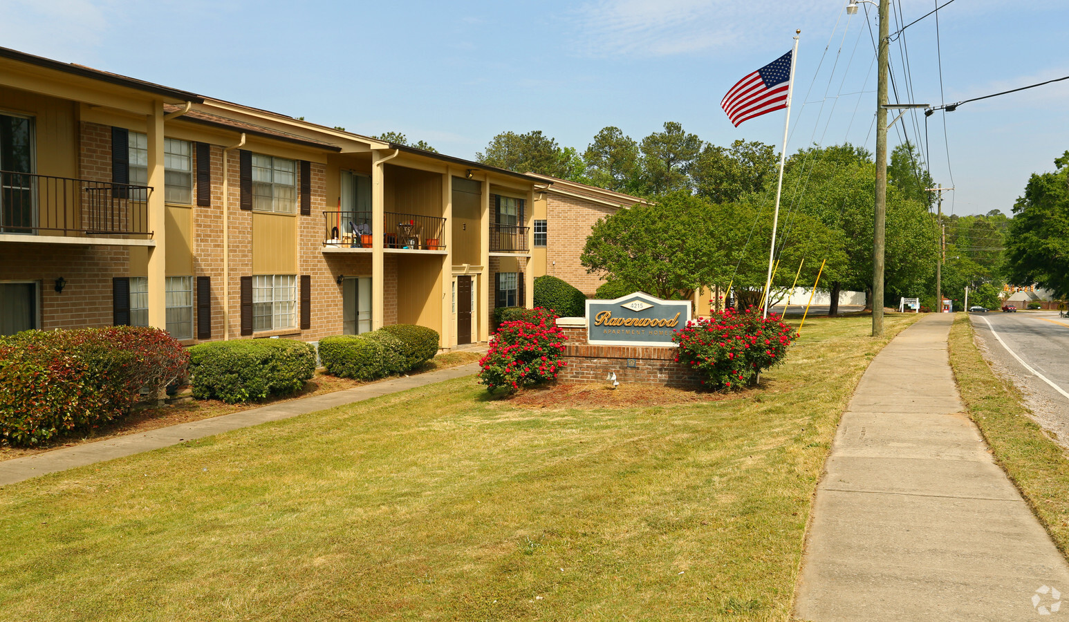
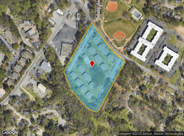
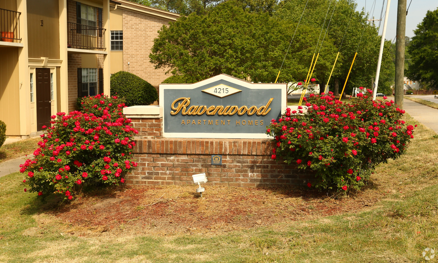
Property Record
4215 Bethel Church Rd, Columbia, SC 29206

NEARBY LISTINGS FOR SALE OR LEASE
Property Detail
4215 Bethel Church Rd
14012-10-10
Alliance Sh Portfolio Limted Partnership
Apartment
RAVENWOOD HILLS APTS. 553.4X620.3X595.2X596.3 #SU #PR RB162-740
AE
Richland
45079C0263L
South Carolina
2024
7.63 AC
2023
Northeast Arcadia Lakes
011202
Columbia
114,930 SF
Columbia, SC
DEMOGRAPHICS near 4215 Bethel Church Rd
1 Mile
3 Mile
5 Mile
2024 Total Population
8,471
75,242
166,523
2029 Population
8,603
76,637
169,664
Pop Growth 2024-2029
+ 1.56%
+ 1.85%
+ 1.89%
Average Age
41
38
36
2024 Total Households
3,872
29,729
68,163
HH Growth 2024-2029
+ 1.63%
+ 2.10%
+ 2.00%
Median Household Inc
$63,792
$48,374
$45,762
Avg Household Size
2.10
2.20
2.10
2024 Avg HH Vehicles
2.00
2.00
2.00
Median Home Value
$222,222
$223,899
$208,113
Median Year Built
1962
1964
1970
Nearby Places
- Restaurants
- Banks
- Shops
- Fitness
- Groceries
PUBLIC TRANSPORTATION
COMMUTER RAIL
Columbia Amtrak Station (Silver Star - Amtrak)
DRIVE
WALK
Distance
Columbia Amtrak Station (Silver Star - Amtrak)
13 min
5.7 mi
AIRPORT
Columbia Metro
DRIVE
WALK
Distance
Columbia Metro
31 min
15.2 mi
Freight Ports
North Charleston Terminal
DRIVE
WALK
Distance
North Charleston Terminal
130 min
110.4 mi
Nearby Properties
Address
Land Use
TOTAL SIZE
Lot Size
Zoning
Address
Land Use
TOTAL SIZE
Lot Size
Zoning
501,365 SF
13.28 AC
O-I
Address
Land Use
TOTAL SIZE
Lot Size
Zoning
383,491 SF
2.36 AC
C-3
Address
Land Use
TOTAL SIZE
Lot Size
Zoning
100 SF
19.24 AC
C-1
Address
Land Use
TOTAL SIZE
Lot Size
Zoning
313,244 SF
12.75 AC
RM-HD
Address
Land Use
TOTAL SIZE
Lot Size
Zoning
231,426 SF
10 AC
C-3
Address
Land Use
TOTAL SIZE
Lot Size
Zoning
169,291 SF
18.97 AC
C-3
Address
Land Use
TOTAL SIZE
Lot Size
Zoning
9.66 AC
C-1
Address
Land Use
TOTAL SIZE
Lot Size
Zoning
13,028 SF
31.69 AC
RG-1
Address
Land Use
TOTAL SIZE
Lot Size
Zoning
259,948 SF
14.40 AC
RM-HD
Address
Land Use
TOTAL SIZE
Lot Size
Zoning
202,048 SF
20.98 AC
C-3
Address
Land Use
TOTAL SIZE
Lot Size
Zoning
55.91 AC
M-1
Address
Land Use
TOTAL SIZE
Lot Size
Zoning
100 SF
156.42 AC
RSF-2
Address
Land Use
TOTAL SIZE
Lot Size
Zoning
20 AC
C-3
Address
Land Use
TOTAL SIZE
Lot Size
Zoning
414,262 SF
34.45 AC
RM-HD
Address
Land Use
TOTAL SIZE
Lot Size
Zoning
113,510 SF
11.60 AC
GC
Address
Land Use
TOTAL SIZE
Lot Size
Zoning
129,721 SF
3.72 AC
C-3
Address
Land Use
TOTAL SIZE
Lot Size
Zoning
3.02 AC
RM-2
Address
Land Use
TOTAL SIZE
Lot Size
Zoning
89,639 SF
14.68 AC
C-3
Address
Land Use
TOTAL SIZE
Lot Size
Zoning
63,220 SF
3.71 AC
RG-2
Address
Land Use
TOTAL SIZE
Lot Size
Zoning
145,081 SF
22.36 AC
C-3
Address
Land Use
TOTAL SIZE
Lot Size
Zoning
65,058 SF
3.54 AC
C-1
Address
Land Use
TOTAL SIZE
Lot Size
Zoning
97,683 SF
11.60 AC
C-3
Address
Land Use
TOTAL SIZE
Lot Size
Zoning
100 SF
7.42 AC
C-1
Address
Land Use
TOTAL SIZE
Lot Size
Zoning
111,569 SF
5.51 AC
C-3
Address
Land Use
TOTAL SIZE
Lot Size
Zoning
42,735 SF
2.12 AC
C-1
Address
Land Use
TOTAL SIZE
Lot Size
Zoning
97,324 SF
9.29 AC
C-3
Address
Land Use
TOTAL SIZE
Lot Size
Zoning
14,360 SF
4.61 AC
C-1
Address
Land Use
TOTAL SIZE
Lot Size
Zoning
4.14 AC
C-1
Address
Land Use
TOTAL SIZE
Lot Size
Zoning
65,242 SF
10.17 AC
MU-2
Address
Land Use
TOTAL SIZE
Lot Size
Zoning
199,962 SF
40.13 AC
RG-1
The World's #1 Commercial Real Estate Marketplace
Connect with us
© 2025 CoStar Group
The information above has been obtained from sources believed reliable. While we do not doubt its accuracy we have not verified it and make no guarantee, warranty or representation about it. It is your responsibility to independently confirm its accuracy and completeness. Any projections, opinions, assumptions, or estimates used are for example only and do not represent the current or future performance of the property. The value of this transaction to you depends on tax and other factors which should be evaluated by your tax, financial, and legal advisors. You and your advisors should conduct a careful, independent investigation of the property to determine to your satisfaction the suitability of the property for your needs.