Property Record
4220 Blacks Chapel Rd, Sanford, NC 27332
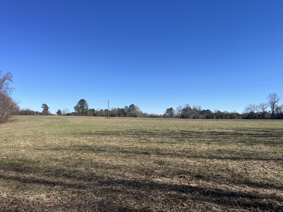
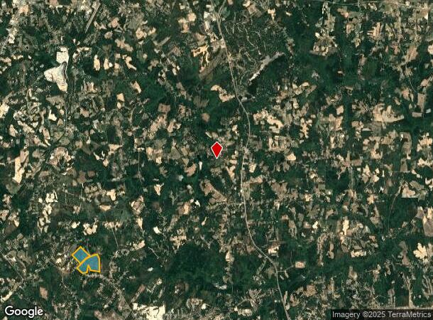
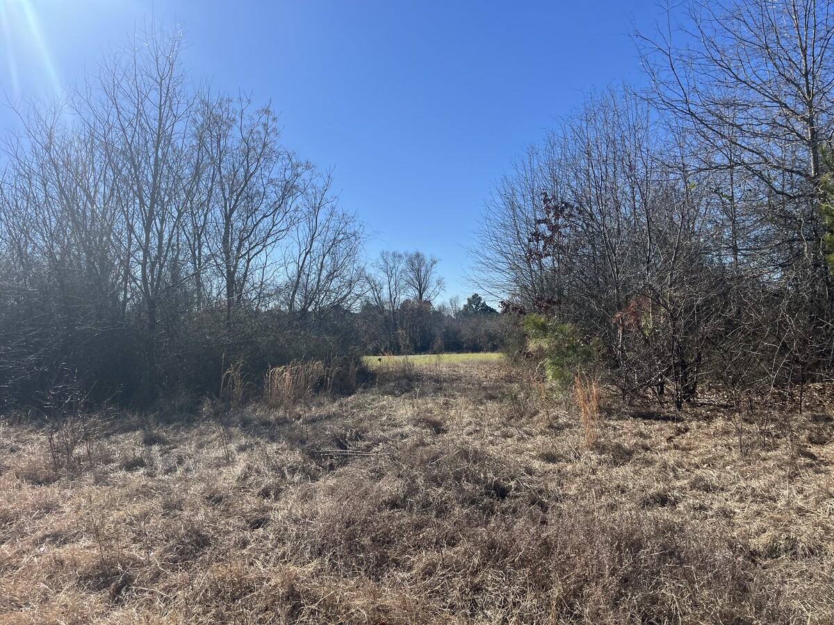
This Property Is For Sale
NEARBY LISTINGS FOR SALE OR LEASE
Property Detail
4220 Blacks Chapel Rd
9547-47-6610-00
4220 BLACKS CHAPEL RD
Timberlandforesttreesagricultural
Lee
AE
North Carolina
3710954600L
192.40 AC
2024
North Carolina Southeast Area
2024
Other Market Areas
030504
Sanford, NC
DEMOGRAPHICS near 4220 Blacks Chapel Rd
1 Mile
3 Mile
5 Mile
2024 Total Population
1,379
5,257
13,308
2029 Population
1,345
5,413
14,234
Pop Growth 2024-2029
(2.47%)
+ 2.97%
+ 6.96%
Average Age
46
43
41
2024 Total Households
554
2,039
5,082
HH Growth 2024-2029
(2.53%)
+ 2.80%
+ 6.91%
Median Household Inc
$102,083
$72,811
$66,907
Avg Household Size
2.50
2.60
2.60
2024 Avg HH Vehicles
3.00
2.00
2.00
Median Home Value
$185,150
$166,537
$160,336
Median Year Built
2003
1999
1995
Nearby Places
- Restaurants
- Banks
- Shops
- Fitness
- Groceries
PUBLIC TRANSPORTATION
AIRPORT
Fayetteville Regional/Grannis Field
DRIVE
WALK
Distance
Fayetteville Regional/Grannis Field
51 min
33.4 mi
Freight Ports
Port of Wilmington
DRIVE
WALK
Distance
Port of Wilmington
168 min
119.1 mi
Nearby Properties
Address
Land Use
TOTAL SIZE
Lot Size
Zoning
Address
Land Use
TOTAL SIZE
Lot Size
Zoning
121.09 AC
LIGHT INDU
Address
Land Use
TOTAL SIZE
Lot Size
Zoning
45.70 AC
IND
Address
Land Use
TOTAL SIZE
Lot Size
Zoning
22,969 SF
72.18 AC
RESIDENTIA
Address
Land Use
TOTAL SIZE
Lot Size
Zoning
7.22 AC
CZ
Address
Land Use
TOTAL SIZE
Lot Size
Zoning
5,085 SF
3.50 AC
CZ
Address
Land Use
TOTAL SIZE
Lot Size
Zoning
10,675 SF
2.62 AC
C2
Address
Land Use
TOTAL SIZE
Lot Size
Zoning
4,644 SF
17.30 AC
RA20R
Address
Land Use
TOTAL SIZE
Lot Size
Zoning
135 AC
Address
Land Use
TOTAL SIZE
Lot Size
Zoning
9,100 SF
1.29 AC
COMM
Address
Land Use
TOTAL SIZE
Lot Size
Zoning
18.66 AC
LIGHT INDU
Address
Land Use
TOTAL SIZE
Lot Size
Zoning
38.78 AC
RESIDENTIA
Address
Land Use
TOTAL SIZE
Lot Size
Zoning
3,202 SF
1.75 AC
COMM
Address
Land Use
TOTAL SIZE
Lot Size
Zoning
4,920 SF
0.85 AC
OFFICE & I
Address
Land Use
TOTAL SIZE
Lot Size
Zoning
4.90 AC
SSCZD
Address
Land Use
TOTAL SIZE
Lot Size
Zoning
231.88 AC
RESIDENTIA
Address
Land Use
TOTAL SIZE
Lot Size
Zoning
7.60 AC
C2
Address
Land Use
TOTAL SIZE
Lot Size
Zoning
9,000 SF
2.65 AC
LIGHT INDU
Address
Land Use
TOTAL SIZE
Lot Size
Zoning
53.99 AC
RA20R
Address
Land Use
TOTAL SIZE
Lot Size
Zoning
2.54 AC
Address
Land Use
TOTAL SIZE
Lot Size
Zoning
9,916 SF
5.71 AC
RESIDENTIA
Address
Land Use
TOTAL SIZE
Lot Size
Zoning
1,057 SF
138.48 AC
RESIDENTIA
Address
Land Use
TOTAL SIZE
Lot Size
Zoning
9.86 AC
Address
Land Use
TOTAL SIZE
Lot Size
Zoning
1,350 SF
14.87 AC
RAMH
Address
Land Use
TOTAL SIZE
Lot Size
Zoning
918 SF
168.55 AC
RESIDENTIA
Address
Land Use
TOTAL SIZE
Lot Size
Zoning
141 AC
RA20R
Address
Land Use
TOTAL SIZE
Lot Size
Zoning
110.81 AC
RA20R
Address
Land Use
TOTAL SIZE
Lot Size
Zoning
1,864 SF
49.28 AC
RESIDENTIA
Address
Land Use
TOTAL SIZE
Lot Size
Zoning
2,155 SF
77.48 AC
RESIDENTIA
Address
Land Use
TOTAL SIZE
Lot Size
Zoning
129.87 AC
RESIDENTIA
The World's #1 Commercial Real Estate Marketplace
Connect with us
© 2025 CoStar Group
The information above has been obtained from sources believed reliable. While we do not doubt its accuracy we have not verified it and make no guarantee, warranty or representation about it. It is your responsibility to independently confirm its accuracy and completeness. Any projections, opinions, assumptions, or estimates used are for example only and do not represent the current or future performance of the property. The value of this transaction to you depends on tax and other factors which should be evaluated by your tax, financial, and legal advisors. You and your advisors should conduct a careful, independent investigation of the property to determine to your satisfaction the suitability of the property for your needs.