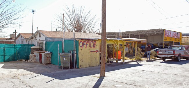
Property Record
4220 Dyer St, El Paso, TX 79930


NEARBY LISTINGS FOR SALE OR LEASE
Property Detail
4220 Dyer St
El Paso
Morningside Heights
El Paso, TX
El Paso
M794-999-0540-4800
Texas
Sfr
0.05 AC
800 SF
Northeast
DEMOGRAPHICS near 4220 Dyer St
1 Mile
3 Mile
5 Mile
2024 Total Population
13,153
75,614
184,834
2029 Population
13,302
77,114
188,610
Pop Growth 2024-2029
+ 1.13%
+ 1.98%
+ 2.04%
Average Age
37
37
38
2024 Total Households
5,068
27,701
70,829
HH Growth 2024-2029
+ 0.99%
+ 1.96%
+ 2.11%
Median Household Inc
$32,118
$37,871
$35,695
Avg Household Size
2.50
2.60
2.40
2024 Avg HH Vehicles
2.00
2.00
2.00
Median Home Value
$113,433
$127,856
$141,016
Median Year Built
1957
1961
1965
Nearby Places
Map Layers
Map Styles
 Street
 Aerial
- Restaurants
- Banks
- Shops
- Fitness
- Groceries
PUBLIC TRANSPORTATION
AIRPORT
El Paso International
DRIVE
WALK
Distance
El Paso International
16 min
8.1 mi
Freight Ports
Port of Corpus Christi
DRIVE
WALK
Distance
Port of Corpus Christi
682 min
694.1 mi
SALE & LEASE HISTORY
LISTING DATE
SALE/LEASE

Sep 25, 2016
For Lease
Sep 23, 2016
For Sale
Jun 17, 2019
For Lease
Nearby Properties
Address
Land Use
TOTAL SIZE
Lot Size
Zoning
Address
Land Use
TOTAL SIZE
Lot Size
Zoning
561,866 SF
27.25 AC
C4
Address
Land Use
TOTAL SIZE
Lot Size
Zoning
89,935 SF
7.01 AC
PMD
Address
Land Use
TOTAL SIZE
Lot Size
Zoning
374,839 SF
33.29 AC
C3S
Address
Land Use
TOTAL SIZE
Lot Size
Zoning
683,161 SF
M1
Address
Land Use
TOTAL SIZE
Lot Size
Zoning
289,146 SF
11.87 AC
C1S
Address
Land Use
TOTAL SIZE
Lot Size
Zoning
213,351 SF
12 AC
C3S
Address
Land Use
TOTAL SIZE
Lot Size
Zoning
74,907 SF
8.07 AC
C4
Address
Land Use
TOTAL SIZE
Lot Size
Zoning
142,532 SF
13.32 AC
C3S
Address
Land Use
TOTAL SIZE
Lot Size
Zoning
177.87 AC
Address
Land Use
TOTAL SIZE
Lot Size
Zoning
142,858 SF
0.17 AC
R3H
Address
Land Use
TOTAL SIZE
Lot Size
Zoning
229,821 SF
10.18 AC
A2
Address
Land Use
TOTAL SIZE
Lot Size
Zoning
138,825 SF
23.17 AC
R3
Address
Land Use
TOTAL SIZE
Lot Size
Zoning
164,884 SF
14.65 AC
C4
Address
Land Use
TOTAL SIZE
Lot Size
Zoning
74,244 SF
1.55 AC
C4
Address
Land Use
TOTAL SIZE
Lot Size
Zoning
180,932 SF
13.99 AC
R4H
Address
Land Use
TOTAL SIZE
Lot Size
Zoning
320,991 SF
15.48 AC
M1
Address
Land Use
TOTAL SIZE
Lot Size
Zoning
254,768 SF
10.11 AC
A2
Address
Land Use
TOTAL SIZE
Lot Size
Zoning
109.74 AC
M1
Address
Land Use
TOTAL SIZE
Lot Size
Zoning
113,523 SF
7.29 AC
A3O
Address
Land Use
TOTAL SIZE
Lot Size
Zoning
222,381 SF
14.40 AC
M1
Address
Land Use
TOTAL SIZE
Lot Size
Zoning
72,340 SF
1.68 AC
C3S
Address
Land Use
TOTAL SIZE
Lot Size
Zoning
214,003 SF
9.47 AC
C4
Address
Land Use
TOTAL SIZE
Lot Size
Zoning
44,178 SF
1.03 AC
A1C
Address
Land Use
TOTAL SIZE
Lot Size
Zoning
75,000 SF
6.15 AC
R4H
Address
Land Use
TOTAL SIZE
Lot Size
Zoning
121,036 SF
C3
Address
Land Use
TOTAL SIZE
Lot Size
Zoning
61,770 SF
8.28 AC
C3
Address
Land Use
TOTAL SIZE
Lot Size
Zoning
139,428 SF
3.51 AC
R4
Address
Land Use
TOTAL SIZE
Lot Size
Zoning
69,840 SF
3.39 AC
R4S
Address
Land Use
TOTAL SIZE
Lot Size
Zoning
68,431 SF
2.41 AC
R4
Address
Land Use
TOTAL SIZE
Lot Size
Zoning
68,191 SF
4.68 AC
M1
The World's #1 Commercial Real Estate Marketplace
Connect with us
© 2025 CoStar Group
The information above has been obtained from sources believed reliable. While we do not doubt its accuracy we have not verified it and make no guarantee, warranty or representation about it. It is your responsibility to independently confirm its accuracy and completeness. Any projections, opinions, assumptions, or estimates used are for example only and do not represent the current or future performance of the property. The value of this transaction to you depends on tax and other factors which should be evaluated by your tax, financial, and legal advisors. You and your advisors should conduct a careful, independent investigation of the property to determine to your satisfaction the suitability of the property for your needs.