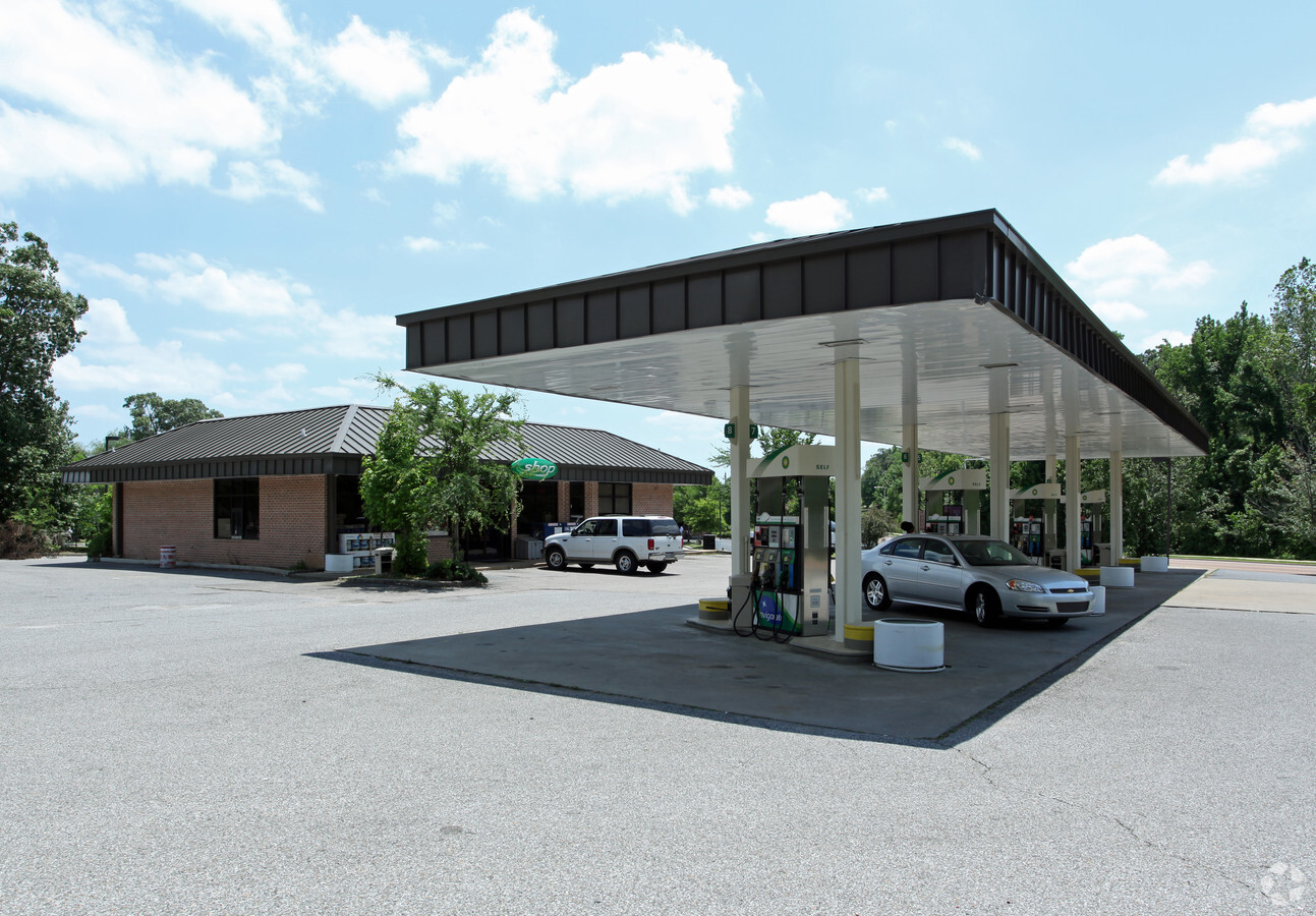
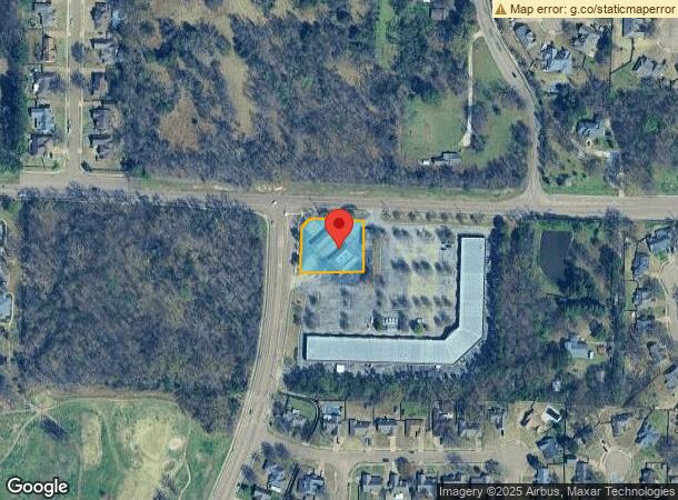
Property Record
4230 Altruria Rd, Bartlett, TN 38135

NEARBY LISTINGS FOR SALE OR LEASE
Property Detail
4230 Altruria Rd
B0-148-0-0890
Jennings School Commercial
Storebuilding
ES ALTRURIA RD COR EGYPT-CENTRAL RD (SE)
X
Shelby
47157C0301G
Tennessee
2023
1.03 AC
2024
Northeast
020656
Memphis
3,680 SF
Memphis, TN-MS-AR
DEMOGRAPHICS near 4230 Altruria Rd
1 Mile
3 Mile
5 Mile
2024 Total Population
8,042
46,573
110,975
2029 Population
7,763
45,006
107,766
Pop Growth 2024-2029
(3.47%)
(3.36%)
(2.89%)
Average Age
41
40
38
2024 Total Households
3,000
17,118
41,148
HH Growth 2024-2029
(3.60%)
(3.48%)
(2.97%)
Median Household Inc
$93,413
$82,609
$65,987
Avg Household Size
2.60
2.70
2.60
2024 Avg HH Vehicles
2.00
2.00
2.00
Median Home Value
$240,300
$224,522
$203,791
Median Year Built
1992
1989
1985
Nearby Places
- Restaurants
- Banks
- Shops
- Fitness
- Groceries
PUBLIC TRANSPORTATION
AIRPORT
Memphis International
DRIVE
WALK
Distance
Memphis International
33 min
19.6 mi
Freight Ports
Port of Shreveport
DRIVE
WALK
Distance
Port of Shreveport
421 min
384.3 mi
SALE & LEASE HISTORY
LISTING DATE
SALE/LEASE

Jul 26, 2019
For Sale
Nearby Properties
Address
Land Use
TOTAL SIZE
Lot Size
Zoning
Address
Land Use
TOTAL SIZE
Lot Size
Zoning
198,103 SF
17.75 AC
CG-MS
Address
Land Use
TOTAL SIZE
Lot Size
Zoning
62,852 SF
10.15 AC
RS-12
Address
Land Use
TOTAL SIZE
Lot Size
Zoning
108,678 SF
8.99 AC
R-E
Address
Land Use
TOTAL SIZE
Lot Size
Zoning
133,020 SF
11.73 AC
SC-1
Address
Land Use
TOTAL SIZE
Lot Size
Zoning
39,018 SF
22.21 AC
RU-2
Address
Land Use
TOTAL SIZE
Lot Size
Zoning
86,875 SF
7.09 AC
I-P
Address
Land Use
TOTAL SIZE
Lot Size
Zoning
134,599 SF
6.43 AC
I-P
Address
Land Use
TOTAL SIZE
Lot Size
Zoning
67,640 SF
20.28 AC
R-M
Address
Land Use
TOTAL SIZE
Lot Size
Zoning
76,169 SF
5.39 AC
I-P
Address
Land Use
TOTAL SIZE
Lot Size
Zoning
181,319 SF
14.82 AC
CMU-2
Address
Land Use
TOTAL SIZE
Lot Size
Zoning
269,880 SF
15.24 AC
I-P
Address
Land Use
TOTAL SIZE
Lot Size
Zoning
38,833 SF
4.84 AC
I-P
Address
Land Use
TOTAL SIZE
Lot Size
Zoning
120,000 SF
9.64 AC
I-P
Address
Land Use
TOTAL SIZE
Lot Size
Zoning
85,332 SF
10.51 AC
R-M
Address
Land Use
TOTAL SIZE
Lot Size
Zoning
63,096 SF
7.10 AC
CMU-3
Address
Land Use
TOTAL SIZE
Lot Size
Zoning
50,538 SF
5 AC
R-10
Address
Land Use
TOTAL SIZE
Lot Size
Zoning
232,375 SF
20 AC
I-P
Address
Land Use
TOTAL SIZE
Lot Size
Zoning
51,770 SF
2.02 AC
I-O
Address
Land Use
TOTAL SIZE
Lot Size
Zoning
78,948 SF
11.40 AC
SC-1
Address
Land Use
TOTAL SIZE
Lot Size
Zoning
140,987 SF
16.22 AC
SC-1
Address
Land Use
TOTAL SIZE
Lot Size
Zoning
59,257 SF
8.48 AC
SC-1
Address
Land Use
TOTAL SIZE
Lot Size
Zoning
47,465 SF
12.55 AC
R-M
Address
Land Use
TOTAL SIZE
Lot Size
Zoning
40,030 SF
3.40 AC
CMU-2
Address
Land Use
TOTAL SIZE
Lot Size
Zoning
33,971 SF
3.43 AC
CG-MS
Address
Land Use
TOTAL SIZE
Lot Size
Zoning
60,320 SF
5.36 AC
C-H
Address
Land Use
TOTAL SIZE
Lot Size
Zoning
33,250 SF
4.40 AC
SC-1
Address
Land Use
TOTAL SIZE
Lot Size
Zoning
6,587 SF
3.38 AC
RS-18
Address
Land Use
TOTAL SIZE
Lot Size
Zoning
45,078 SF
6.03 AC
AG
Address
Land Use
TOTAL SIZE
Lot Size
Zoning
42,706 SF
3.94 AC
RS-10
Address
Land Use
TOTAL SIZE
Lot Size
Zoning
15 AC
CMP-1
The World's #1 Commercial Real Estate Marketplace
Connect with us
© 2025 CoStar Group
The information above has been obtained from sources believed reliable. While we do not doubt its accuracy we have not verified it and make no guarantee, warranty or representation about it. It is your responsibility to independently confirm its accuracy and completeness. Any projections, opinions, assumptions, or estimates used are for example only and do not represent the current or future performance of the property. The value of this transaction to you depends on tax and other factors which should be evaluated by your tax, financial, and legal advisors. You and your advisors should conduct a careful, independent investigation of the property to determine to your satisfaction the suitability of the property for your needs.