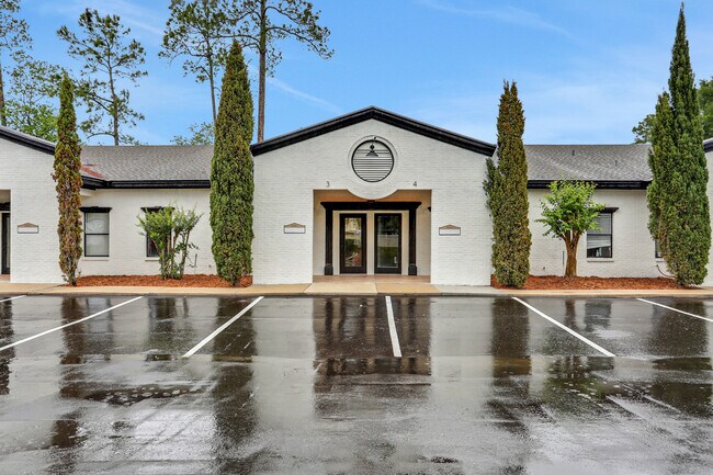
Property Record
4231 Walnut Bnd, Jacksonville, FL 32257


NEARBY LISTINGS FOR SALE OR LEASE
Property Detail
4231 Walnut Bnd
155649-0520
Section Land
Officebuilding
04-4S-27E .77 PT SW1/4 OF NW1/4 RECD O/R 21519-2290 BEING PARCELS A,B
X
Duval
12031C0561H
Florida
2025
0.36 AC
2026
Mandarin
016731
Jacksonville (Florida)
4,288 SF
Jacksonville, FL
DEMOGRAPHICS near 4231 Walnut Bnd
1 Mile
3 Mile
5 Mile
2024 Total Population
13,737
65,559
146,864
2029 Population
14,209
68,123
155,660
Pop Growth 2024-2029
+ 3.44%
+ 3.91%
+ 5.99%
Average Age
41
41
41
2024 Total Households
5,920
26,698
61,066
HH Growth 2024-2029
+ 3.38%
+ 3.96%
+ 5.91%
Median Household Inc
$63,422
$76,221
$71,604
Avg Household Size
2.20
2.40
2.30
2024 Avg HH Vehicles
2.00
2.00
2.00
Median Home Value
$229,824
$283,307
$295,271
Median Year Built
1984
1985
1987
Nearby Places
Map Layers
Map Styles
 Street
 Aerial
- Restaurants
- Banks
- Shops
- Fitness
- Groceries
PUBLIC TRANSPORTATION
AIRPORT
Jacksonville International
DRIVE
WALK
Distance
Jacksonville International
44 min
26.8 mi
SALE & LEASE HISTORY
LISTING DATE
SALE/LEASE

May 08, 2023
For Lease
Feb 13, 2025
For Lease
Aug 09, 2022
For Sale
Nearby Properties
Address
Land Use
TOTAL SIZE
Lot Size
Zoning
Address
Land Use
TOTAL SIZE
Lot Size
Zoning
438,224 SF
35.14 AC
RMD-D
Address
Land Use
TOTAL SIZE
Lot Size
Zoning
287,406 SF
32.10 AC
CCG-1
Address
Land Use
TOTAL SIZE
Lot Size
Zoning
266,087 SF
35.07 AC
RMD-D
Address
Land Use
TOTAL SIZE
Lot Size
Zoning
307,396 SF
24.45 AC
PUD
Address
Land Use
TOTAL SIZE
Lot Size
Zoning
304,017 SF
20.58 AC
RMD-D
Address
Land Use
TOTAL SIZE
Lot Size
Zoning
291,833 SF
16.91 AC
CRO
Address
Land Use
TOTAL SIZE
Lot Size
Zoning
236,068 SF
18.87 AC
PUD
Address
Land Use
TOTAL SIZE
Lot Size
Zoning
404,315 SF
19.27 AC
RMD-D
Address
Land Use
TOTAL SIZE
Lot Size
Zoning
294,353 SF
14.58 AC
RMD-D
Address
Land Use
TOTAL SIZE
Lot Size
Zoning
327,854 SF
26.24 AC
RMD-D
Address
Land Use
TOTAL SIZE
Lot Size
Zoning
304,277 SF
25.03 AC
CCG-2
Address
Land Use
TOTAL SIZE
Lot Size
Zoning
207,736 SF
18.55 AC
RMD-C
Address
Land Use
TOTAL SIZE
Lot Size
Zoning
166,126 SF
17.26 AC
CCG-1
Address
Land Use
TOTAL SIZE
Lot Size
Zoning
273,060 SF
23.70 AC
CCG-1
Address
Land Use
TOTAL SIZE
Lot Size
Zoning
240,240 SF
13.91 AC
PUD
Address
Land Use
TOTAL SIZE
Lot Size
Zoning
148,931 SF
16.93 AC
RMD-D
Address
Land Use
TOTAL SIZE
Lot Size
Zoning
248,748 SF
17.60 AC
RMD-D
Address
Land Use
TOTAL SIZE
Lot Size
Zoning
213,374 SF
14.77 AC
PUD
Address
Land Use
TOTAL SIZE
Lot Size
Zoning
167,936 SF
14.64 AC
RMD-C
Address
Land Use
TOTAL SIZE
Lot Size
Zoning
177,088 SF
15.02 AC
RMD-D
Address
Land Use
TOTAL SIZE
Lot Size
Zoning
263,796 SF
36.89 AC
PUD
Address
Land Use
TOTAL SIZE
Lot Size
Zoning
167,580 SF
13.16 AC
RMD-D
Address
Land Use
TOTAL SIZE
Lot Size
Zoning
265,371 SF
18.26 AC
IH
Address
Land Use
TOTAL SIZE
Lot Size
Zoning
330,139 SF
73.17 AC
PBF-1
Address
Land Use
TOTAL SIZE
Lot Size
Zoning
246,534 SF
18.99 AC
RMD-D
Address
Land Use
TOTAL SIZE
Lot Size
Zoning
264,352 SF
20.49 AC
PUD
Address
Land Use
TOTAL SIZE
Lot Size
Zoning
202,348 SF
18.15 AC
IL
Address
Land Use
TOTAL SIZE
Lot Size
Zoning
184,663 SF
12.84 AC
IL
Address
Land Use
TOTAL SIZE
Lot Size
Zoning
388,745 SF
49.78 AC
PBF-1
Address
Land Use
TOTAL SIZE
Lot Size
Zoning
396,016 SF
14.15 AC
IBP
The World's #1 Commercial Real Estate Marketplace
Connect with us
© 2025 CoStar Group
The information above has been obtained from sources believed reliable. While we do not doubt its accuracy we have not verified it and make no guarantee, warranty or representation about it. It is your responsibility to independently confirm its accuracy and completeness. Any projections, opinions, assumptions, or estimates used are for example only and do not represent the current or future performance of the property. The value of this transaction to you depends on tax and other factors which should be evaluated by your tax, financial, and legal advisors. You and your advisors should conduct a careful, independent investigation of the property to determine to your satisfaction the suitability of the property for your needs.