Property Record
4245 Main St, Harrisburg, NC 28075


NEARBY LISTINGS FOR SALE OR LEASE
-
-
View all Harrisburg listings for lease on LoopNet.com
Property Detail
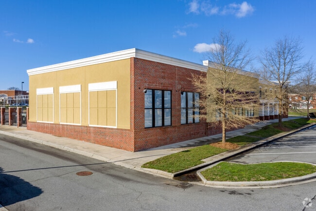
4245 Main St
5507-87-8589-0000
Harrisburg
Storebuilding
OUTPARCEL L HARRISBURG TOWN CENTER
X
Cabarrus
3710550700K
North Carolina
0
1.38 AC
2025
Cabarrus County
042604
Charlotte
21,561 SF
Charlotte-Concord-Gastonia, NC-SC
DEMOGRAPHICS near 4245 Main St
1 Mile
3 Mile
5 Mile
2024 Total Population
5,438
36,401
108,595
2029 Population
6,088
40,257
119,205
Pop Growth 2024-2029
+ 11.95%
+ 10.59%
+ 9.77%
Average Age
40
38
36
2024 Total Households
2,022
12,510
39,064
HH Growth 2024-2029
+ 10.53%
+ 9.40%
+ 8.86%
Median Household Inc
$105,426
$102,844
$84,150
Avg Household Size
2.70
2.90
2.70
2024 Avg HH Vehicles
2.00
2.00
2.00
Median Home Value
$268,821
$312,823
$295,118
Median Year Built
2002
2002
2001
Nearby Places
Map Layers
Map Styles
 Street
 Aerial
- Restaurants
- Banks
- Shops
- Fitness
- Groceries
PUBLIC TRANSPORTATION
AIRPORT
Concord-Padgett Regional
DRIVE
WALK
Distance
Concord-Padgett Regional
18 min
8.2 mi
Charlotte/Douglas International
DRIVE
WALK
Distance
Charlotte/Douglas International
38 min
22.5 mi
SALE & LEASE HISTORY
LISTING DATE
SALE/LEASE

Oct 08, 2020
For Lease
Jan 27, 2017
For Lease
Feb 10, 2020
For Lease
Nearby Properties
Address
Land Use
TOTAL SIZE
Lot Size
Zoning
Address
Land Use
TOTAL SIZE
Lot Size
Zoning
154,304 SF
857.72 AC
PID
Address
Land Use
TOTAL SIZE
Lot Size
Zoning
33,090 SF
19.43 AC
C-2
Address
Land Use
TOTAL SIZE
Lot Size
Zoning
333,498 SF
17.66 AC
R3
Address
Land Use
TOTAL SIZE
Lot Size
Zoning
196,893 SF
43.82 AC
MDR
Address
Land Use
TOTAL SIZE
Lot Size
Zoning
226,355 SF
99.26 AC
O-I
Address
Land Use
TOTAL SIZE
Lot Size
Zoning
350,339 SF
77.60 AC
RM-1
Address
Land Use
TOTAL SIZE
Lot Size
Zoning
184,955 SF
5.78 AC
Address
Land Use
TOTAL SIZE
Lot Size
Zoning
169,115 SF
4.86 AC
Address
Land Use
TOTAL SIZE
Lot Size
Zoning
175,978 SF
63.81 AC
O-I
Address
Land Use
TOTAL SIZE
Lot Size
Zoning
142,368 SF
13.32 AC
MX2
Address
Land Use
TOTAL SIZE
Lot Size
Zoning
21,714 SF
15.02 AC
RC
Address
Land Use
TOTAL SIZE
Lot Size
Zoning
152,554 SF
29.94 AC
O-I
Address
Land Use
TOTAL SIZE
Lot Size
Zoning
360,400 SF
20.32 AC
EC
Address
Land Use
TOTAL SIZE
Lot Size
Zoning
125,245 SF
21.47 AC
O-I
Address
Land Use
TOTAL SIZE
Lot Size
Zoning
304,000 SF
17.30 AC
EC
Address
Land Use
TOTAL SIZE
Lot Size
Zoning
160,357 SF
26.85 AC
O-I
Address
Land Use
TOTAL SIZE
Lot Size
Zoning
4,588 SF
550.66 AC
I-2
Address
Land Use
TOTAL SIZE
Lot Size
Zoning
209,420 SF
32.12 AC
EC
Address
Land Use
TOTAL SIZE
Lot Size
Zoning
123,800 SF
43.87 AC
CUI-1
Address
Land Use
TOTAL SIZE
Lot Size
Zoning
184,784 SF
16.30 AC
I-1
Address
Land Use
TOTAL SIZE
Lot Size
Zoning
48,888 SF
15.29 AC
GC
Address
Land Use
TOTAL SIZE
Lot Size
Zoning
12,486 SF
232.04 AC
O-I
Address
Land Use
TOTAL SIZE
Lot Size
Zoning
174,732 SF
29.05 AC
LI
Address
Land Use
TOTAL SIZE
Lot Size
Zoning
105,130 SF
5.03 AC
Address
Land Use
TOTAL SIZE
Lot Size
Zoning
24,943 SF
84.40 AC
R3
Address
Land Use
TOTAL SIZE
Lot Size
Zoning
8,656 SF
10.01 AC
RC
Address
Land Use
TOTAL SIZE
Lot Size
Zoning
54,503 SF
9.32 AC
EC
Address
Land Use
TOTAL SIZE
Lot Size
Zoning
12,150 SF
7.23 AC
GI
Address
Land Use
TOTAL SIZE
Lot Size
Zoning
220,121 SF
10.99 AC
I-2
Address
Land Use
TOTAL SIZE
Lot Size
Zoning
29,954 SF
17.75 AC
GC
The World's #1 Commercial Real Estate Marketplace
Connect with us
© 2025 CoStar Group
The information above has been obtained from sources believed reliable. While we do not doubt its accuracy we have not verified it and make no guarantee, warranty or representation about it. It is your responsibility to independently confirm its accuracy and completeness. Any projections, opinions, assumptions, or estimates used are for example only and do not represent the current or future performance of the property. The value of this transaction to you depends on tax and other factors which should be evaluated by your tax, financial, and legal advisors. You and your advisors should conduct a careful, independent investigation of the property to determine to your satisfaction the suitability of the property for your needs.