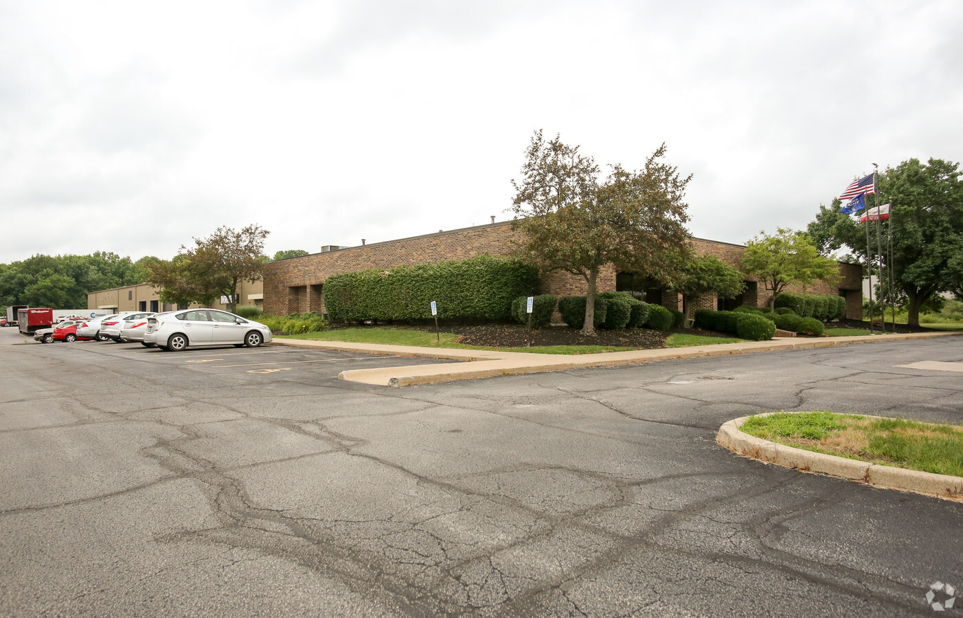
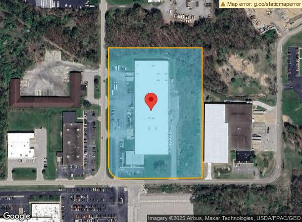
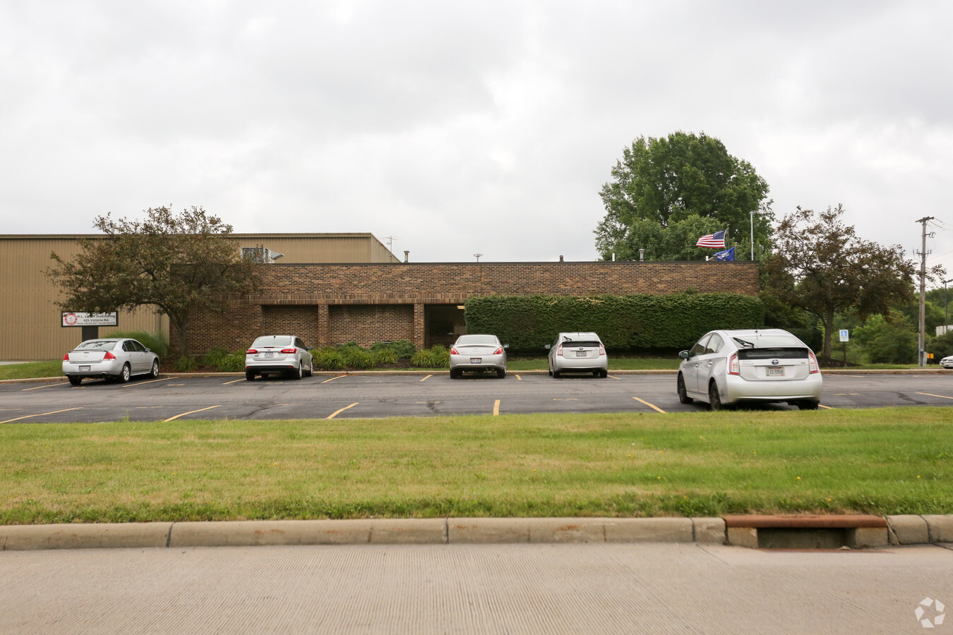
Property Record
425 Victoria Rd, Youngstown, OH 44515
NEARBY LISTINGS FOR SALE OR LEASE
Property Detail
425 Victoria Rd
Youngstown-Warren-Boardman, OH-PA
TRACT 6
48-106-0-009.00-0
Mahoning
Warehouse
Ohio
2023
9.98 AC
2023
Austintown
812500
Youngstown/Warren/Boardman
121,094 SF
DEMOGRAPHICS near 425 Victoria Rd
1 Mile
3 Mile
5 Mile
2024 Total Population
1,845
23,143
67,588
2029 Population
1,811
22,546
66,136
Pop Growth 2024-2029
(1.84%)
(2.58%)
(2.15%)
Average Age
47
45
43
2024 Total Households
768
10,519
29,634
HH Growth 2024-2029
(1.95%)
(2.75%)
(2.27%)
Median Household Inc
$63,816
$53,808
$51,231
Avg Household Size
2.30
2.10
2.20
2024 Avg HH Vehicles
2.00
2.00
2.00
Median Home Value
$146,410
$145,652
$122,976
Median Year Built
1973
1969
1963
Nearby Places
- Restaurants
- Banks
- Shops
- Fitness
- Groceries
Nearby Properties
Address
Land Use
TOTAL SIZE
Lot Size
Zoning
Address
Land Use
TOTAL SIZE
Lot Size
Zoning
170,866 SF
189.16 AC
Address
Land Use
TOTAL SIZE
Lot Size
Zoning
1,582.88 AC
Address
Land Use
TOTAL SIZE
Lot Size
Zoning
188,134 SF
12.60 AC
R1
Address
Land Use
TOTAL SIZE
Lot Size
Zoning
127,210 SF
12.43 AC
R1
Address
Land Use
TOTAL SIZE
Lot Size
Zoning
122,806 SF
9.46 AC
R1
Address
Land Use
TOTAL SIZE
Lot Size
Zoning
Address
Land Use
TOTAL SIZE
Lot Size
Zoning
324,442 SF
54 AC
R1
Address
Land Use
TOTAL SIZE
Lot Size
Zoning
14.92 AC
Address
Land Use
TOTAL SIZE
Lot Size
Zoning
98,609 SF
11.01 AC
Address
Land Use
TOTAL SIZE
Lot Size
Zoning
54,767 SF
16 AC
B2
Address
Land Use
TOTAL SIZE
Lot Size
Zoning
123,472 SF
28.58 AC
R3
Address
Land Use
TOTAL SIZE
Lot Size
Zoning
474,195 SF
18.81 AC
I2
Address
Land Use
TOTAL SIZE
Lot Size
Zoning
58,282 SF
24.96 AC
Address
Land Use
TOTAL SIZE
Lot Size
Zoning
62,222 SF
7.62 AC
B2
Address
Land Use
TOTAL SIZE
Lot Size
Zoning
71,678 SF
7.78 AC
Address
Land Use
TOTAL SIZE
Lot Size
Zoning
395,799 SF
18.29 AC
I2
Address
Land Use
TOTAL SIZE
Lot Size
Zoning
81,954 SF
15 AC
R3
Address
Land Use
TOTAL SIZE
Lot Size
Zoning
95,231 SF
37.75 AC
ASER
Address
Land Use
TOTAL SIZE
Lot Size
Zoning
23,603 SF
8.87 AC
B2
Address
Land Use
TOTAL SIZE
Lot Size
Zoning
120,168 SF
18.07 AC
B2
Address
Land Use
TOTAL SIZE
Lot Size
Zoning
70,713 SF
7.73 AC
B2
Address
Land Use
TOTAL SIZE
Lot Size
Zoning
58,663 SF
24.53 AC
ASER
Address
Land Use
TOTAL SIZE
Lot Size
Zoning
43,927 SF
13.94 AC
R3
Address
Land Use
TOTAL SIZE
Lot Size
Zoning
58,085 SF
3.30 AC
I2
Address
Land Use
TOTAL SIZE
Lot Size
Zoning
57,318 SF
3.01 AC
B2
Address
Land Use
TOTAL SIZE
Lot Size
Zoning
11,472 SF
11 AC
R3
Address
Land Use
TOTAL SIZE
Lot Size
Zoning
94,096 SF
4.46 AC
I2
Address
Land Use
TOTAL SIZE
Lot Size
Zoning
64,536 SF
9.10 AC
B2
Address
Land Use
TOTAL SIZE
Lot Size
Zoning
102,448 SF
9.96 AC
B2
Address
Land Use
TOTAL SIZE
Lot Size
Zoning
46,928 SF
12.88 AC
B2
The World's #1 Commercial Real Estate Marketplace
Connect with us
© 2025 CoStar Group
The information above has been obtained from sources believed reliable. While we do not doubt its accuracy we have not verified it and make no guarantee, warranty or representation about it. It is your responsibility to independently confirm its accuracy and completeness. Any projections, opinions, assumptions, or estimates used are for example only and do not represent the current or future performance of the property. The value of this transaction to you depends on tax and other factors which should be evaluated by your tax, financial, and legal advisors. You and your advisors should conduct a careful, independent investigation of the property to determine to your satisfaction the suitability of the property for your needs.