Property Record
4256 Corporate Exchange Dr, Hudsonville, MI 49426
NEARBY LISTINGS FOR SALE OR LEASE
-
-
View all Hudsonville listings for sale on LoopNet.com
Property Detail
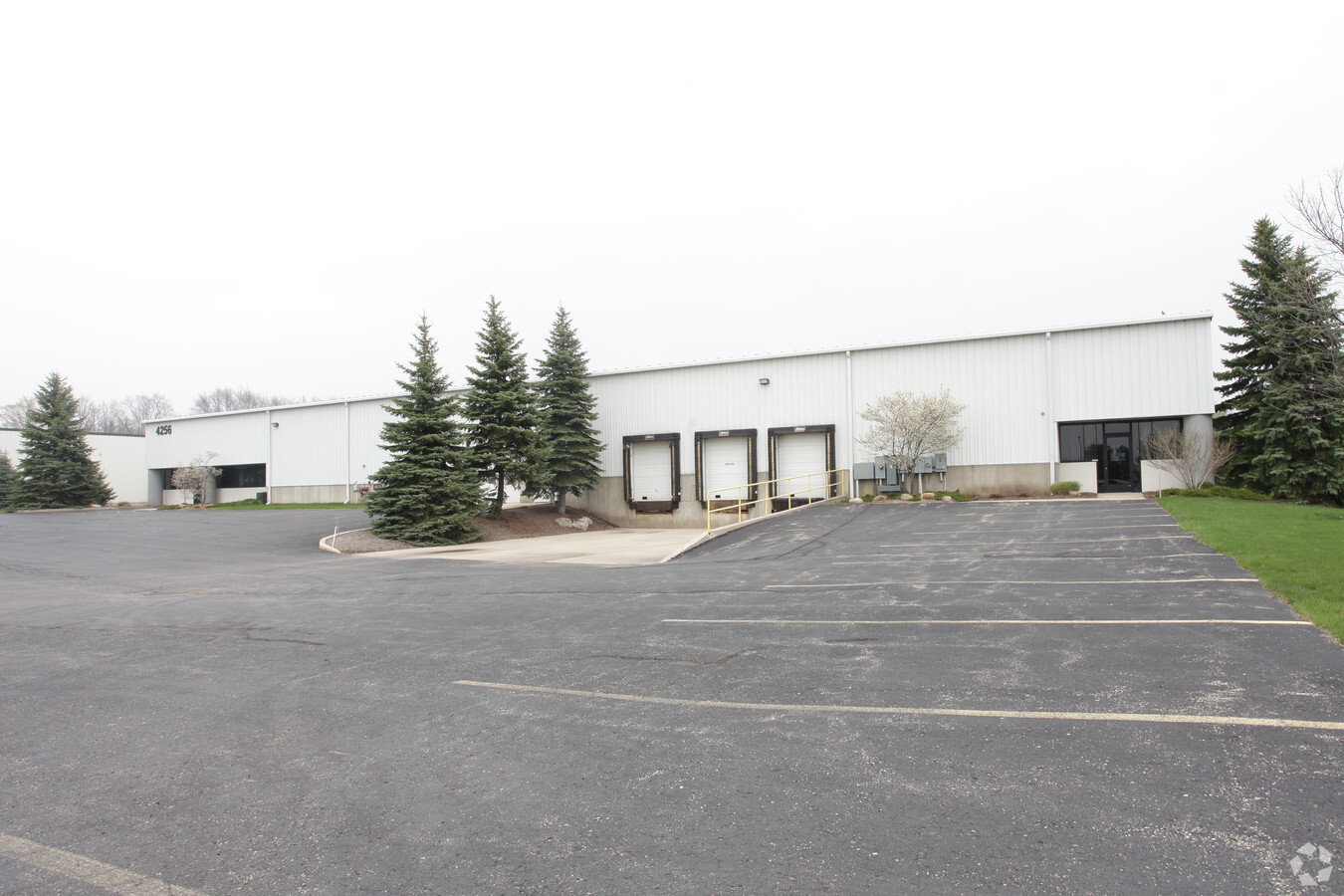
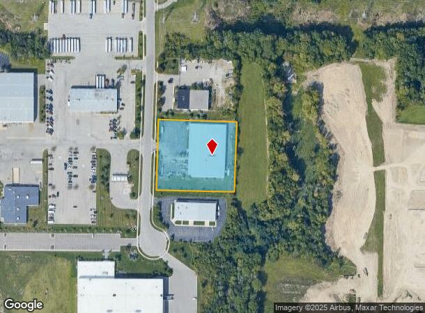
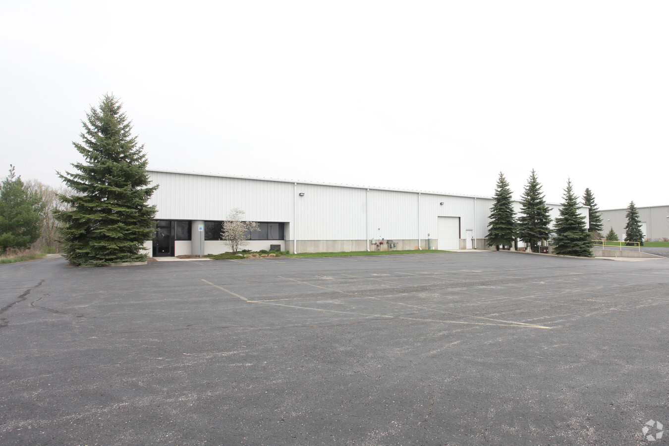
4256 Corporate Exchange Dr
70-18-04-301-025
PART OF SW 1/4 COM W 1/4 COR, TH S 01D 52M 09S W 66192 FT, S 89D 56M 04S E 16604 FT ALG N LI OF S 1/2 OF N 1/2 OF SW 1/4, TH S 01D 47M 45S W 25306 FT TO PT OF BEG, TH S 88D 12M 15S E 3268 FT, S 01D 47M 45S W 290 FT, N 88D 12M 15S W 3268 FT, N 01D 47M
Lightindustrial
Ottawa
X
Michigan
26139C0351E
2.15 AC
2024
E Ottawa Cnty/Hudsonville
2024
West Michigan
023001
Grand Rapids-Wyoming, MI
32,140 SF
DEMOGRAPHICS near 4256 Corporate Exchange Dr
1 Mile
3 Mile
5 Mile
2024 Total Population
4,359
20,068
65,028
2029 Population
4,601
21,113
68,113
Pop Growth 2024-2029
+ 5.55%
+ 5.21%
+ 4.74%
Average Age
33
37
38
2024 Total Households
1,470
6,979
22,518
HH Growth 2024-2029
+ 5.65%
+ 5.30%
+ 4.81%
Median Household Inc
$87,718
$90,712
$90,628
Avg Household Size
2.90
2.80
2.80
2024 Avg HH Vehicles
2.00
2.00
2.00
Median Home Value
$286,450
$275,647
$274,053
Median Year Built
2004
1997
1989
Nearby Places
- Restaurants
- Banks
- Shops
- Fitness
- Groceries
PUBLIC TRANSPORTATION
AIRPORT
Gerald R Ford International
DRIVE
WALK
Distance
Gerald R Ford International
30 min
21.0 mi
Freight Ports
Port Milwaukee
DRIVE
WALK
Distance
Port Milwaukee
292 min
249.2 mi
Nearby Properties
Address
Land Use
TOTAL SIZE
Lot Size
Zoning
Address
Land Use
TOTAL SIZE
Lot Size
Zoning
196,665 SF
46.39 AC
SEE MAP
Address
Land Use
TOTAL SIZE
Lot Size
Zoning
273,515 SF
Address
Land Use
TOTAL SIZE
Lot Size
Zoning
20.60 AC
HDR
Address
Land Use
TOTAL SIZE
Lot Size
Zoning
22.23 AC
R-4
Address
Land Use
TOTAL SIZE
Lot Size
Zoning
74.03 AC
MHP
Address
Land Use
TOTAL SIZE
Lot Size
Zoning
138,648 SF
Address
Land Use
TOTAL SIZE
Lot Size
Zoning
322,519 SF
27.04 AC
IND-G
Address
Land Use
TOTAL SIZE
Lot Size
Zoning
83,640 SF
R-1-A
Address
Land Use
TOTAL SIZE
Lot Size
Zoning
85,799 SF
12.89 AC
SEE MAP
Address
Land Use
TOTAL SIZE
Lot Size
Zoning
66,766 SF
R-1-A
Address
Land Use
TOTAL SIZE
Lot Size
Zoning
162,719 SF
19.76 AC
SEE MAP
Address
Land Use
TOTAL SIZE
Lot Size
Zoning
392,381 SF
21.73 AC
SEE MAP
Address
Land Use
TOTAL SIZE
Lot Size
Zoning
121,265 SF
17.97 AC
I-2
Address
Land Use
TOTAL SIZE
Lot Size
Zoning
139,774 SF
10.67 AC
HDR-B
Address
Land Use
TOTAL SIZE
Lot Size
Zoning
8,464 SF
80.47 AC
SEE MAP
Address
Land Use
TOTAL SIZE
Lot Size
Zoning
56,784 SF
7.93 AC
R-4
Address
Land Use
TOTAL SIZE
Lot Size
Zoning
78,846 SF
8.73 AC
I
Address
Land Use
TOTAL SIZE
Lot Size
Zoning
11.56 AC
SEE MAP
Address
Land Use
TOTAL SIZE
Lot Size
Zoning
6.29 AC
SEE MAP
Address
Land Use
TOTAL SIZE
Lot Size
Zoning
78,392 SF
10.45 AC
I-2
Address
Land Use
TOTAL SIZE
Lot Size
Zoning
91,450 SF
10.45 AC
SEE MAP
Address
Land Use
TOTAL SIZE
Lot Size
Zoning
44,400 SF
6.69 AC
HS
Address
Land Use
TOTAL SIZE
Lot Size
Zoning
60,000 SF
18.36 AC
I-1
Address
Land Use
TOTAL SIZE
Lot Size
Zoning
103,976 SF
8.68 AC
IND-G
Address
Land Use
TOTAL SIZE
Lot Size
Zoning
38,017 SF
5.46 AC
HC
Address
Land Use
TOTAL SIZE
Lot Size
Zoning
32,400 SF
67.30 AC
SEE MAP
Address
Land Use
TOTAL SIZE
Lot Size
Zoning
94,894 SF
7.35 AC
I
Address
Land Use
TOTAL SIZE
Lot Size
Zoning
42,914 SF
4.04 AC
SEE MAP
Address
Land Use
TOTAL SIZE
Lot Size
Zoning
50,578 SF
31.51 AC
SEE MAP
Address
Land Use
TOTAL SIZE
Lot Size
Zoning
35,916 SF
3.30 AC
CS
The World's #1 Commercial Real Estate Marketplace
Connect with us
© 2025 CoStar Group
The information above has been obtained from sources believed reliable. While we do not doubt its accuracy we have not verified it and make no guarantee, warranty or representation about it. It is your responsibility to independently confirm its accuracy and completeness. Any projections, opinions, assumptions, or estimates used are for example only and do not represent the current or future performance of the property. The value of this transaction to you depends on tax and other factors which should be evaluated by your tax, financial, and legal advisors. You and your advisors should conduct a careful, independent investigation of the property to determine to your satisfaction the suitability of the property for your needs.