Property Record
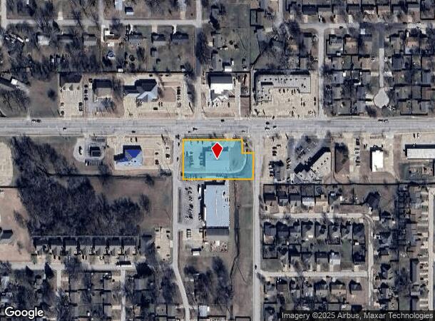
426 E 141St St, Glenpool, OK 74033

NEARBY LISTINGS FOR SALE OR LEASE
Property Detail
426 E 141St St
Tulsa, OK
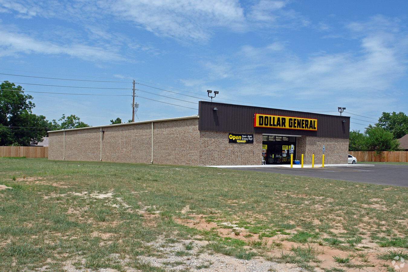
Dollar General Of Glenpool Rsb Pt L1&2 B
84992-72-14-45880
LT 1 BLK 1
Storebuilding
Tulsa
X
Oklahoma
40143C0409K
1
2023
1.16 AC
2024
South Tulsa
007704
Tulsa
8,000 SF
DEMOGRAPHICS near 426 E 141St St
1 Mile
3 Mile
5 Mile
2024 Total Population
8,568
25,428
50,769
2029 Population
8,787
26,248
52,610
Pop Growth 2024-2029
+ 2.56%
+ 3.22%
+ 3.63%
Average Age
35
36
36
2024 Total Households
2,965
8,641
17,511
HH Growth 2024-2029
+ 2.56%
+ 3.28%
+ 3.68%
Median Household Inc
$68,352
$83,533
$90,522
Avg Household Size
2.80
2.90
2.90
2024 Avg HH Vehicles
2.00
2.00
2.00
Median Home Value
$164,634
$227,316
$251,000
Median Year Built
1986
2001
2002
Nearby Places
- Restaurants
- Banks
- Shops
- Fitness
- Groceries
PUBLIC TRANSPORTATION
AIRPORT
Tulsa International
DRIVE
WALK
Distance
Tulsa International
32 min
23.6 mi
Freight Ports
Tulsa Port Of Catoosa
DRIVE
WALK
Distance
Tulsa Port Of Catoosa
41 min
32.3 mi
Nearby Properties
Address
Land Use
TOTAL SIZE
Lot Size
Zoning
Address
Land Use
TOTAL SIZE
Lot Size
Zoning
52,441 SF
12.79 AC
CS
Address
Land Use
TOTAL SIZE
Lot Size
Zoning
58,907 SF
5 AC
CG
Address
Land Use
TOTAL SIZE
Lot Size
Zoning
49,735 SF
14.35 AC
CG
Address
Land Use
TOTAL SIZE
Lot Size
Zoning
116,016 SF
54.80 AC
CG
Address
Land Use
TOTAL SIZE
Lot Size
Zoning
81,732 SF
26.20 AC
AG
Address
Land Use
TOTAL SIZE
Lot Size
Zoning
49,025 SF
10.75 AC
AG
Address
Land Use
TOTAL SIZE
Lot Size
Zoning
28,761 SF
9.71 AC
RS1
Address
Land Use
TOTAL SIZE
Lot Size
Zoning
15,636 SF
4.91 AC
AG
Address
Land Use
TOTAL SIZE
Lot Size
Zoning
25,555 SF
17.31 AC
CN
Address
Land Use
TOTAL SIZE
Lot Size
Zoning
331,125 SF
17.64 AC
CG
Address
Land Use
TOTAL SIZE
Lot Size
Zoning
11,436 SF
1.38 AC
CG
Address
Land Use
TOTAL SIZE
Lot Size
Zoning
25,932 SF
15 AC
RE
Address
Land Use
TOTAL SIZE
Lot Size
Zoning
6,702 SF
3.63 AC
AG
Address
Land Use
TOTAL SIZE
Lot Size
Zoning
216,308 SF
23.91 AC
CG
Address
Land Use
TOTAL SIZE
Lot Size
Zoning
23,600 SF
15.69 AC
Address
Land Use
TOTAL SIZE
Lot Size
Zoning
3,660 SF
10 AC
CG
Address
Land Use
TOTAL SIZE
Lot Size
Zoning
38,476 SF
18.68 AC
CG
Address
Land Use
TOTAL SIZE
Lot Size
Zoning
68,298 SF
28.60 AC
CG
Address
Land Use
TOTAL SIZE
Lot Size
Zoning
16,310 SF
10.28 AC
AG
Address
Land Use
TOTAL SIZE
Lot Size
Zoning
19,857 SF
3.44 AC
AG
Address
Land Use
TOTAL SIZE
Lot Size
Zoning
16,068 SF
0.80 AC
CG
Address
Land Use
TOTAL SIZE
Lot Size
Zoning
27.87 AC
IM
Address
Land Use
TOTAL SIZE
Lot Size
Zoning
12,938 SF
2.14 AC
CG
Address
Land Use
TOTAL SIZE
Lot Size
Zoning
32,408 SF
6.25 AC
AG
Address
Land Use
TOTAL SIZE
Lot Size
Zoning
7,472 SF
13.13 AC
AG
Address
Land Use
TOTAL SIZE
Lot Size
Zoning
48,200 SF
2.61 AC
CG
Address
Land Use
TOTAL SIZE
Lot Size
Zoning
15,097 SF
4.43 AC
RE
Address
Land Use
TOTAL SIZE
Lot Size
Zoning
27,910 SF
2.54 AC
CG
Address
Land Use
TOTAL SIZE
Lot Size
Zoning
33,128 SF
1.83 AC
RM2
Address
Land Use
TOTAL SIZE
Lot Size
Zoning
5,971 SF
2.66 AC
AG
The World's #1 Commercial Real Estate Marketplace
Connect with us
© 2025 CoStar Group
The information above has been obtained from sources believed reliable. While we do not doubt its accuracy we have not verified it and make no guarantee, warranty or representation about it. It is your responsibility to independently confirm its accuracy and completeness. Any projections, opinions, assumptions, or estimates used are for example only and do not represent the current or future performance of the property. The value of this transaction to you depends on tax and other factors which should be evaluated by your tax, financial, and legal advisors. You and your advisors should conduct a careful, independent investigation of the property to determine to your satisfaction the suitability of the property for your needs.