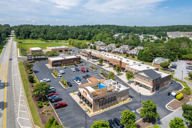
Property Record
429 Loganville Hwy, Winder, GA 30680

NEARBY LISTINGS FOR SALE OR LEASE
Property Detail
429 Loganville Hwy
Atlanta-Sandy Springs-Roswell, GA
Resource Park
WN06-002E
TRACT 2 B 2.08 AC (COMMON AREA)
Commercialnec
Barrow
X
Georgia
13013C0126D
0
2025
2.07 AC
2025
S Barrow
180205
Atlanta
DEMOGRAPHICS near 429 Loganville Hwy
1 Mile
3 Mile
5 Mile
2024 Total Population
2,776
25,434
55,296
2029 Population
3,239
29,738
64,599
Pop Growth 2024-2029
+ 16.68%
+ 16.92%
+ 16.82%
Average Age
35
36
37
2024 Total Households
982
8,884
18,890
HH Growth 2024-2029
+ 16.90%
+ 17.06%
+ 16.98%
Median Household Inc
$68,071
$59,033
$65,254
Avg Household Size
2.80
2.80
2.90
2024 Avg HH Vehicles
2.00
2.00
2.00
Median Home Value
$187,236
$195,026
$201,316
Median Year Built
2000
1994
1998
Nearby Places
Map Layers
Map Styles
 Street
 Aerial
- Restaurants
- Banks
- Shops
- Fitness
- Groceries
SALE & LEASE HISTORY
LISTING DATE
SALE/LEASE

Sep 23, 2022
For Lease
Sep 23, 2016
For Sale
Sep 20, 2019
For Lease
Jan 22, 2019
For Lease
Feb 08, 2018
For Lease
Dec 16, 2022
For Lease
Nearby Properties
Address
Land Use
TOTAL SIZE
Lot Size
Zoning
Address
Land Use
TOTAL SIZE
Lot Size
Zoning
1,456 SF
1,732.81 AC
G
Address
Land Use
TOTAL SIZE
Lot Size
Zoning
26,789 SF
35.64 AC
C-3
Address
Land Use
TOTAL SIZE
Lot Size
Zoning
165,737 SF
124.90 AC
G
Address
Land Use
TOTAL SIZE
Lot Size
Zoning
22,320 SF
15.90 AC
R-3
Address
Land Use
TOTAL SIZE
Lot Size
Zoning
105,850 SF
61 AC
G
Address
Land Use
TOTAL SIZE
Lot Size
Zoning
690,427 SF
156.03 AC
M-1
Address
Land Use
TOTAL SIZE
Lot Size
Zoning
165,737 SF
9.70 AC
G
Address
Land Use
TOTAL SIZE
Lot Size
Zoning
2,046 SF
12.97 AC
B-2,R-3
Address
Land Use
TOTAL SIZE
Lot Size
Zoning
37,012 SF
10.55 AC
OI
Address
Land Use
TOTAL SIZE
Lot Size
Zoning
50,000 SF
29 AC
G
Address
Land Use
TOTAL SIZE
Lot Size
Zoning
89,684 SF
64.92 AC
B-2
Address
Land Use
TOTAL SIZE
Lot Size
Zoning
104,805 SF
12.54 AC
C-3
Address
Land Use
TOTAL SIZE
Lot Size
Zoning
189,400 SF
24.79 AC
C-2
Address
Land Use
TOTAL SIZE
Lot Size
Zoning
233,462 SF
25.22 AC
C-2
Address
Land Use
TOTAL SIZE
Lot Size
Zoning
2,398 SF
8.13 AC
R-3
Address
Land Use
TOTAL SIZE
Lot Size
Zoning
132,156 SF
10.05 AC
C-2
Address
Land Use
TOTAL SIZE
Lot Size
Zoning
83,937 SF
17.83 AC
B-1
Address
Land Use
TOTAL SIZE
Lot Size
Zoning
1,188 SF
7.63 AC
R-3
Address
Land Use
TOTAL SIZE
Lot Size
Zoning
79,029 SF
9.72 AC
C-2
Address
Land Use
TOTAL SIZE
Lot Size
Zoning
3,370 SF
352.38 AC
G,TNPD
Address
Land Use
TOTAL SIZE
Lot Size
Zoning
60,540 SF
79.35 AC
AG
Address
Land Use
TOTAL SIZE
Lot Size
Zoning
38,550 SF
3.04 AC
C-2
Address
Land Use
TOTAL SIZE
Lot Size
Zoning
37,162 SF
4.62 AC
R-3
Address
Land Use
TOTAL SIZE
Lot Size
Zoning
3,462 SF
10.05 AC
G,R-3
Address
Land Use
TOTAL SIZE
Lot Size
Zoning
55,420 SF
5.05 AC
C-3
Address
Land Use
TOTAL SIZE
Lot Size
Zoning
26,802 SF
5 AC
AG
Address
Land Use
TOTAL SIZE
Lot Size
Zoning
2,160 SF
23.93 AC
B-1
Address
Land Use
TOTAL SIZE
Lot Size
Zoning
8,916 SF
67.07 AC
R-3
Address
Land Use
TOTAL SIZE
Lot Size
Zoning
105.99 AC
C-3
Address
Land Use
TOTAL SIZE
Lot Size
Zoning
46,339 SF
2 AC
B-2
The World's #1 Commercial Real Estate Marketplace
Connect with us
© 2026 CoStar Group
The information above has been obtained from sources believed reliable. While we do not doubt its accuracy we have not verified it and make no guarantee, warranty or representation about it. It is your responsibility to independently confirm its accuracy and completeness. Any projections, opinions, assumptions, or estimates used are for example only and do not represent the current or future performance of the property. The value of this transaction to you depends on tax and other factors which should be evaluated by your tax, financial, and legal advisors. You and your advisors should conduct a careful, independent investigation of the property to determine to your satisfaction the suitability of the property for your needs.