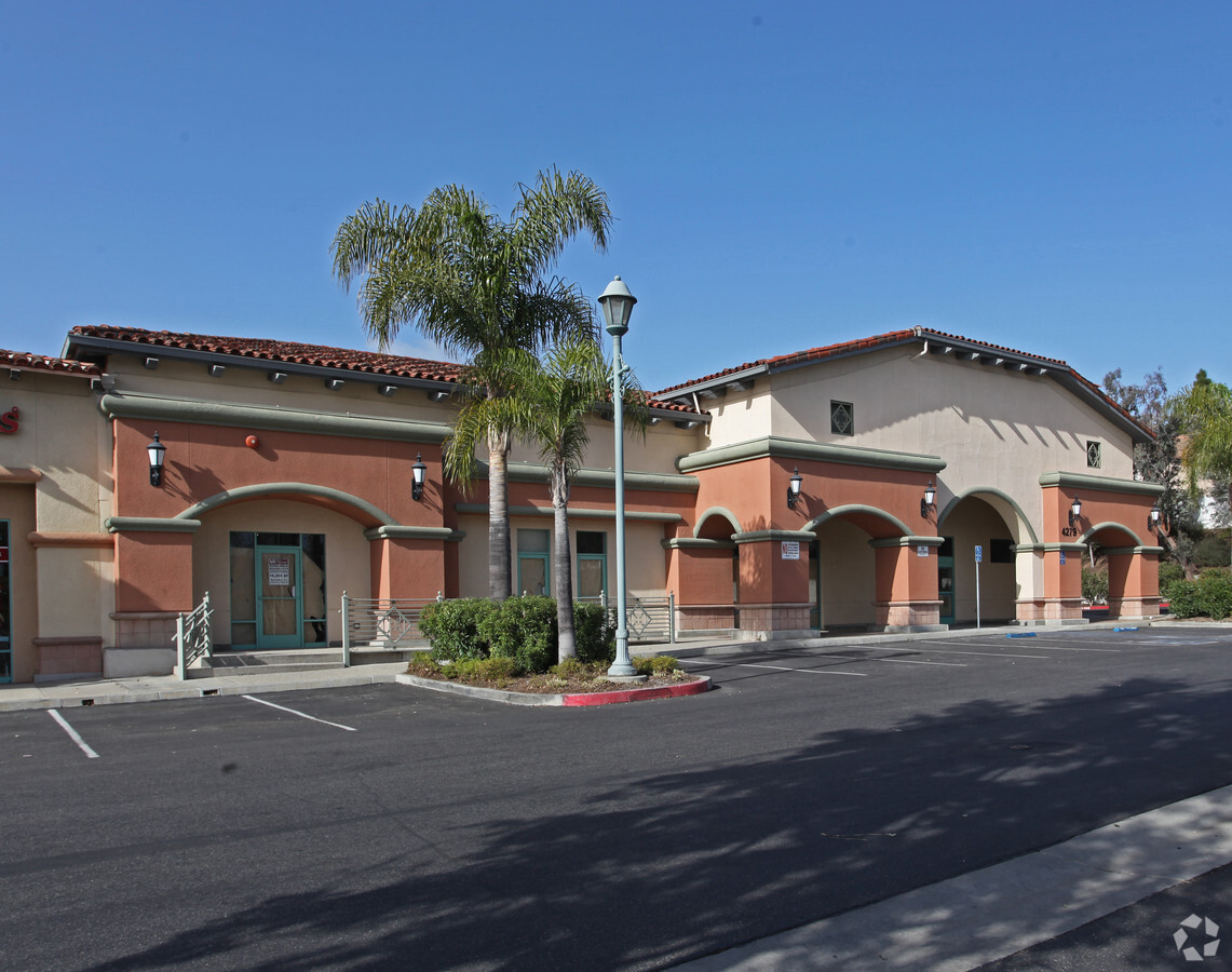
Property Record
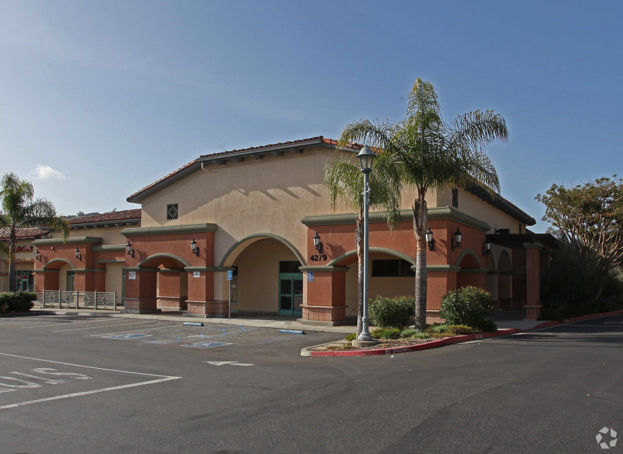
4279 Tierra Rejada Rd, Moorpark, CA 93021

NEARBY LISTINGS FOR SALE OR LEASE
Property Detail
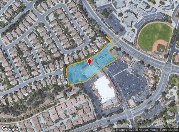
4279 Tierra Rejada Rd
505-0-300-065
TRACT: 508100 LOT: 1 REF: 136MR 70
Regionalshoppingcenterormallwithanchorstore
Ventura
X
California
06111C0819E
1
2024
2.51 AC
2024
Moorpark/Simi Valley
007607
Los Angeles
16,880 SF
Oxnard-Thousand Oaks-Ventura, CA
DEMOGRAPHICS near 4279 Tierra Rejada Rd
1 Mile
3 Mile
5 Mile
2024 Total Population
9,614
33,933
77,624
2029 Population
9,430
33,243
76,246
Pop Growth 2024-2029
(1.91%)
(2.03%)
(1.78%)
Average Age
42
41
42
2024 Total Households
3,195
10,851
25,681
HH Growth 2024-2029
(2.10%)
(2.21%)
(1.87%)
Median Household Inc
$142,704
$129,911
$125,257
Avg Household Size
3.00
3.10
2.90
2024 Avg HH Vehicles
2.00
2.00
2.00
Median Home Value
$747,386
$804,453
$793,357
Median Year Built
1985
1985
1981
Nearby Places
- Restaurants
- Banks
- Shops
- Fitness
- Groceries
PUBLIC TRANSPORTATION
COMMUTER RAIL
Moorpark (Ventura County Line - Southern California Regional Rail Authority (Metrolink))
DRIVE
WALK
Distance
Moorpark (Ventura County Line - Southern California Regional Rail Authority (Metrolink))
5 min
2.7 mi
Freight Ports
The Port of Hueneme
DRIVE
WALK
Distance
The Port of Hueneme
37 min
22.3 mi
Nearby Properties
Address
Land Use
TOTAL SIZE
Lot Size
Zoning
Address
Land Use
TOTAL SIZE
Lot Size
Zoning
4,950 SF
50.22 AC
Address
Land Use
TOTAL SIZE
Lot Size
Zoning
321,174 SF
14.21 AC
Address
Land Use
TOTAL SIZE
Lot Size
Zoning
68,205 SF
11.95 AC
M1
Address
Land Use
TOTAL SIZE
Lot Size
Zoning
152,456 SF
7.89 AC
RPD15
Address
Land Use
TOTAL SIZE
Lot Size
Zoning
134,520 SF
6.50 AC
RPD15
Address
Land Use
TOTAL SIZE
Lot Size
Zoning
Address
Land Use
TOTAL SIZE
Lot Size
Zoning
Address
Land Use
TOTAL SIZE
Lot Size
Zoning
17,165 SF
11.52 AC
Address
Land Use
TOTAL SIZE
Lot Size
Zoning
4,731 SF
5.01 AC
Address
Land Use
TOTAL SIZE
Lot Size
Zoning
127,176 SF
6.87 AC
Address
Land Use
TOTAL SIZE
Lot Size
Zoning
160,008 SF
40.68 AC
Address
Land Use
TOTAL SIZE
Lot Size
Zoning
134,726 SF
6.01 AC
M1
Address
Land Use
TOTAL SIZE
Lot Size
Zoning
1,332 SF
6.08 AC
Address
Land Use
TOTAL SIZE
Lot Size
Zoning
162,556 SF
6.21 AC
M1
Address
Land Use
TOTAL SIZE
Lot Size
Zoning
14,708 SF
16.08 AC
M-1
Address
Land Use
TOTAL SIZE
Lot Size
Zoning
12,748 SF
6.42 AC
Address
Land Use
TOTAL SIZE
Lot Size
Zoning
12,507 SF
9.05 AC
Address
Land Use
TOTAL SIZE
Lot Size
Zoning
52,547 SF
10.83 AC
Address
Land Use
TOTAL SIZE
Lot Size
Zoning
43,525 SF
3.13 AC
RPD1
Address
Land Use
TOTAL SIZE
Lot Size
Zoning
24,849 SF
7.22 AC
Address
Land Use
TOTAL SIZE
Lot Size
Zoning
Address
Land Use
TOTAL SIZE
Lot Size
Zoning
143 SF
7.84 AC
RPD15
Address
Land Use
TOTAL SIZE
Lot Size
Zoning
95,711 SF
7.24 AC
Address
Land Use
TOTAL SIZE
Lot Size
Zoning
11,736 SF
4.08 AC
RPD5
Address
Land Use
TOTAL SIZE
Lot Size
Zoning
129,541 SF
6.08 AC
Address
Land Use
TOTAL SIZE
Lot Size
Zoning
44,840 SF
1.98 AC
RPD15
Address
Land Use
TOTAL SIZE
Lot Size
Zoning
48,586 SF
5.15 AC
Address
Land Use
TOTAL SIZE
Lot Size
Zoning
14,618 SF
1.27 AC
Address
Land Use
TOTAL SIZE
Lot Size
Zoning
31,751 SF
9.96 AC
Address
Land Use
TOTAL SIZE
Lot Size
Zoning
121,964 SF
5.39 AC
The World's #1 Commercial Real Estate Marketplace
Connect with us
© 2025 CoStar Group
The information above has been obtained from sources believed reliable. While we do not doubt its accuracy we have not verified it and make no guarantee, warranty or representation about it. It is your responsibility to independently confirm its accuracy and completeness. Any projections, opinions, assumptions, or estimates used are for example only and do not represent the current or future performance of the property. The value of this transaction to you depends on tax and other factors which should be evaluated by your tax, financial, and legal advisors. You and your advisors should conduct a careful, independent investigation of the property to determine to your satisfaction the suitability of the property for your needs.