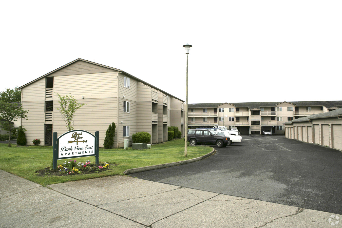
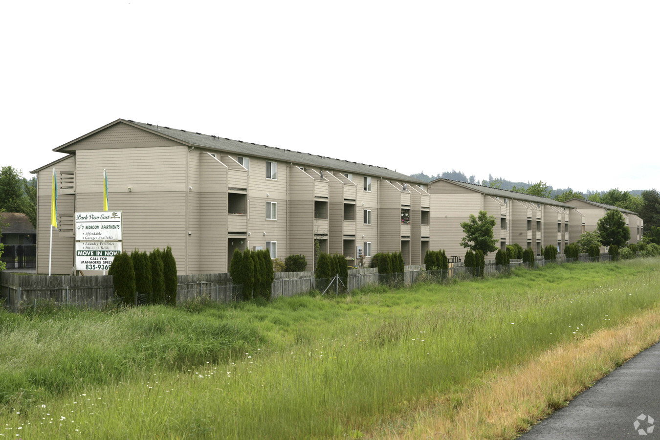
Property Record
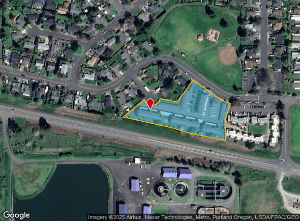
4290 Addy St, Washougal, WA 98671

NEARBY LISTINGS FOR SALE OR LEASE
-
-
View all Washougal listings for sale on LoopNet.com
Property Detail
4290 Addy St
Portland-Vancouver-Hillsboro, OR-WA
Bethea Park Estates
071086-176
BETHEA PARK ESTATES #1 TRACT A & LOTS 5,6 & 7 FOR ASSESSOR USE ONLY EXC A TT OF LAND LOCATED IN A PTN OF TRACT A BETHEA PARK ESTATE A SUBDIV IN W1/2 OF W1/2 OF GIBBONS DLC IN SEC 16-1-4 DAF: BEG AT SE COR OF TRACT A SD PT BEING INTERSECTION OF R/W OF
Multifamilydwelling
Clark
X
Washington
53011C0554E
5,6,7
2025
2.35 AC
2025
Outlying Vancouver
040507
Portland
79,500 SF
DEMOGRAPHICS near 4290 Addy St
1 Mile
3 Mile
5 Mile
2024 Total Population
4,792
18,748
47,140
2029 Population
5,138
20,121
49,248
Pop Growth 2024-2029
+ 7.22%
+ 7.32%
+ 4.47%
Average Age
40
41
41
2024 Total Households
1,713
6,978
17,037
HH Growth 2024-2029
+ 7.30%
+ 7.45%
+ 4.47%
Median Household Inc
$91,884
$96,170
$94,219
Avg Household Size
2.80
2.70
2.70
2024 Avg HH Vehicles
2.00
2.00
2.00
Median Home Value
$394,348
$476,219
$472,433
Median Year Built
1991
1994
1991
Nearby Places
- Restaurants
- Banks
- Shops
- Fitness
- Groceries
PUBLIC TRANSPORTATION
AIRPORT
Portland International
DRIVE
WALK
Distance
Portland International
26 min
17.3 mi
Freight Ports
Port of Portland
DRIVE
WALK
Distance
Port of Portland
37 min
26.3 mi
Nearby Properties
Address
Land Use
TOTAL SIZE
Lot Size
Zoning
Address
Land Use
TOTAL SIZE
Lot Size
Zoning
262,320 SF
25.24 AC
IP
Address
Land Use
TOTAL SIZE
Lot Size
Zoning
123,157 SF
24.23 AC
GR 5
Address
Land Use
TOTAL SIZE
Lot Size
Zoning
114,696 SF
2.29 AC
MF-18
Address
Land Use
TOTAL SIZE
Lot Size
Zoning
142,571 SF
1.73 AC
TC-C
Address
Land Use
TOTAL SIZE
Lot Size
Zoning
83,139 SF
7.36 AC
HI
Address
Land Use
TOTAL SIZE
Lot Size
Zoning
256,888 SF
18.91 AC
TC-C
Address
Land Use
TOTAL SIZE
Lot Size
Zoning
108,108 SF
5.35 AC
IP
Address
Land Use
TOTAL SIZE
Lot Size
Zoning
64,400 SF
3.30 AC
MF-18
Address
Land Use
TOTAL SIZE
Lot Size
Zoning
75,360 SF
4.46 AC
RC
Address
Land Use
TOTAL SIZE
Lot Size
Zoning
56,376 SF
4.04 AC
CC
Address
Land Use
TOTAL SIZE
Lot Size
Zoning
69,043 SF
0.92 AC
TC-C
Address
Land Use
TOTAL SIZE
Lot Size
Zoning
49,500 SF
6.48 AC
HI
Address
Land Use
TOTAL SIZE
Lot Size
Zoning
53,663 SF
3.40 AC
CH
Address
Land Use
TOTAL SIZE
Lot Size
Zoning
97,260 SF
4.70 AC
CH
Address
Land Use
TOTAL SIZE
Lot Size
Zoning
49,522 SF
5.05 AC
HI
Address
Land Use
TOTAL SIZE
Lot Size
Zoning
49,500 SF
5.84 AC
HI
Address
Land Use
TOTAL SIZE
Lot Size
Zoning
16,384 SF
61.53 AC
IP
Address
Land Use
TOTAL SIZE
Lot Size
Zoning
61,500 SF
1.64 AC
MF-18
Address
Land Use
TOTAL SIZE
Lot Size
Zoning
47,668 SF
73.93 AC
P/OS
Address
Land Use
TOTAL SIZE
Lot Size
Zoning
48,352 SF
0.58 AC
CH
Address
Land Use
TOTAL SIZE
Lot Size
Zoning
42,870 SF
3.43 AC
MF-18
Address
Land Use
TOTAL SIZE
Lot Size
Zoning
54,074 SF
0.20 AC
TC-C
Address
Land Use
TOTAL SIZE
Lot Size
Zoning
104,652 SF
1.90 AC
IP
Address
Land Use
TOTAL SIZE
Lot Size
Zoning
61,136 SF
9.73 AC
HI
Address
Land Use
TOTAL SIZE
Lot Size
Zoning
65,986 SF
1.69 AC
HI
Address
Land Use
TOTAL SIZE
Lot Size
Zoning
81,863 SF
5.10 AC
HI
Address
Land Use
TOTAL SIZE
Lot Size
Zoning
33,988 SF
0.14 AC
CC
Address
Land Use
TOTAL SIZE
Lot Size
Zoning
12,242 SF
1.90 AC
CH
The World's #1 Commercial Real Estate Marketplace
Connect with us
© 2025 CoStar Group
The information above has been obtained from sources believed reliable. While we do not doubt its accuracy we have not verified it and make no guarantee, warranty or representation about it. It is your responsibility to independently confirm its accuracy and completeness. Any projections, opinions, assumptions, or estimates used are for example only and do not represent the current or future performance of the property. The value of this transaction to you depends on tax and other factors which should be evaluated by your tax, financial, and legal advisors. You and your advisors should conduct a careful, independent investigation of the property to determine to your satisfaction the suitability of the property for your needs.