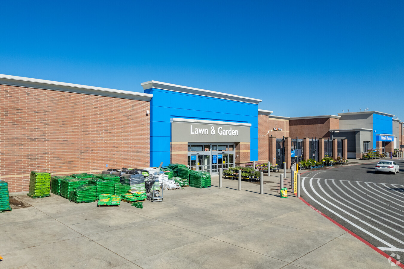
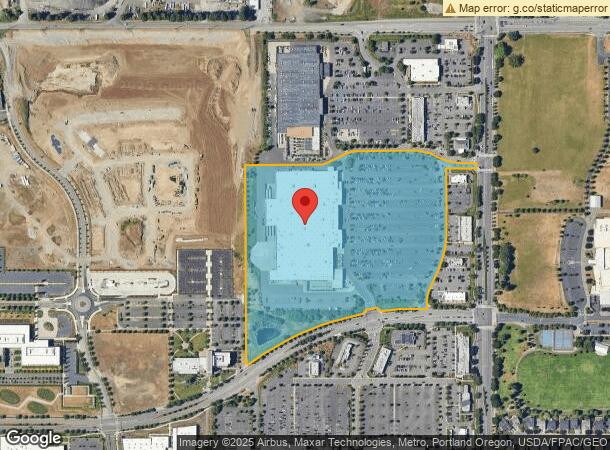
Property Record
430 Se 192Nd Ave, Vancouver, WA 98683
NEARBY LISTINGS FOR SALE OR LEASE
Property Detail
430 Se 192Nd Ave
Portland-Vancouver-Hillsboro, OR-WA
Wal-Mart Land Div Short Plat 3-853
176628-001
WAL-MART LAND DIV LOT 1 SP3-853 22.68A FOR ASSESSOR USE ONLY: TOWI & SUBJ TO EAS PER AFN 4871423
Storemultistory
Clark
X
Washington
53011C0530D
1
2025
22.68 AC
2025
Cascade Park
041329
Portland
209,725 SF
DEMOGRAPHICS near 430 Se 192Nd Ave
1 Mile
3 Mile
5 Mile
2024 Total Population
11,044
84,823
176,170
2029 Population
11,946
91,610
190,017
Pop Growth 2024-2029
+ 8.17%
+ 8.00%
+ 7.86%
Average Age
40
41
40
2024 Total Households
4,474
31,862
65,419
HH Growth 2024-2029
+ 8.18%
+ 8.14%
+ 7.98%
Median Household Inc
$94,653
$94,671
$85,697
Avg Household Size
2.50
2.60
2.60
2024 Avg HH Vehicles
2.00
2.00
2.00
Median Home Value
$466,821
$471,049
$441,888
Median Year Built
2003
1995
1994
Nearby Places
- Restaurants
- Banks
- Shops
- Fitness
- Groceries
PUBLIC TRANSPORTATION
AIRPORT
Portland International
DRIVE
WALK
Distance
Portland International
21 min
10.7 mi
Freight Ports
Port of Vancouver
DRIVE
WALK
Distance
Port of Vancouver
26 min
14.3 mi
SALE & LEASE HISTORY
LISTING DATE
SALE/LEASE

Jan 30, 2017
For Lease
Nearby Properties
Address
Land Use
TOTAL SIZE
Lot Size
Zoning
Address
Land Use
TOTAL SIZE
Lot Size
Zoning
309,088 SF
17.57 AC
RC
Address
Land Use
TOTAL SIZE
Lot Size
Zoning
817,650 SF
119.73 AC
LI/BP
Address
Land Use
TOTAL SIZE
Lot Size
Zoning
339,894 SF
27.82 AC
R-22
Address
Land Use
TOTAL SIZE
Lot Size
Zoning
929,350 SF
143.57 AC
LI/BP
Address
Land Use
TOTAL SIZE
Lot Size
Zoning
399,563 SF
12.98 AC
CC
Address
Land Use
TOTAL SIZE
Lot Size
Zoning
104,279 SF
6.09 AC
MX
Address
Land Use
TOTAL SIZE
Lot Size
Zoning
233,766 SF
5.34 AC
R-30
Address
Land Use
TOTAL SIZE
Lot Size
Zoning
264,044 SF
11.16 AC
CC
Address
Land Use
TOTAL SIZE
Lot Size
Zoning
253,976 SF
11.46 AC
MX
Address
Land Use
TOTAL SIZE
Lot Size
Zoning
285,765 SF
14.41 AC
R-22
Address
Land Use
TOTAL SIZE
Lot Size
Zoning
171,584 SF
6.26 AC
MX
Address
Land Use
TOTAL SIZE
Lot Size
Zoning
301,864 SF
9.53 AC
R-22
Address
Land Use
TOTAL SIZE
Lot Size
Zoning
188,974 SF
7.19 AC
R-30
Address
Land Use
TOTAL SIZE
Lot Size
Zoning
204,999 SF
5.71 AC
MX
Address
Land Use
TOTAL SIZE
Lot Size
Zoning
273,844 SF
13.09 AC
R-22
Address
Land Use
TOTAL SIZE
Lot Size
Zoning
247,598 SF
45.75 AC
CG
Address
Land Use
TOTAL SIZE
Lot Size
Zoning
603,750 SF
49.11 AC
IL
Address
Land Use
TOTAL SIZE
Lot Size
Zoning
199,197 SF
10.60 AC
R-22
Address
Land Use
TOTAL SIZE
Lot Size
Zoning
175,840 SF
12.30 AC
R-18
Address
Land Use
TOTAL SIZE
Lot Size
Zoning
199,550 SF
12.27 AC
R-30
Address
Land Use
TOTAL SIZE
Lot Size
Zoning
197,911 SF
12.96 AC
R-18
Address
Land Use
TOTAL SIZE
Lot Size
Zoning
174,240 SF
11.25 AC
R-22
Address
Land Use
TOTAL SIZE
Lot Size
Zoning
166,444 SF
9.80 AC
R-22
Address
Land Use
TOTAL SIZE
Lot Size
Zoning
164,030 SF
24.75 AC
R-6
Address
Land Use
TOTAL SIZE
Lot Size
Zoning
357,948 SF
8.03 AC
IL
Address
Land Use
TOTAL SIZE
Lot Size
Zoning
170,275 SF
9.74 AC
R-22
Address
Land Use
TOTAL SIZE
Lot Size
Zoning
706,024 SF
16.41 AC
IL
Address
Land Use
TOTAL SIZE
Lot Size
Zoning
174,510 SF
9.76 AC
BP
Address
Land Use
TOTAL SIZE
Lot Size
Zoning
44,228 SF
8.01 AC
LI/BP
Address
Land Use
TOTAL SIZE
Lot Size
Zoning
253,354 SF
6.69 AC
IL
The World's #1 Commercial Real Estate Marketplace
Connect with us
© 2025 CoStar Group
The information above has been obtained from sources believed reliable. While we do not doubt its accuracy we have not verified it and make no guarantee, warranty or representation about it. It is your responsibility to independently confirm its accuracy and completeness. Any projections, opinions, assumptions, or estimates used are for example only and do not represent the current or future performance of the property. The value of this transaction to you depends on tax and other factors which should be evaluated by your tax, financial, and legal advisors. You and your advisors should conduct a careful, independent investigation of the property to determine to your satisfaction the suitability of the property for your needs.