Property Record
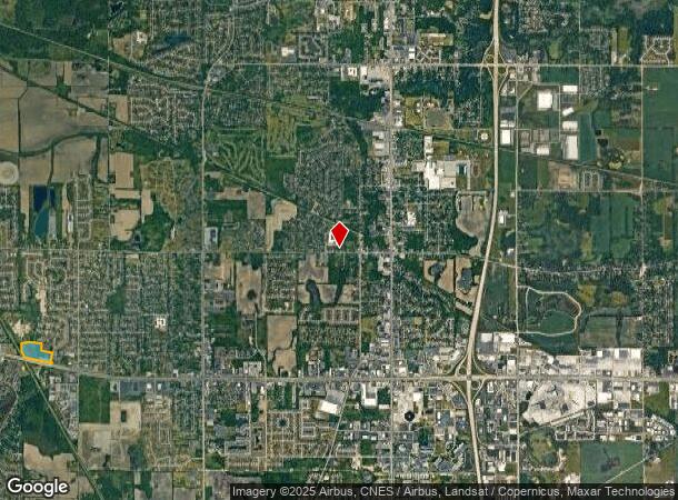
7700 Clark Approx St, Merrillville, IN 46410

NEARBY LISTINGS FOR SALE OR LEASE
Property Detail
7700 Clark Approx St
45-12-19-151-002.000-030
PART OF SW1/4 NW1/4 & NW1/4 NW1/4 S.19 T.35 R.8 17.18 AC
Recreationalacreage
Lake
A
Indiana
18089C0232E
17.18 AC
2023
Indiana
2024
Chicago
042404
Chicago-Naperville-Elgin, IL-IN-WI
DEMOGRAPHICS near 7700 Clark Approx St
1 Mile
3 Mile
5 Mile
2024 Total Population
9,069
47,870
119,301
2029 Population
9,025
47,767
119,503
Pop Growth 2024-2029
(0.49%)
(0.22%)
+ 0.17%
Average Age
38
42
41
2024 Total Households
3,593
18,882
47,522
HH Growth 2024-2029
(0.53%)
(0.20%)
+ 0.13%
Median Household Inc
$67,244
$74,898
$72,057
Avg Household Size
2.40
2.40
2.40
2024 Avg HH Vehicles
2.00
2.00
2.00
Median Home Value
$219,772
$225,971
$225,524
Median Year Built
1980
1985
1978
Nearby Places
- Restaurants
- Banks
- Shops
- Fitness
- Groceries
PUBLIC TRANSPORTATION
AIRPORT
Chicago Midway International
DRIVE
WALK
Distance
Chicago Midway International
63 min
41.2 mi
Freight Ports
Port Milwaukee
DRIVE
WALK
Distance
Port Milwaukee
163 min
126.5 mi
SALE & LEASE HISTORY
LISTING DATE
SALE/LEASE

Apr 14, 2017
For Sale
Nearby Properties
Address
Land Use
TOTAL SIZE
Lot Size
Zoning
Address
Land Use
TOTAL SIZE
Lot Size
Zoning
713,953 SF
39.61 AC
Address
Land Use
TOTAL SIZE
Lot Size
Zoning
722,810 SF
64.65 AC
R33
Address
Land Use
TOTAL SIZE
Lot Size
Zoning
598,983 SF
88 AC
Address
Land Use
TOTAL SIZE
Lot Size
Zoning
590,274 SF
48.18 AC
Address
Land Use
TOTAL SIZE
Lot Size
Zoning
536,896 SF
20.08 AC
Address
Land Use
TOTAL SIZE
Lot Size
Zoning
377,878 SF
21.58 AC
Address
Land Use
TOTAL SIZE
Lot Size
Zoning
365,748 SF
17.44 AC
R33
Address
Land Use
TOTAL SIZE
Lot Size
Zoning
321,432 SF
44.38 AC
Address
Land Use
TOTAL SIZE
Lot Size
Zoning
289,840 SF
15.31 AC
Address
Land Use
TOTAL SIZE
Lot Size
Zoning
291,060 SF
37.07 AC
Address
Land Use
TOTAL SIZE
Lot Size
Zoning
159,548 SF
16.18 AC
Address
Land Use
TOTAL SIZE
Lot Size
Zoning
236,904 SF
11.30 AC
R33
Address
Land Use
TOTAL SIZE
Lot Size
Zoning
116,352 SF
9 AC
Address
Land Use
TOTAL SIZE
Lot Size
Zoning
276,540 SF
21.16 AC
Address
Land Use
TOTAL SIZE
Lot Size
Zoning
194,027 SF
13.55 AC
Address
Land Use
TOTAL SIZE
Lot Size
Zoning
171,546 SF
19 AC
Address
Land Use
TOTAL SIZE
Lot Size
Zoning
237,204 SF
28.82 AC
Address
Land Use
TOTAL SIZE
Lot Size
Zoning
116,352 SF
8.08 AC
Address
Land Use
TOTAL SIZE
Lot Size
Zoning
108,193 SF
2.42 AC
Address
Land Use
TOTAL SIZE
Lot Size
Zoning
329,040 SF
30.18 AC
Address
Land Use
TOTAL SIZE
Lot Size
Zoning
190,352 SF
12.36 AC
Address
Land Use
TOTAL SIZE
Lot Size
Zoning
177,628 SF
12.95 AC
R3
Address
Land Use
TOTAL SIZE
Lot Size
Zoning
126,603 SF
8.81 AC
Address
Land Use
TOTAL SIZE
Lot Size
Zoning
153,602 SF
15.81 AC
R33
Address
Land Use
TOTAL SIZE
Lot Size
Zoning
237,291 SF
33.51 AC
R33
Address
Land Use
TOTAL SIZE
Lot Size
Zoning
87,264 SF
7.74 AC
Address
Land Use
TOTAL SIZE
Lot Size
Zoning
61,318 SF
15.79 AC
R33
Address
Land Use
TOTAL SIZE
Lot Size
Zoning
199,154 SF
15.70 AC
Address
Land Use
TOTAL SIZE
Lot Size
Zoning
92,823 SF
8.56 AC
Address
Land Use
TOTAL SIZE
Lot Size
Zoning
159,117 SF
14.85 AC
R33
The World's #1 Commercial Real Estate Marketplace
Connect with us
© 2025 CoStar Group
The information above has been obtained from sources believed reliable. While we do not doubt its accuracy we have not verified it and make no guarantee, warranty or representation about it. It is your responsibility to independently confirm its accuracy and completeness. Any projections, opinions, assumptions, or estimates used are for example only and do not represent the current or future performance of the property. The value of this transaction to you depends on tax and other factors which should be evaluated by your tax, financial, and legal advisors. You and your advisors should conduct a careful, independent investigation of the property to determine to your satisfaction the suitability of the property for your needs.