Property Record
4301-4341 Woodridge Pky, Porter, TX 77365

NEARBY LISTINGS FOR SALE OR LEASE
Property Detail
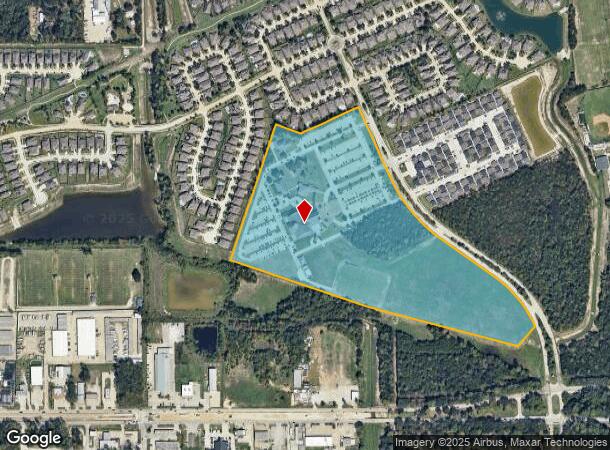
4301-4341 Woodridge Pky
0283-00-00119
H T & Bb Rr Co
Commercialnec
A0283 - H T & BB RR CO, TRACT 1C-4, (AKA ST MARTHA CATHOLIC CHURCH SITE P#2009094745), ACRES 35
AE
Montgomery
48339C0750H
Texas
0
35 AC
2024
Kingwood/Humble
692304
Houston
13,238 SF
Houston-The Woodlands-Sugar Land, TX
DEMOGRAPHICS near 4301-4341 Woodridge Pky
1 Mile
3 Mile
5 Mile
2024 Total Population
8,403
76,559
122,390
2029 Population
9,661
85,897
136,778
Pop Growth 2024-2029
+ 14.97%
+ 12.20%
+ 11.76%
Average Age
37
39
38
2024 Total Households
3,093
28,555
44,004
HH Growth 2024-2029
+ 15.49%
+ 12.82%
+ 12.06%
Median Household Inc
$71,655
$83,230
$90,276
Avg Household Size
2.70
2.60
2.70
2024 Avg HH Vehicles
2.00
2.00
2.00
Median Home Value
$217,229
$253,454
$258,618
Median Year Built
2000
1995
1996
Nearby Places
- Restaurants
- Banks
- Shops
- Fitness
- Groceries
PUBLIC TRANSPORTATION
AIRPORT
George Bush Intcntl/Houston
DRIVE
WALK
Distance
George Bush Intcntl/Houston
23 min
15.4 mi
William P Hobby
DRIVE
WALK
Distance
William P Hobby
55 min
37.0 mi
Freight Ports
Port of Houston
DRIVE
WALK
Distance
Port of Houston
44 min
30.7 mi
Nearby Properties
Address
Land Use
TOTAL SIZE
Lot Size
Zoning
Address
Land Use
TOTAL SIZE
Lot Size
Zoning
633,347 SF
32.15 AC
5
Address
Land Use
TOTAL SIZE
Lot Size
Zoning
733,100 SF
28.18 AC
Address
Land Use
TOTAL SIZE
Lot Size
Zoning
407,266 SF
25.02 AC
Address
Land Use
TOTAL SIZE
Lot Size
Zoning
367,951 SF
26.50 AC
Address
Land Use
TOTAL SIZE
Lot Size
Zoning
151,097 SF
15.50 AC
Address
Land Use
TOTAL SIZE
Lot Size
Zoning
160,351 SF
15.61 AC
Address
Land Use
TOTAL SIZE
Lot Size
Zoning
363,730 SF
12.59 AC
Address
Land Use
TOTAL SIZE
Lot Size
Zoning
275,500 SF
13.58 AC
Address
Land Use
TOTAL SIZE
Lot Size
Zoning
284,662 SF
14.60 AC
Address
Land Use
TOTAL SIZE
Lot Size
Zoning
392,395 SF
14.86 AC
5
Address
Land Use
TOTAL SIZE
Lot Size
Zoning
341,175 SF
65.76 AC
5
Address
Land Use
TOTAL SIZE
Lot Size
Zoning
327,725 SF
22.04 AC
5
Address
Land Use
TOTAL SIZE
Lot Size
Zoning
105,311 SF
14.93 AC
5
Address
Land Use
TOTAL SIZE
Lot Size
Zoning
374,791 SF
17.36 AC
Address
Land Use
TOTAL SIZE
Lot Size
Zoning
343,814 SF
12.83 AC
Address
Land Use
TOTAL SIZE
Lot Size
Zoning
201,363 SF
24.98 AC
5
Address
Land Use
TOTAL SIZE
Lot Size
Zoning
125,148 SF
10.73 AC
5
Address
Land Use
TOTAL SIZE
Lot Size
Zoning
269,585 SF
8.34 AC
Address
Land Use
TOTAL SIZE
Lot Size
Zoning
237,552 SF
13.28 AC
5
Address
Land Use
TOTAL SIZE
Lot Size
Zoning
194,418 SF
6.93 AC
Address
Land Use
TOTAL SIZE
Lot Size
Zoning
130,934 SF
10.71 AC
Address
Land Use
TOTAL SIZE
Lot Size
Zoning
60,584 SF
9.14 AC
Address
Land Use
TOTAL SIZE
Lot Size
Zoning
80,722 SF
28.27 AC
Address
Land Use
TOTAL SIZE
Lot Size
Zoning
237,686 SF
6.53 AC
5
Address
Land Use
TOTAL SIZE
Lot Size
Zoning
128,920 SF
46.76 AC
Address
Land Use
TOTAL SIZE
Lot Size
Zoning
192,620 SF
7.46 AC
Address
Land Use
TOTAL SIZE
Lot Size
Zoning
235,072 SF
26.44 AC
5
Address
Land Use
TOTAL SIZE
Lot Size
Zoning
256,120 SF
9.81 AC
Address
Land Use
TOTAL SIZE
Lot Size
Zoning
215,554 SF
20.89 AC
5
Address
Land Use
TOTAL SIZE
Lot Size
Zoning
106,147 SF
14.03 AC
The World's #1 Commercial Real Estate Marketplace
Connect with us
© 2025 CoStar Group
The information above has been obtained from sources believed reliable. While we do not doubt its accuracy we have not verified it and make no guarantee, warranty or representation about it. It is your responsibility to independently confirm its accuracy and completeness. Any projections, opinions, assumptions, or estimates used are for example only and do not represent the current or future performance of the property. The value of this transaction to you depends on tax and other factors which should be evaluated by your tax, financial, and legal advisors. You and your advisors should conduct a careful, independent investigation of the property to determine to your satisfaction the suitability of the property for your needs.