Property Record
4301 N Shadeland Ave, Indianapolis, IN 46226


NEARBY LISTINGS FOR SALE OR LEASE
Property Detail
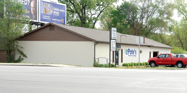
4301 N Shadeland Ave
49-07-13-118-002.000-407
Na
Storebuilding
PT W1/2 NW1/4 S13 T16 R4 BEG 2085.66FT S OF NW CORE 200FT S 80FT W 200FT N 80FT TO BEG .367AC
X
Marion
18097C0160F
Indiana
2023
0.37 AC
2024
Fort Ben
330805
Indianapolis
3,920 SF
Indianapolis-Carmel-Anderson, IN
DEMOGRAPHICS near 4301 N Shadeland Ave
1 Mile
3 Mile
5 Mile
2024 Total Population
12,584
84,270
227,788
2029 Population
12,375
83,765
226,054
Pop Growth 2024-2029
(1.66%)
(0.60%)
(0.76%)
Average Age
35
37
37
2024 Total Households
5,017
33,115
93,416
HH Growth 2024-2029
(1.75%)
(0.61%)
(0.84%)
Median Household Inc
$37,997
$42,380
$50,985
Avg Household Size
2.40
2.50
2.40
2024 Avg HH Vehicles
1.00
2.00
2.00
Median Home Value
$121,257
$117,127
$163,437
Median Year Built
1962
1965
1965
Nearby Places
Map Layers
Map Styles
 Street
 Aerial
- Restaurants
- Banks
- Shops
- Fitness
- Groceries
PUBLIC TRANSPORTATION
AIRPORT
Indianapolis International
DRIVE
WALK
Distance
Indianapolis International
40 min
22.7 mi
SALE & LEASE HISTORY
LISTING DATE
SALE/LEASE

May 29, 2018
For Sale
Feb 15, 2018
For Sale
Feb 03, 2017
For Sale
Nearby Properties
Address
Land Use
TOTAL SIZE
Lot Size
Zoning
Address
Land Use
TOTAL SIZE
Lot Size
Zoning
532,932 SF
61.88 AC
ZO03
Address
Land Use
TOTAL SIZE
Lot Size
Zoning
2,556 SF
35.56 AC
ZO01
Address
Land Use
TOTAL SIZE
Lot Size
Zoning
4,217 SF
7.37 AC
ZO01
Address
Land Use
TOTAL SIZE
Lot Size
Zoning
143,890 SF
37.81 AC
ZO01
Address
Land Use
TOTAL SIZE
Lot Size
Zoning
6,000 SF
8.79 AC
ZO01
Address
Land Use
TOTAL SIZE
Lot Size
Zoning
4,588 SF
24.33 AC
ZO01
Address
Land Use
TOTAL SIZE
Lot Size
Zoning
13,087 SF
57.88 AC
Address
Land Use
TOTAL SIZE
Lot Size
Zoning
136,336 SF
8.74 AC
ZO01
Address
Land Use
TOTAL SIZE
Lot Size
Zoning
536,804 SF
25.94 AC
ZO01
Address
Land Use
TOTAL SIZE
Lot Size
Zoning
6,770 SF
38.91 AC
Address
Land Use
TOTAL SIZE
Lot Size
Zoning
293,952 SF
12.88 AC
ZO01
Address
Land Use
TOTAL SIZE
Lot Size
Zoning
65,095 SF
4.06 AC
ZO01
Address
Land Use
TOTAL SIZE
Lot Size
Zoning
1,066 SF
24.93 AC
Address
Land Use
TOTAL SIZE
Lot Size
Zoning
118,126 SF
6.31 AC
ZO01
Address
Land Use
TOTAL SIZE
Lot Size
Zoning
1,768 SF
30.88 AC
ZO01
Address
Land Use
TOTAL SIZE
Lot Size
Zoning
925,384 SF
49.48 AC
ZO01
Address
Land Use
TOTAL SIZE
Lot Size
Zoning
150,929 SF
28.61 AC
ZO01
Address
Land Use
TOTAL SIZE
Lot Size
Zoning
167,808 SF
14.95 AC
ZO01
Address
Land Use
TOTAL SIZE
Lot Size
Zoning
268,930 SF
20.55 AC
ZO01
Address
Land Use
TOTAL SIZE
Lot Size
Zoning
269,450 SF
5.85 AC
Address
Land Use
TOTAL SIZE
Lot Size
Zoning
1,865 SF
22.15 AC
ZO01
Address
Land Use
TOTAL SIZE
Lot Size
Zoning
329,180 SF
20.88 AC
Address
Land Use
TOTAL SIZE
Lot Size
Zoning
1,490 SF
14.21 AC
ZO01
Address
Land Use
TOTAL SIZE
Lot Size
Zoning
16,160 SF
25.93 AC
ZO01
Address
Land Use
TOTAL SIZE
Lot Size
Zoning
278,338 SF
14.80 AC
Address
Land Use
TOTAL SIZE
Lot Size
Zoning
4,878 SF
25.65 AC
Address
Land Use
TOTAL SIZE
Lot Size
Zoning
206,080 SF
12.97 AC
ZO01
Address
Land Use
TOTAL SIZE
Lot Size
Zoning
175,046 SF
15.77 AC
ZO01
Address
Land Use
TOTAL SIZE
Lot Size
Zoning
640 SF
26.44 AC
Address
Land Use
TOTAL SIZE
Lot Size
Zoning
254,641 SF
29.53 AC
The World's #1 Commercial Real Estate Marketplace
Connect with us
© 2026 CoStar Group
The information above has been obtained from sources believed reliable. While we do not doubt its accuracy we have not verified it and make no guarantee, warranty or representation about it. It is your responsibility to independently confirm its accuracy and completeness. Any projections, opinions, assumptions, or estimates used are for example only and do not represent the current or future performance of the property. The value of this transaction to you depends on tax and other factors which should be evaluated by your tax, financial, and legal advisors. You and your advisors should conduct a careful, independent investigation of the property to determine to your satisfaction the suitability of the property for your needs.