Property Record
4303 Atlantic Blvd, Jacksonville, FL 32207


NEARBY LISTINGS FOR SALE OR LEASE
Property Detail
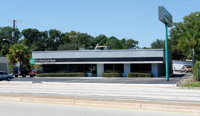
4303 Atlantic Blvd
Jacksonville, FL
Greeleys S/D St Nicholas
129821-0000
1-64 42-2S-27E GREELEYS S/D S1/2 LOT 17,LOTS 18 TO 21,LOT 22, PT CL ST ORD 78-1200-642(EX ST RD) O/RS 5818-2331,2330,4226-55
Vehiclerentalsvehiclesales
Duval
X
Florida
12031C0386J
17
2024
0.72 AC
2025
Southside
015600
Jacksonville (Florida)
3,598 SF
DEMOGRAPHICS near 4303 Atlantic Blvd
1 Mile
3 Mile
5 Mile
2024 Total Population
7,943
83,065
228,151
2029 Population
8,469
87,823
240,477
Pop Growth 2024-2029
+ 6.62%
+ 5.73%
+ 5.40%
Average Age
39
39
38
2024 Total Households
3,447
34,784
94,926
HH Growth 2024-2029
+ 6.64%
+ 6.10%
+ 5.66%
Median Household Inc
$42,264
$45,426
$46,271
Avg Household Size
2.30
2.20
2.30
2024 Avg HH Vehicles
1.00
1.00
1.00
Median Home Value
$303,521
$207,291
$200,480
Median Year Built
1968
1966
1970
Nearby Places
Map Layers
Map Styles
 Street
 Aerial
- Restaurants
- Banks
- Shops
- Fitness
- Groceries
PUBLIC TRANSPORTATION
COMMUTER RAIL
DRIVE
WALK
Distance
17 min
9.6 mi
AIRPORT
Jacksonville International
DRIVE
WALK
Distance
Jacksonville International
29 min
18.3 mi
Freight Ports
Jacksonville Port
DRIVE
WALK
Distance
Jacksonville Port
10 min
5.1 mi
Nearby Properties
Address
Land Use
TOTAL SIZE
Lot Size
Zoning
Address
Land Use
TOTAL SIZE
Lot Size
Zoning
1,086,885 SF
16.83 AC
CCBD
Address
Land Use
TOTAL SIZE
Lot Size
Zoning
543,383 SF
7.87 AC
CCBD
Address
Land Use
TOTAL SIZE
Lot Size
Zoning
1,150,143 SF
43.90 AC
CCBD
Address
Land Use
TOTAL SIZE
Lot Size
Zoning
442,972 SF
5.33 AC
PUD
Address
Land Use
TOTAL SIZE
Lot Size
Zoning
875,866 SF
22.33 AC
PBF-3
Address
Land Use
TOTAL SIZE
Lot Size
Zoning
165,408 SF
2.45 AC
CCBD
Address
Land Use
TOTAL SIZE
Lot Size
Zoning
521,850 SF
10.06 AC
CCBD
Address
Land Use
TOTAL SIZE
Lot Size
Zoning
831,560 SF
1.16 AC
PUD
Address
Land Use
TOTAL SIZE
Lot Size
Zoning
127,732 SF
1.44 AC
CCBD
Address
Land Use
TOTAL SIZE
Lot Size
Zoning
146,636 SF
2.88 AC
CCBD
Address
Land Use
TOTAL SIZE
Lot Size
Zoning
369,638 SF
6.30 AC
CCBD
Address
Land Use
TOTAL SIZE
Lot Size
Zoning
326,485 SF
1.56 AC
CCBD
Address
Land Use
TOTAL SIZE
Lot Size
Zoning
992,501 SF
2.97 AC
CCBD
Address
Land Use
TOTAL SIZE
Lot Size
Zoning
503,858 SF
1.32 AC
CCBD
Address
Land Use
TOTAL SIZE
Lot Size
Zoning
194,877 SF
11.64 AC
CCBD
Address
Land Use
TOTAL SIZE
Lot Size
Zoning
336,623 SF
1.98 AC
CCBD
Address
Land Use
TOTAL SIZE
Lot Size
Zoning
453,728 SF
8.20 AC
CCBD
Address
Land Use
TOTAL SIZE
Lot Size
Zoning
224,600 SF
3.41 AC
PUD
Address
Land Use
TOTAL SIZE
Lot Size
Zoning
253,858 SF
4.93 AC
PUD
Address
Land Use
TOTAL SIZE
Lot Size
Zoning
270,000 SF
8.90 AC
PUD
Address
Land Use
TOTAL SIZE
Lot Size
Zoning
329,412 SF
1.75 AC
CCBD
Address
Land Use
TOTAL SIZE
Lot Size
Zoning
203,763 SF
9.97 AC
PUD
Address
Land Use
TOTAL SIZE
Lot Size
Zoning
211,073 SF
8.99 AC
PUD
Address
Land Use
TOTAL SIZE
Lot Size
Zoning
189,151 SF
3.57 AC
PUD
Address
Land Use
TOTAL SIZE
Lot Size
Zoning
213,439 SF
1.96 AC
CCBD
Address
Land Use
TOTAL SIZE
Lot Size
Zoning
335,832 SF
6.67 AC
PBF-2
Address
Land Use
TOTAL SIZE
Lot Size
Zoning
430,668 SF
27.20 AC
RMD-D
Address
Land Use
TOTAL SIZE
Lot Size
Zoning
165,035 SF
1.52 AC
CCBD
Address
Land Use
TOTAL SIZE
Lot Size
Zoning
125,571 SF
5.97 AC
CCBD
Address
Land Use
TOTAL SIZE
Lot Size
Zoning
155,495 SF
3.01 AC
CCBD
The World's #1 Commercial Real Estate Marketplace
Connect with us
© 2025 CoStar Group
The information above has been obtained from sources believed reliable. While we do not doubt its accuracy we have not verified it and make no guarantee, warranty or representation about it. It is your responsibility to independently confirm its accuracy and completeness. Any projections, opinions, assumptions, or estimates used are for example only and do not represent the current or future performance of the property. The value of this transaction to you depends on tax and other factors which should be evaluated by your tax, financial, and legal advisors. You and your advisors should conduct a careful, independent investigation of the property to determine to your satisfaction the suitability of the property for your needs.