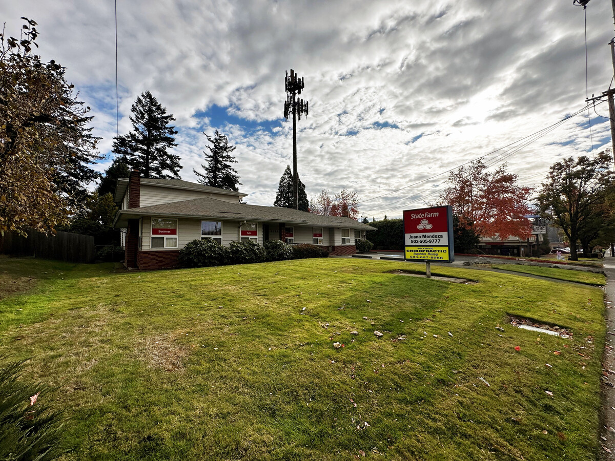
Property Record
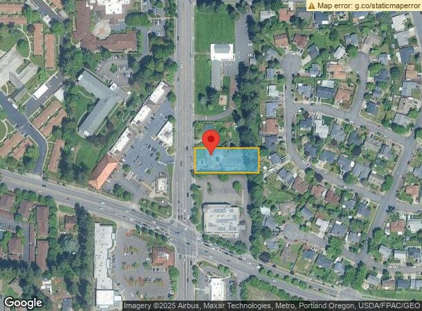
4304 Se 182Nd Ave, Gresham, OR 97030

NEARBY LISTINGS FOR SALE OR LEASE
Property Detail
4304 Se 182Nd Ave
R338582
Couchs Addition
Commercialnec
SECTION 08 1S 3E, TL 14000 0.57 ACRES
X
Multnomah
41051C0401J
Oregon
2023
0.57 AC
2023
Gresham
009803
Portland
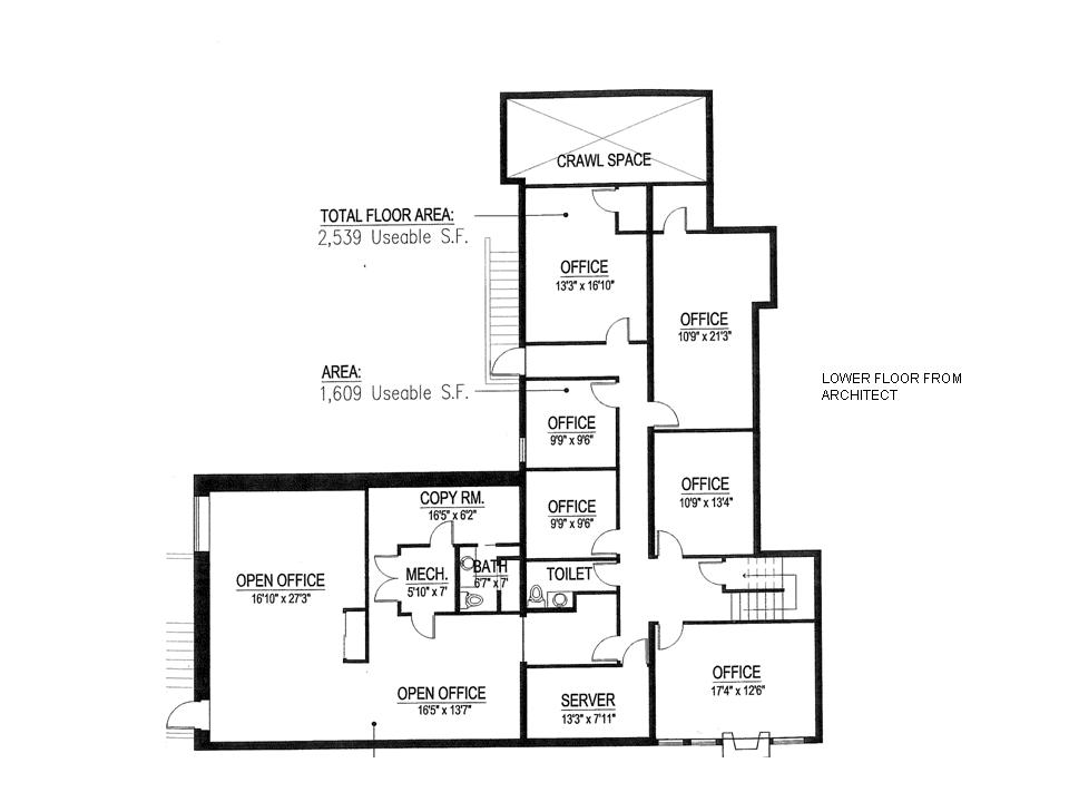
12,221 SF
Portland-Vancouver-Hillsboro, OR-WA
DEMOGRAPHICS near 4304 Se 182Nd Ave
1 Mile
3 Mile
5 Mile
2024 Total Population
16,432
131,981
307,021
2029 Population
15,987
129,265
302,148
Pop Growth 2024-2029
(2.71%)
(2.06%)
(1.59%)
Average Age
40
39
40
2024 Total Households
5,882
45,587
108,139
HH Growth 2024-2029
(2.99%)
(2.39%)
(1.92%)
Median Household Inc
$65,300
$62,385
$68,651
Avg Household Size
2.70
2.70
2.70
2024 Avg HH Vehicles
2.00
2.00
2.00
Median Home Value
$378,448
$382,615
$409,129
Median Year Built
1980
1978
1981
Nearby Places
- Restaurants
- Banks
- Shops
- Fitness
- Groceries
PUBLIC TRANSPORTATION
AIRPORT
Portland International
DRIVE
WALK
Distance
Portland International
22 min
12.5 mi
Freight Ports
Port of Portland
DRIVE
WALK
Distance
Port of Portland
29 min
17.9 mi
SALE & LEASE HISTORY
LISTING DATE
SALE/LEASE

Sep 25, 2016
For Lease
Dec 15, 2022
For Sale
Aug 15, 2019
For Lease
Nearby Properties
Address
Land Use
TOTAL SIZE
Lot Size
Zoning
Address
Land Use
TOTAL SIZE
Lot Size
Zoning
Address
Land Use
TOTAL SIZE
Lot Size
Zoning
3.20 AC
DEM
Address
Land Use
TOTAL SIZE
Lot Size
Zoning
361,549 SF
39.26 AC
IR
Address
Land Use
TOTAL SIZE
Lot Size
Zoning
137.54 AC
GI
Address
Land Use
TOTAL SIZE
Lot Size
Zoning
81,136 SF
6.89 AC
RTC
Address
Land Use
TOTAL SIZE
Lot Size
Zoning
109,231 SF
7.87 AC
HI
Address
Land Use
TOTAL SIZE
Lot Size
Zoning
75,850 SF
11.55 AC
LDR-5
Address
Land Use
TOTAL SIZE
Lot Size
Zoning
123,716 SF
20.03 AC
LDR-5
Address
Land Use
TOTAL SIZE
Lot Size
Zoning
357,603 SF
22.69 AC
GI
Address
Land Use
TOTAL SIZE
Lot Size
Zoning
237,815 SF
22.70 AC
TLDR
Address
Land Use
TOTAL SIZE
Lot Size
Zoning
191,466 SF
34.68 AC
R/CSP
Address
Land Use
TOTAL SIZE
Lot Size
Zoning
85,380 SF
5.04 AC
TD
Address
Land Use
TOTAL SIZE
Lot Size
Zoning
129,462 SF
15.90 AC
R7
Address
Land Use
TOTAL SIZE
Lot Size
Zoning
258,564 SF
20.56 AC
LDR7
Address
Land Use
TOTAL SIZE
Lot Size
Zoning
86,138 SF
5.93 AC
R7
Address
Land Use
TOTAL SIZE
Lot Size
Zoning
238,492 SF
13.10 AC
CMF
Address
Land Use
TOTAL SIZE
Lot Size
Zoning
254,580 SF
4.76 AC
TDHC
Address
Land Use
TOTAL SIZE
Lot Size
Zoning
222,022 SF
11.64 AC
CMF
Address
Land Use
TOTAL SIZE
Lot Size
Zoning
62,592 SF
1.47 AC
RM3
Address
Land Use
TOTAL SIZE
Lot Size
Zoning
60,000 SF
1.55 AC
RTC
Address
Land Use
TOTAL SIZE
Lot Size
Zoning
83,072 SF
9.58 AC
LDR-5
Address
Land Use
TOTAL SIZE
Lot Size
Zoning
95,642 SF
5.30 AC
HI
Address
Land Use
TOTAL SIZE
Lot Size
Zoning
141,899 SF
13.51 AC
DMU
Address
Land Use
TOTAL SIZE
Lot Size
Zoning
61,524 SF
7.31 AC
LDR-5
Address
Land Use
TOTAL SIZE
Lot Size
Zoning
208,905 SF
10.17 AC
CMF
Address
Land Use
TOTAL SIZE
Lot Size
Zoning
87,429 SF
0.95 AC
DTM
Address
Land Use
TOTAL SIZE
Lot Size
Zoning
95,901 SF
4.91 AC
CC
Address
Land Use
TOTAL SIZE
Lot Size
Zoning
64,934 SF
9.88 AC
LDR-7
Address
Land Use
TOTAL SIZE
Lot Size
Zoning
67,554 SF
3.88 AC
TD
Address
Land Use
TOTAL SIZE
Lot Size
Zoning
199,805 SF
4.96 AC
MDR-24
The World's #1 Commercial Real Estate Marketplace
Connect with us
© 2025 CoStar Group
The information above has been obtained from sources believed reliable. While we do not doubt its accuracy we have not verified it and make no guarantee, warranty or representation about it. It is your responsibility to independently confirm its accuracy and completeness. Any projections, opinions, assumptions, or estimates used are for example only and do not represent the current or future performance of the property. The value of this transaction to you depends on tax and other factors which should be evaluated by your tax, financial, and legal advisors. You and your advisors should conduct a careful, independent investigation of the property to determine to your satisfaction the suitability of the property for your needs.