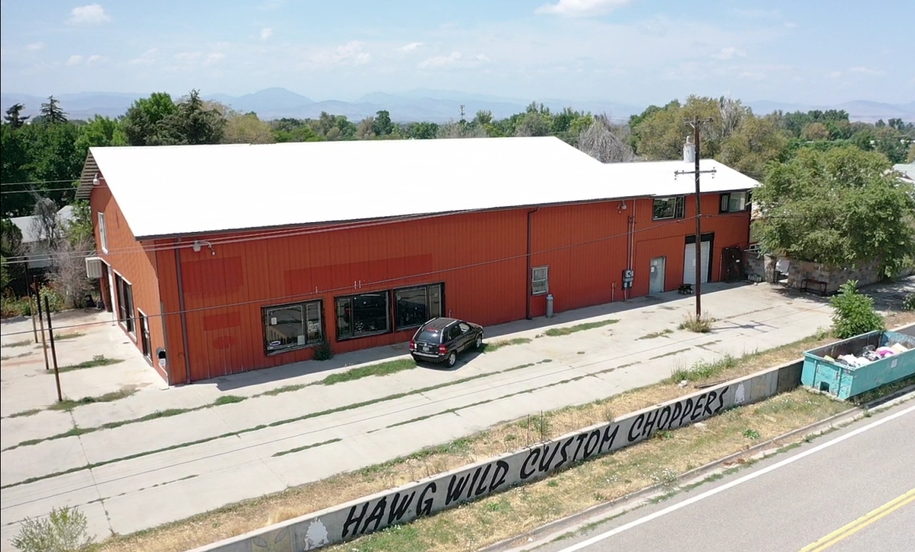
Property Record
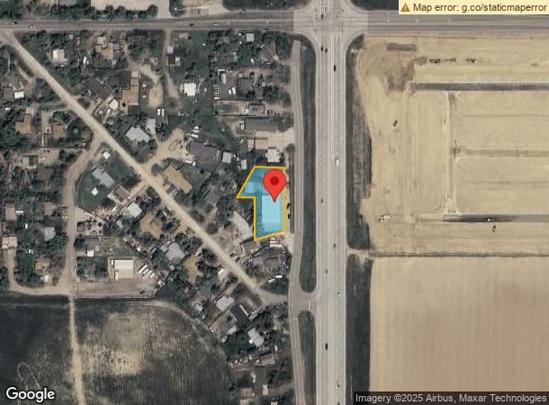
4315 Hawg Wild Rd, Loveland, CO 80537
NEARBY LISTINGS FOR SALE OR LEASE
-
-
-
No Photo
-
View all Loveland listings for sale on LoopNet.com
Property Detail
4315 Hawg Wild Rd
Fort Collins, CO
Floyd Hicks Subdivision, Amended Plat Of
94021-12-001
LOT 1, FLOYD HICKS SUBDIVISION, AMENDED PLAT OF A PORTION OF LOT 6 (2002068707)
Commercialbuilding
Larimer
X
Colorado
08123C1675E
1,6
2023
0.58 AC
2025
Fort Collins
002602
Denver
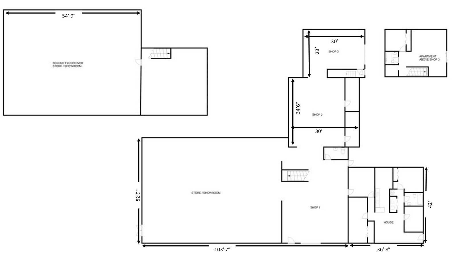
6,316 SF
DEMOGRAPHICS near 4315 Hawg Wild Rd
1 Mile
3 Mile
5 Mile
2024 Total Population
2,379
18,623
60,777
2029 Population
2,580
19,877
64,217
Pop Growth 2024-2029
+ 8.45%
+ 6.73%
+ 5.66%
Average Age
41
41
42
2024 Total Households
908
7,467
25,197
HH Growth 2024-2029
+ 8.70%
+ 6.96%
+ 5.84%
Median Household Inc
$99,505
$84,817
$76,564
Avg Household Size
2.60
2.40
2.40
2024 Avg HH Vehicles
3.00
2.00
2.00
Median Home Value
$607,143
$441,759
$426,083
Median Year Built
2008
1990
1986
Nearby Places
- Restaurants
- Banks
- Shops
- Fitness
- Groceries
SALE & LEASE HISTORY
LISTING DATE
SALE/LEASE

Aug 16, 2021
For Sale
Aug 13, 2021
For Lease
Nearby Properties
Address
Land Use
TOTAL SIZE
Lot Size
Zoning
Address
Land Use
TOTAL SIZE
Lot Size
Zoning
1 SF
57.61 AC
FA1
Address
Land Use
TOTAL SIZE
Lot Size
Zoning
115,599 SF
13.15 AC
P38
Address
Land Use
TOTAL SIZE
Lot Size
Zoning
35,000 SF
33.15 AC
FA1
Address
Land Use
TOTAL SIZE
Lot Size
Zoning
196,188 SF
13.26 AC
C
Address
Land Use
TOTAL SIZE
Lot Size
Zoning
296,360 SF
11.88 AC
B
Address
Land Use
TOTAL SIZE
Lot Size
Zoning
165,709 SF
10.52 AC
Address
Land Use
TOTAL SIZE
Lot Size
Zoning
137,950 SF
10.16 AC
Address
Land Use
TOTAL SIZE
Lot Size
Zoning
48,952 SF
6.38 AC
FA
Address
Land Use
TOTAL SIZE
Lot Size
Zoning
139,289 SF
23.55 AC
I
Address
Land Use
TOTAL SIZE
Lot Size
Zoning
745,209 SF
63.03 AC
I
Address
Land Use
TOTAL SIZE
Lot Size
Zoning
65,755 SF
2.22 AC
Address
Land Use
TOTAL SIZE
Lot Size
Zoning
51,650 SF
10.48 AC
Address
Land Use
TOTAL SIZE
Lot Size
Zoning
70,550 SF
4.08 AC
Address
Land Use
TOTAL SIZE
Lot Size
Zoning
303,658 SF
30.21 AC
Address
Land Use
TOTAL SIZE
Lot Size
Zoning
135,814 SF
10.91 AC
Address
Land Use
TOTAL SIZE
Lot Size
Zoning
72,300 SF
7.22 AC
I1
Address
Land Use
TOTAL SIZE
Lot Size
Zoning
125,590 SF
8.73 AC
Address
Land Use
TOTAL SIZE
Lot Size
Zoning
84,478 SF
6.39 AC
I
Address
Land Use
TOTAL SIZE
Lot Size
Zoning
50,313 SF
4.23 AC
Address
Land Use
TOTAL SIZE
Lot Size
Zoning
69,820 SF
3.03 AC
Address
Land Use
TOTAL SIZE
Lot Size
Zoning
61,095 SF
4.73 AC
Address
Land Use
TOTAL SIZE
Lot Size
Zoning
23,100 SF
2.14 AC
Address
Land Use
TOTAL SIZE
Lot Size
Zoning
73,544 SF
5.37 AC
Address
Land Use
TOTAL SIZE
Lot Size
Zoning
78,211 SF
4.56 AC
FA
Address
Land Use
TOTAL SIZE
Lot Size
Zoning
163,036 SF
7.08 AC
P38
Address
Land Use
TOTAL SIZE
Lot Size
Zoning
28,200 SF
7.90 AC
R1E
Address
Land Use
TOTAL SIZE
Lot Size
Zoning
33,830 SF
6.60 AC
FA
Address
Land Use
TOTAL SIZE
Lot Size
Zoning
212,731 SF
10.20 AC
P25
Address
Land Use
TOTAL SIZE
Lot Size
Zoning
86,578 SF
6.74 AC
I
Address
Land Use
TOTAL SIZE
Lot Size
Zoning
56,352 SF
3.49 AC
P38
The World's #1 Commercial Real Estate Marketplace
Connect with us
© 2025 CoStar Group
The information above has been obtained from sources believed reliable. While we do not doubt its accuracy we have not verified it and make no guarantee, warranty or representation about it. It is your responsibility to independently confirm its accuracy and completeness. Any projections, opinions, assumptions, or estimates used are for example only and do not represent the current or future performance of the property. The value of this transaction to you depends on tax and other factors which should be evaluated by your tax, financial, and legal advisors. You and your advisors should conduct a careful, independent investigation of the property to determine to your satisfaction the suitability of the property for your needs.