Property Record
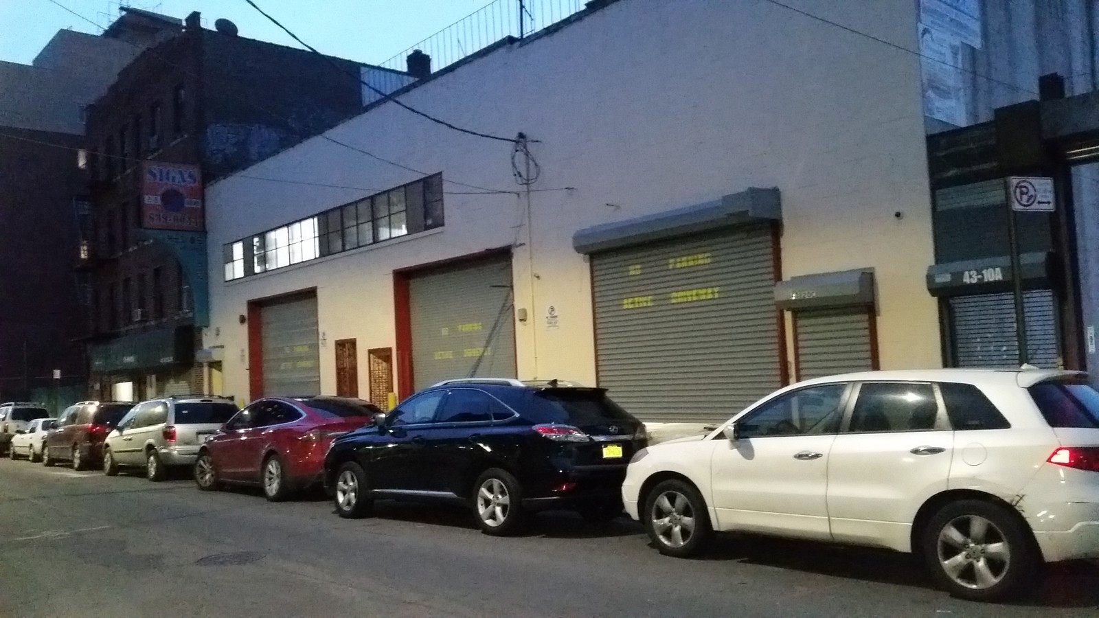
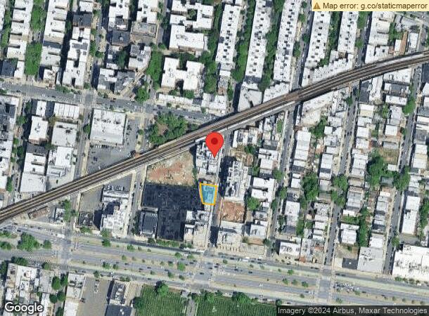
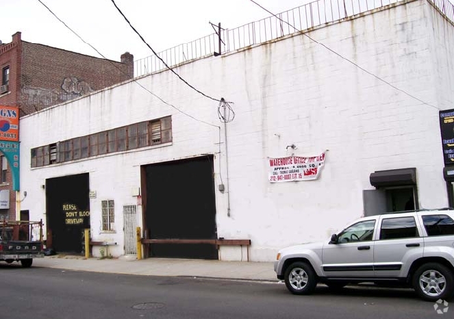
4320 52Nd St, Woodside, NY 11377

NEARBY LISTINGS FOR SALE OR LEASE
Property Detail
4320 52Nd St
01320-0037
Woodside Heights
Apartment
Queens
X
New York
3604970206F
37
2023
0.11 AC
2024
Northwest Queens
025302
Long Island (New York)
25,187 SF
New York-Jersey City-White Plains, NY-NJ
DEMOGRAPHICS near 4320 52Nd St
1 Mile
3 Mile
5 Mile
2024 Total Population
112,518
1,015,698
3,001,637
2029 Population
106,270
953,423
2,803,708
Pop Growth 2024-2029
(5.55%)
(6.13%)
(6.59%)
Average Age
41
40
40
2024 Total Households
43,183
409,289
1,275,624
HH Growth 2024-2029
(5.66%)
(6.26%)
(6.87%)
Median Household Inc
$70,399
$82,747
$80,807
Avg Household Size
2.50
2.40
2.20
2024 Avg HH Vehicles
1.00
1.00
.00
Median Home Value
$629,241
$771,717
$839,336
Median Year Built
1948
1953
1953
Nearby Places
- Restaurants
- Banks
- Shops
- Fitness
- Groceries
PUBLIC TRANSPORTATION
TRANSIT/SUBWAY
52 Street (7 - New York MTA Subway (The Subway))
DRIVE
WALK
Distance
52 Street (7 - New York MTA Subway (The Subway))
0 min
0 min
0.0 mi
46 Street-Bliss Street (7 - New York MTA Subway (The Subway))
DRIVE
WALK
Distance
46 Street-Bliss Street (7 - New York MTA Subway (The Subway))
1 min
6 min
0.3 mi
Woodside-61 Street (7 - New York MTA Subway (The Subway))
DRIVE
WALK
Distance
Woodside-61 Street (7 - New York MTA Subway (The Subway))
2 min
10 min
0.5 mi
40 Street-Lowery Street (7 - New York MTA Subway (The Subway))
DRIVE
WALK
Distance
40 Street-Lowery Street (7 - New York MTA Subway (The Subway))
2 min
13 min
0.7 mi
Northern Boulevard (E - New York MTA Subway (The Subway), M - New York MTA Subway (The Subway), R - New York MTA Subway (The Subway))
DRIVE
WALK
Distance
Northern Boulevard (E - New York MTA Subway (The Subway), M - New York MTA Subway (The Subway), R - New York MTA Subway (The Subway))
4 min
15 min
0.8 mi
COMMUTER RAIL
Woodside Station (Babylon Branch - Long Island Rail Road, Far Rockaway Branch - Long Island Rail Road, Hempstead Branch - Long Island Rail Road, Long Beach Branch - Long Island Rail Road, Montauk Branch - Long Island Rail Road, Port Jefferson Branch - Long Island Rail Road, Port Washington Branch - Long Island Rail Road, Ronkonkoma Branch - Long Island Rail Road)
DRIVE
WALK
Distance
Woodside Station (Babylon Branch - Long Island Rail Road, Far Rockaway Branch - Long Island Rail Road, Hempstead Branch - Long Island Rail Road, Long Beach Branch - Long Island Rail Road, Montauk Branch - Long Island Rail Road, Port Jefferson Branch - Long Island Rail Road, Port Washington Branch - Long Island Rail Road, Ronkonkoma Branch - Long Island Rail Road)
2 min
10 min
0.6 mi
Hunterspoint Avenue Station (Hempstead Branch - Long Island Rail Road, Oyster Bay Branch - Long Island Rail Road)
DRIVE
WALK
Distance
Hunterspoint Avenue Station (Hempstead Branch - Long Island Rail Road, Oyster Bay Branch - Long Island Rail Road)
5 min
2.0 mi
AIRPORT
Laguardia
DRIVE
WALK
Distance
Laguardia
9 min
4.0 mi
John F Kennedy International
DRIVE
WALK
Distance
John F Kennedy International
22 min
13.1 mi
Newark Liberty International
DRIVE
WALK
Distance
Newark Liberty International
30 min
18.8 mi
Freight Ports
NY - Red Hook Container Terminal
DRIVE
WALK
Distance
NY - Red Hook Container Terminal
15 min
7.8 mi
SALE & LEASE HISTORY
LISTING DATE
SALE/LEASE

Dec 19, 2016
For Lease
Nearby Properties
Address
Land Use
TOTAL SIZE
Lot Size
Zoning
Address
Land Use
TOTAL SIZE
Lot Size
Zoning
2,400,000 SF
15.14 AC
C5-2
Address
Land Use
TOTAL SIZE
Lot Size
Zoning
2,230,742 SF
6.33 AC
R9
Address
Land Use
TOTAL SIZE
Lot Size
Zoning
1,200,000 SF
10.24 AC
R9
Address
Land Use
TOTAL SIZE
Lot Size
Zoning
1,065,915 SF
2.13 AC
M16R10
Address
Land Use
TOTAL SIZE
Lot Size
Zoning
757,439 SF
0.91 AC
C1-9
Address
Land Use
TOTAL SIZE
Lot Size
Zoning
1,502,532 SF
6.35 AC
R7B
Address
Land Use
TOTAL SIZE
Lot Size
Zoning
714,224 SF
0.70 AC
R8
Address
Land Use
TOTAL SIZE
Lot Size
Zoning
805,287 SF
1 AC
R10
Address
Land Use
TOTAL SIZE
Lot Size
Zoning
772,163 SF
5.24 AC
C4-5X
Address
Land Use
TOTAL SIZE
Lot Size
Zoning
984,760 SF
2.04 AC
M3-1
Address
Land Use
TOTAL SIZE
Lot Size
Zoning
661,538 SF
11.26 AC
R7-2
Address
Land Use
TOTAL SIZE
Lot Size
Zoning
1,359,110 SF
1.89 AC
C5-3
Address
Land Use
TOTAL SIZE
Lot Size
Zoning
527,900 SF
0.57 AC
R10
Address
Land Use
TOTAL SIZE
Lot Size
Zoning
1,292,074 SF
C4-2F
Address
Land Use
TOTAL SIZE
Lot Size
Zoning
334,675 SF
10.24 AC
R9
Address
Land Use
TOTAL SIZE
Lot Size
Zoning
538,454 SF
2.37 AC
R9
Address
Land Use
TOTAL SIZE
Lot Size
Zoning
410,239 SF
0.77 AC
R10
Address
Land Use
TOTAL SIZE
Lot Size
Zoning
234,891 SF
3.17 AC
C4-5X
Address
Land Use
TOTAL SIZE
Lot Size
Zoning
798,819 SF
2.57 AC
R6
Address
Land Use
TOTAL SIZE
Lot Size
Zoning
804,200 SF
5.28 AC
R7-2
Address
Land Use
TOTAL SIZE
Lot Size
Zoning
905,824 SF
1.84 AC
R8B
Address
Land Use
TOTAL SIZE
Lot Size
Zoning
505,416 SF
M16R10
Address
Land Use
TOTAL SIZE
Lot Size
Zoning
684,862 SF
1.65 AC
M3-1
Address
Land Use
TOTAL SIZE
Lot Size
Zoning
504,420 SF
0.96 AC
R10
Address
Land Use
TOTAL SIZE
Lot Size
Zoning
710,860 SF
1.52 AC
M15R9
Address
Land Use
TOTAL SIZE
Lot Size
Zoning
409,285 SF
0.65 AC
R10
Address
Land Use
TOTAL SIZE
Lot Size
Zoning
490,480 SF
1.62 AC
R8
Address
Land Use
TOTAL SIZE
Lot Size
Zoning
369,482 SF
0.99 AC
R8
Address
Land Use
TOTAL SIZE
Lot Size
Zoning
630,112 SF
1.20 AC
R8
Address
Land Use
TOTAL SIZE
Lot Size
Zoning
94,247 SF
8.63 AC
M1-4
The World's #1 Commercial Real Estate Marketplace
Connect with us
© 2025 CoStar Group
The information above has been obtained from sources believed reliable. While we do not doubt its accuracy we have not verified it and make no guarantee, warranty or representation about it. It is your responsibility to independently confirm its accuracy and completeness. Any projections, opinions, assumptions, or estimates used are for example only and do not represent the current or future performance of the property. The value of this transaction to you depends on tax and other factors which should be evaluated by your tax, financial, and legal advisors. You and your advisors should conduct a careful, independent investigation of the property to determine to your satisfaction the suitability of the property for your needs.