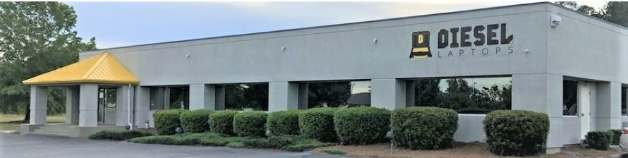
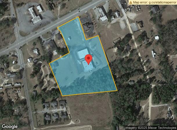
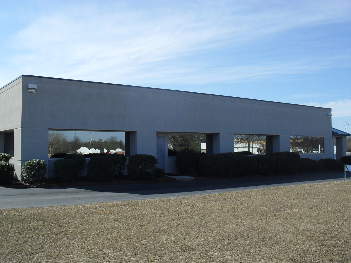
Property Record
4335 Augusta Hwy, Gilbert, SC 29054
NEARBY LISTINGS FOR SALE OR LEASE
Property Detail
4335 Augusta Hwy
005100-03-032
Banning Property Management Llc
Religious
PARCEL B, C, & D
X
Lexington
45063C0225J
South Carolina
0
8.90 AC
2024
Outlying Lexington County
021306
Columbia
1,950 SF
Columbia, SC
DEMOGRAPHICS near 4335 Augusta Hwy
1 Mile
3 Mile
5 Mile
2024 Total Population
706
5,768
17,870
2029 Population
781
6,371
19,637
Pop Growth 2024-2029
+ 10.62%
+ 10.45%
+ 9.89%
Average Age
42
41
41
2024 Total Households
269
2,190
6,790
HH Growth 2024-2029
+ 10.78%
+ 10.59%
+ 10.04%
Median Household Inc
$74,858
$73,438
$75,038
Avg Household Size
2.60
2.60
2.60
2024 Avg HH Vehicles
3.00
3.00
2.00
Median Home Value
$216,071
$220,312
$244,915
Median Year Built
1997
1997
1998
Nearby Places
- Restaurants
- Banks
- Shops
- Fitness
- Groceries
PUBLIC TRANSPORTATION
AIRPORT
Columbia Metro
DRIVE
WALK
Distance
Columbia Metro
43 min
22.2 mi
Freight Ports
North Charleston Terminal
DRIVE
WALK
Distance
North Charleston Terminal
144 min
120.1 mi
SALE & LEASE HISTORY
LISTING DATE
SALE/LEASE

Sep 11, 2017
For Lease
Sep 08, 2017
For Sale
Apr 25, 2019
For Sale
Nearby Properties
Address
Land Use
TOTAL SIZE
Lot Size
Zoning
Address
Land Use
TOTAL SIZE
Lot Size
Zoning
4,800 SF
9.22 AC
RD
Address
Land Use
TOTAL SIZE
Lot Size
Zoning
28,111 SF
7.01 AC
ID
Address
Land Use
TOTAL SIZE
Lot Size
Zoning
18,080 SF
7.32 AC
ID
Address
Land Use
TOTAL SIZE
Lot Size
Zoning
11,808 SF
7 AC
R
Address
Land Use
TOTAL SIZE
Lot Size
Zoning
788 SF
5 AC
ID
Address
Land Use
TOTAL SIZE
Lot Size
Zoning
10,289 SF
2.82 AC
RD
Address
Land Use
TOTAL SIZE
Lot Size
Zoning
7,000 SF
2 AC
ID
Address
Land Use
TOTAL SIZE
Lot Size
Zoning
9,600 SF
4.84 AC
ID
Address
Land Use
TOTAL SIZE
Lot Size
Zoning
3,400 SF
6 AC
RD
Address
Land Use
TOTAL SIZE
Lot Size
Zoning
8,000 SF
0.67 AC
ID
Address
Land Use
TOTAL SIZE
Lot Size
Zoning
1,000 SF
1.85 AC
ID
Address
Land Use
TOTAL SIZE
Lot Size
Zoning
12,480 SF
2.50 AC
ID
Address
Land Use
TOTAL SIZE
Lot Size
Zoning
3,068 SF
0.96 AC
ID
Address
Land Use
TOTAL SIZE
Lot Size
Zoning
6,725 SF
1.09 AC
RD
Address
Land Use
TOTAL SIZE
Lot Size
Zoning
5,440 SF
4 AC
C
Address
Land Use
TOTAL SIZE
Lot Size
Zoning
20.79 AC
RD
Address
Land Use
TOTAL SIZE
Lot Size
Zoning
10,400 SF
6 AC
LM
Address
Land Use
TOTAL SIZE
Lot Size
Zoning
1.89 AC
RD
Address
Land Use
TOTAL SIZE
Lot Size
Zoning
4,800 SF
1.83 AC
LR
Address
Land Use
TOTAL SIZE
Lot Size
Zoning
6,414 SF
1.56 AC
ID
Address
Land Use
TOTAL SIZE
Lot Size
Zoning
6,498 SF
32.50 AC
RD
Address
Land Use
TOTAL SIZE
Lot Size
Zoning
2,220 SF
11.90 AC
Address
Land Use
TOTAL SIZE
Lot Size
Zoning
20.37 AC
RD
Address
Land Use
TOTAL SIZE
Lot Size
Zoning
5,194 SF
4.05 AC
ID
Address
Land Use
TOTAL SIZE
Lot Size
Zoning
2.67 AC
RD
Address
Land Use
TOTAL SIZE
Lot Size
Zoning
2,940 SF
0.99 AC
ID
Address
Land Use
TOTAL SIZE
Lot Size
Zoning
6,140 SF
2.19 AC
R
Address
Land Use
TOTAL SIZE
Lot Size
Zoning
1,490 SF
4.39 AC
RD
Address
Land Use
TOTAL SIZE
Lot Size
Zoning
1,920 SF
2.20 AC
ID
The World's #1 Commercial Real Estate Marketplace
Connect with us
© 2025 CoStar Group
The information above has been obtained from sources believed reliable. While we do not doubt its accuracy we have not verified it and make no guarantee, warranty or representation about it. It is your responsibility to independently confirm its accuracy and completeness. Any projections, opinions, assumptions, or estimates used are for example only and do not represent the current or future performance of the property. The value of this transaction to you depends on tax and other factors which should be evaluated by your tax, financial, and legal advisors. You and your advisors should conduct a careful, independent investigation of the property to determine to your satisfaction the suitability of the property for your needs.