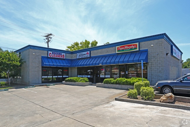
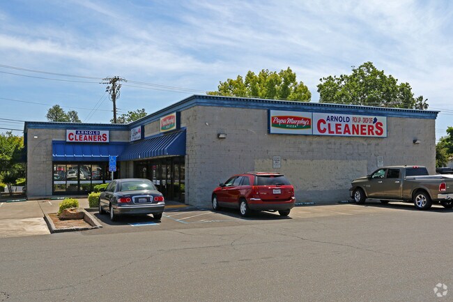
Property Record
4340 Arden Way, Sacramento, CA 95864

Property Detail
4340 Arden Way
289-0011-018
PORTION LOT42
Storebuilding
Sacramento
SC
California
B and X Area of moderate flood hazard, usually the area between the limits of the 100-year and 500-year floods.
42
2025
0.31 AC
2025
Arden/Watt/Howe
005803
Sacramento
4,770 SF
Sacramento-Roseville-Folsom, CA
NEARBY LISTINGS FOR SALE OR LEASE
DEMOGRAPHICS near 4340 Arden Way
1 mile
3 mile
5 mile
2025 Total Population
11,459
152,534
345,787
2030 Population
11,529
154,029
349,756
Pop Growth 2025-2030
+ 0.61%
+ 0.98%
+ 1.15%
Average Age
45
40
39
2025 Total Households
4,559
61,413
134,317
HH Growth 2025-2030
+ 0.70%
+ 1.03%
+ 1.19%
Median Household Inc
$151,171
$82,647
$78,836
Avg Household Size
2.50
2.40
2.50
2025 Avg HH Vehicles
2.00
2.00
2.00
Median Home Value
$733,349
$556,197
$499,833
Median Year Built
1957
1970
1971
Nearby Places
Map Layers
Map Styles
 Street
 Aerial
Layers
 Traffic
 Biking
Places
Listings with unknown addresses are not visible on the map
- Restaurants
- Banks
- Shops
- Fitness
- Groceries
PUBLIC TRANSPORTATION
AIRPORT
Sacramento International
Drive
Walk
Distance
Sacramento International
27 min
17.1 mi
Freight Ports
Port of Stockton
Drive
Walk
Distance
Port of Stockton
67 min
55.4 mi
Nearby Properties
Address
Land Use
TOTAL SIZE
Lot Size
Zoning
Address
Land Use
TOTAL SIZE
Lot Size
Zoning
490,607 SF
32.63 AC
RD-30
Address
Land Use
TOTAL SIZE
Lot Size
Zoning
512,630 SF
37.68 AC
SPA (NPA)
Address
Land Use
TOTAL SIZE
Lot Size
Zoning
266,841 SF
47.29 AC
RD-5
Address
Land Use
TOTAL SIZE
Lot Size
Zoning
148,642 SF
7.15 AC
RD-30
Address
Land Use
TOTAL SIZE
Lot Size
Zoning
420,421 SF
25.39 AC
BP
Address
Land Use
TOTAL SIZE
Lot Size
Zoning
190,723 SF
9.10 AC
RD-30
Address
Land Use
TOTAL SIZE
Lot Size
Zoning
156,649 SF
6.14 AC
LC
Address
Land Use
TOTAL SIZE
Lot Size
Zoning
1,281 SF
0.42 AC
RD-20
Address
Land Use
TOTAL SIZE
Lot Size
Zoning
168,560 SF
8.95 AC
RD-30
Address
Land Use
TOTAL SIZE
Lot Size
Zoning
152,000 SF
12.88 AC
SPA
Address
Land Use
TOTAL SIZE
Lot Size
Zoning
137,520 SF
10.37 AC
BP (PC)(PD
Address
Land Use
TOTAL SIZE
Lot Size
Zoning
387,136 SF
8.85 AC
RD-30
Address
Land Use
TOTAL SIZE
Lot Size
Zoning
168,846 SF
7.58 AC
RD-30 (PC)
Address
Land Use
TOTAL SIZE
Lot Size
Zoning
137,255 SF
6.32 AC
RD-30
Address
Land Use
TOTAL SIZE
Lot Size
Zoning
119,824 SF
7.64 AC
RD-30 (PC)
Address
Land Use
TOTAL SIZE
Lot Size
Zoning
278,877 SF
13.17 AC
RD-30
Address
Land Use
TOTAL SIZE
Lot Size
Zoning
0.21 AC
RD-5
Address
Land Use
TOTAL SIZE
Lot Size
Zoning
221,337 SF
12.19 AC
RD 25
Address
Land Use
TOTAL SIZE
Lot Size
Zoning
198,131 SF
13.36 AC
BP
Address
Land Use
TOTAL SIZE
Lot Size
Zoning
106,700 SF
5.38 AC
RD-30
Address
Land Use
TOTAL SIZE
Lot Size
Zoning
169,618 SF
10.44 AC
RD-4
Address
Land Use
TOTAL SIZE
Lot Size
Zoning
74,123 SF
3.55 AC
LC
Address
Land Use
TOTAL SIZE
Lot Size
Zoning
116,440 SF
8.59 AC
RD-30
Address
Land Use
TOTAL SIZE
Lot Size
Zoning
138,263 SF
9.92 AC
SC
Address
Land Use
TOTAL SIZE
Lot Size
Zoning
111,352 SF
1.16 AC
RD-30 RD-1
Address
Land Use
TOTAL SIZE
Lot Size
Zoning
89,098 SF
4.93 AC
RD-40
Address
Land Use
TOTAL SIZE
Lot Size
Zoning
148,576 SF
4.84 AC
RD-30
Address
Land Use
TOTAL SIZE
Lot Size
Zoning
94,249 SF
4.57 AC
RD-30
Address
Land Use
TOTAL SIZE
Lot Size
Zoning
87,534 SF
4.50 AC
RD-30
Address
Land Use
TOTAL SIZE
Lot Size
Zoning
104,791 SF
6.50 AC
RD-30
The World's #1 Commercial Real Estate Marketplace
Connect with us
© 2026 CoStar Group
The information above has been obtained from sources believed reliable. While we do not doubt its accuracy we have not verified it and make no guarantee, warranty or representation about it. It is your responsibility to independently confirm its accuracy and completeness. Any projections, opinions, assumptions, or estimates used are for example only and do not represent the current or future performance of the property. The value of this transaction to you depends on tax and other factors which should be evaluated by your tax, financial, and legal advisors. You and your advisors should conduct a careful, independent investigation of the property to determine to your satisfaction the suitability of the property for your needs.