Property Record
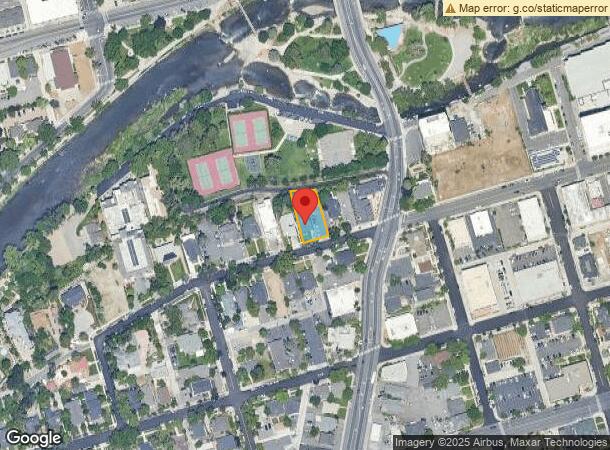
435 Court St, Reno, NV 89501


NEARBY LISTINGS FOR SALE OR LEASE
Property Detail
435 Court St
Reno, NV
Rio Vista Heights
011-101-07
RIO VISTA HEIGHTS LOT 8 FR LOT 9 BLOCK 1
Officebuilding
Washoe
X
Nevada
32031C3039G
8,9
2024
0.26 AC
2024
Downtown
000402
Reno/Sparks
3,741 SF
DEMOGRAPHICS near 435 Court St
1 Mile
3 Mile
5 Mile
2024 Total Population
21,089
135,213
238,387
2029 Population
22,083
142,574
250,878
Pop Growth 2024-2029
+ 4.71%
+ 5.44%
+ 5.24%
Average Age
42
39
39
2024 Total Households
11,609
58,045
98,371
HH Growth 2024-2029
+ 4.85%
+ 5.54%
+ 5.37%
Median Household Inc
$42,792
$52,588
$61,323
Avg Household Size
1.70
2.20
2.30
2024 Avg HH Vehicles
1.00
2.00
2.00
Median Home Value
$499,638
$441,002
$428,819
Median Year Built
1969
1977
1980
Nearby Places
- Restaurants
- Banks
- Shops
- Fitness
- Groceries
PUBLIC TRANSPORTATION
COMMUTER RAIL
Reno (California Zephyr - Amtrak)
DRIVE
WALK
Distance
Reno (California Zephyr - Amtrak)
2 min
12 min
0.6 mi
AIRPORT
Reno/Tahoe International
DRIVE
WALK
Distance
Reno/Tahoe International
26 min
6.4 mi
Freight Ports
Port of Stockton
DRIVE
WALK
Distance
Port of Stockton
208 min
178.9 mi
SALE & LEASE HISTORY
LISTING DATE
SALE/LEASE

Sep 25, 2016
For Lease
Jun 22, 2018
For Lease
Nearby Properties
Address
Land Use
TOTAL SIZE
Lot Size
Zoning
Address
Land Use
TOTAL SIZE
Lot Size
Zoning
120.45 AC
PF
Address
Land Use
TOTAL SIZE
Lot Size
Zoning
2,041,608 SF
28.47 AC
MU
Address
Land Use
TOTAL SIZE
Lot Size
Zoning
1,638,272 SF
17.11 AC
MU
Address
Land Use
TOTAL SIZE
Lot Size
Zoning
750,062 SF
1,131.28 AC
MA
Address
Land Use
TOTAL SIZE
Lot Size
Zoning
799,762 SF
13.30 AC
MU
Address
Land Use
TOTAL SIZE
Lot Size
Zoning
1,865,345 SF
2.75 AC
MD-ED
Address
Land Use
TOTAL SIZE
Lot Size
Zoning
1,103,124 SF
138.61 AC
MU
Address
Land Use
TOTAL SIZE
Lot Size
Zoning
55,187 SF
116.12 AC
GC
Address
Land Use
TOTAL SIZE
Lot Size
Zoning
759,161 SF
37.37 AC
MU
Address
Land Use
TOTAL SIZE
Lot Size
Zoning
902,415 SF
52.71 AC
MA
Address
Land Use
TOTAL SIZE
Lot Size
Zoning
1,048,514 SF
1.30 AC
MU
Address
Land Use
TOTAL SIZE
Lot Size
Zoning
507,606 SF
3.42 AC
MU
Address
Land Use
TOTAL SIZE
Lot Size
Zoning
497,928 SF
3.52 AC
MU
Address
Land Use
TOTAL SIZE
Lot Size
Zoning
292,461 SF
1.22 AC
MU
Address
Land Use
TOTAL SIZE
Lot Size
Zoning
477,926 SF
54.37 AC
MF14
Address
Land Use
TOTAL SIZE
Lot Size
Zoning
189,861 SF
1.69 AC
MD-NWQ
Address
Land Use
TOTAL SIZE
Lot Size
Zoning
396,810 SF
16.21 AC
PD
Address
Land Use
TOTAL SIZE
Lot Size
Zoning
458,588 SF
62.55 AC
PF
Address
Land Use
TOTAL SIZE
Lot Size
Zoning
645,699 SF
4.53 AC
MU
Address
Land Use
TOTAL SIZE
Lot Size
Zoning
232,156 SF
1.76 AC
MU
Address
Land Use
TOTAL SIZE
Lot Size
Zoning
306,626 SF
17.61 AC
MF14 44% /
Address
Land Use
TOTAL SIZE
Lot Size
Zoning
234,478 SF
2.93 AC
MD-ED
Address
Land Use
TOTAL SIZE
Lot Size
Zoning
296,048 SF
93.65 AC
PF
Address
Land Use
TOTAL SIZE
Lot Size
Zoning
460,367 SF
1.52 AC
MD-ED
Address
Land Use
TOTAL SIZE
Lot Size
Zoning
342,947 SF
8.95 AC
MF30
Address
Land Use
TOTAL SIZE
Lot Size
Zoning
194,000 SF
2.24 AC
MD-RD
Address
Land Use
TOTAL SIZE
Lot Size
Zoning
434,002 SF
7.64 AC
MD-NWQ
Address
Land Use
TOTAL SIZE
Lot Size
Zoning
283,243 SF
2.02 AC
MD-UD
Address
Land Use
TOTAL SIZE
Lot Size
Zoning
304,344 SF
10.24 AC
GC
Address
Land Use
TOTAL SIZE
Lot Size
Zoning
587,380 SF
2.59 AC
MD-ED
The World's #1 Commercial Real Estate Marketplace
Connect with us
© 2025 CoStar Group
The information above has been obtained from sources believed reliable. While we do not doubt its accuracy we have not verified it and make no guarantee, warranty or representation about it. It is your responsibility to independently confirm its accuracy and completeness. Any projections, opinions, assumptions, or estimates used are for example only and do not represent the current or future performance of the property. The value of this transaction to you depends on tax and other factors which should be evaluated by your tax, financial, and legal advisors. You and your advisors should conduct a careful, independent investigation of the property to determine to your satisfaction the suitability of the property for your needs.