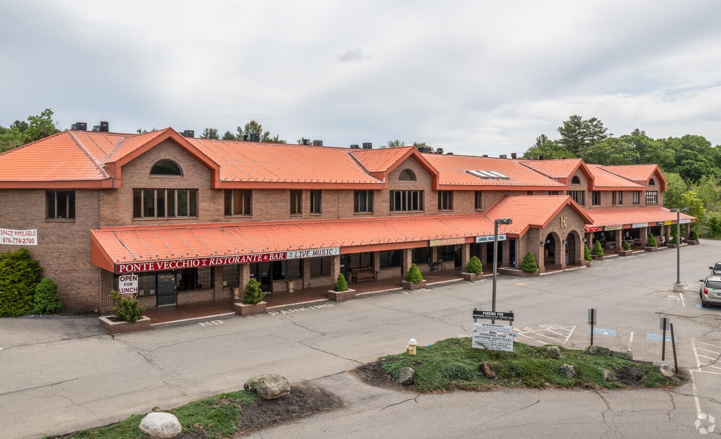
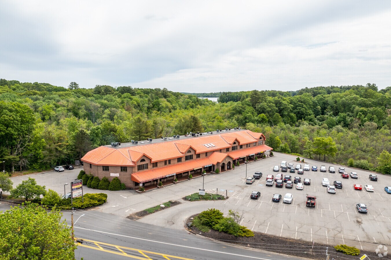
Property Record
435 Newbury St, Danvers, MA 01923

Current Lease Availabilities
NEARBY LISTINGS FOR SALE OR LEASE
Property Detail
435 Newbury St
DANV-000008-000000-000049B
Elio Dibiase
Regionalshoppingcenterormallwithanchorstore
Essex
X
Massachusetts
25009C0402F
49b
2025
4.15 AC
2025
Danvers/Beverly
211402
Boston
35,217 SF
Boston-Cambridge-Newton, MA-NH
DEMOGRAPHICS near 435 Newbury St
1 Mile
3 Mile
5 Mile
2024 Total Population
3,586
32,032
102,943
2029 Population
3,618
31,902
102,615
Pop Growth 2024-2029
+ 0.89%
(0.41%)
(0.32%)
Average Age
45
43
44
2024 Total Households
1,214
11,894
39,873
HH Growth 2024-2029
+ 0.91%
(0.58%)
(0.41%)
Median Household Inc
$116,198
$117,691
$106,151
Avg Household Size
2.50
2.50
2.50
2024 Avg HH Vehicles
2.00
2.00
2.00
Median Home Value
$639,886
$655,175
$608,104
Median Year Built
1976
1968
1967
Nearby Places
- Restaurants
- Banks
- Shops
- Fitness
- Groceries
PUBLIC TRANSPORTATION
COMMUTER RAIL
Hamilton/Wenham (Newburyport/Rockport Line - Massachusetts Bay Transportation Authority Commuter Rail (Purple Line))
DRIVE
WALK
Distance
Hamilton/Wenham (Newburyport/Rockport Line - Massachusetts Bay Transportation Authority Commuter Rail (Purple Line))
13 min
6.0 mi
North Beverly (Newburyport/Rockport Line - Massachusetts Bay Transportation Authority Commuter Rail (Purple Line))
DRIVE
WALK
Distance
North Beverly (Newburyport/Rockport Line - Massachusetts Bay Transportation Authority Commuter Rail (Purple Line))
13 min
6.2 mi
AIRPORT
General Edward Lawrence Logan International
DRIVE
WALK
Distance
General Edward Lawrence Logan International
32 min
19.6 mi
Freight Ports
Port of Boston
DRIVE
WALK
Distance
Port of Boston
35 min
22.5 mi
Nearby Properties
Address
Land Use
TOTAL SIZE
Lot Size
Zoning
Address
Land Use
TOTAL SIZE
Lot Size
Zoning
747,237 SF
36.70 AC
HW
Address
Land Use
TOTAL SIZE
Lot Size
Zoning
374,769 SF
71.70 AC
Address
Land Use
TOTAL SIZE
Lot Size
Zoning
252,965 SF
56.44 AC
R3
Address
Land Use
TOTAL SIZE
Lot Size
Zoning
198.74 AC
R3
Address
Land Use
TOTAL SIZE
Lot Size
Zoning
13.04 AC
HC
Address
Land Use
TOTAL SIZE
Lot Size
Zoning
172.50 AC
R3
Address
Land Use
TOTAL SIZE
Lot Size
Zoning
101,389 SF
20 AC
I
Address
Land Use
TOTAL SIZE
Lot Size
Zoning
65.79 AC
I1
Address
Land Use
TOTAL SIZE
Lot Size
Zoning
40.20 AC
R1B
Address
Land Use
TOTAL SIZE
Lot Size
Zoning
54,302 SF
83.70 AC
R3
Address
Land Use
TOTAL SIZE
Lot Size
Zoning
93,789 SF
8.22 AC
HW
Address
Land Use
TOTAL SIZE
Lot Size
Zoning
111.24 AC
R3
Address
Land Use
TOTAL SIZE
Lot Size
Zoning
37,553 SF
238.29 AC
IR
Address
Land Use
TOTAL SIZE
Lot Size
Zoning
15.32 AC
HC
Address
Land Use
TOTAL SIZE
Lot Size
Zoning
71.68 AC
R3
Address
Land Use
TOTAL SIZE
Lot Size
Zoning
12.57 AC
IH
Address
Land Use
TOTAL SIZE
Lot Size
Zoning
24.54 AC
M1
Address
Land Use
TOTAL SIZE
Lot Size
Zoning
139,582 SF
31.13 AC
R1
Address
Land Use
TOTAL SIZE
Lot Size
Zoning
81,746 SF
10.50 AC
R1A
Address
Land Use
TOTAL SIZE
Lot Size
Zoning
24.87 AC
R3
Address
Land Use
TOTAL SIZE
Lot Size
Zoning
181,659 SF
11.57 AC
R114
Address
Land Use
TOTAL SIZE
Lot Size
Zoning
83,916 SF
15 AC
R3
Address
Land Use
TOTAL SIZE
Lot Size
Zoning
30.70 AC
R2
Address
Land Use
TOTAL SIZE
Lot Size
Zoning
175,699 SF
22.91 AC
R3
Address
Land Use
TOTAL SIZE
Lot Size
Zoning
115,348 SF
16.40 AC
HCD
Address
Land Use
TOTAL SIZE
Lot Size
Zoning
114,680 SF
13.73 AC
HC
Address
Land Use
TOTAL SIZE
Lot Size
Zoning
8.60 AC
I1
Address
Land Use
TOTAL SIZE
Lot Size
Zoning
117,214 SF
8.49 AC
R1B
Address
Land Use
TOTAL SIZE
Lot Size
Zoning
112,452 SF
6.47 AC
HC
Address
Land Use
TOTAL SIZE
Lot Size
Zoning
12.73 AC
IH
The World's #1 Commercial Real Estate Marketplace
Connect with us
© 2025 CoStar Group
The information above has been obtained from sources believed reliable. While we do not doubt its accuracy we have not verified it and make no guarantee, warranty or representation about it. It is your responsibility to independently confirm its accuracy and completeness. Any projections, opinions, assumptions, or estimates used are for example only and do not represent the current or future performance of the property. The value of this transaction to you depends on tax and other factors which should be evaluated by your tax, financial, and legal advisors. You and your advisors should conduct a careful, independent investigation of the property to determine to your satisfaction the suitability of the property for your needs.