Property Record
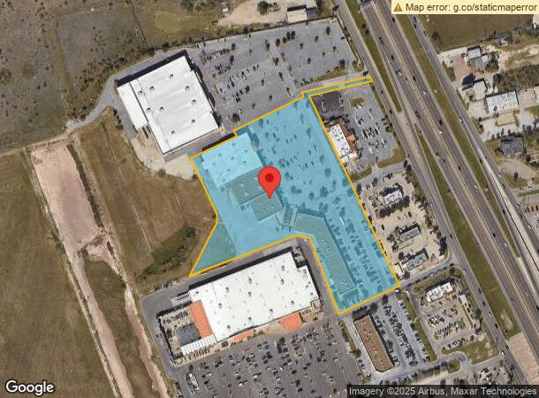
4365 N Expressway, Brownsville, TX 78520

NEARBY LISTINGS FOR SALE OR LEASE
Property Detail
4365 N Expressway
Brownsville-Harlingen, TX
Morrison Crossing Subdivision Replat No
019369-0010-002000
LOT 2 MORRISON CROSSING SUBDIVISION REPLAT NO 1 (C1-2851 A CCMR FILED 8/23/07)
Commercialnec
Cameron
X
Texas
48061C0560F
2
2023
8.27 AC
2024
Greater Brownsville
012509
Brownsville/Harlingen
80,379 SF
DEMOGRAPHICS near 4365 N Expressway
1 Mile
3 Mile
5 Mile
2024 Total Population
8,743
78,814
141,685
2029 Population
8,857
80,272
145,037
Pop Growth 2024-2029
+ 1.30%
+ 1.85%
+ 2.37%
Average Age
34
35
36
2024 Total Households
2,585
24,279
44,549
HH Growth 2024-2029
+ 1.20%
+ 1.89%
+ 2.39%
Median Household Inc
$57,480
$60,815
$54,274
Avg Household Size
3.30
3.20
3.10
2024 Avg HH Vehicles
2.00
2.00
2.00
Median Home Value
$125,206
$137,601
$128,910
Median Year Built
2003
1997
1994
Nearby Places
- Restaurants
- Banks
- Shops
- Fitness
- Groceries
PUBLIC TRANSPORTATION
AIRPORT
Brownsville/South Padre Island International
DRIVE
WALK
Distance
Brownsville/South Padre Island International
14 min
7.9 mi
Valley International
DRIVE
WALK
Distance
Valley International
31 min
23.2 mi
Freight Ports
Port of Brownsville
DRIVE
WALK
Distance
Port of Brownsville
14 min
8.7 mi
SALE & LEASE HISTORY
LISTING DATE
SALE/LEASE

Sep 25, 2016
For Lease
Jan 31, 2019
For Lease
Nearby Properties
Address
Land Use
TOTAL SIZE
Lot Size
Zoning
Address
Land Use
TOTAL SIZE
Lot Size
Zoning
1,019,535 SF
110.69 AC
I
Address
Land Use
TOTAL SIZE
Lot Size
Zoning
452,559 SF
13.79 AC
C
Address
Land Use
TOTAL SIZE
Lot Size
Zoning
232,467 SF
25.82 AC
C
Address
Land Use
TOTAL SIZE
Lot Size
Zoning
196,847 SF
19.62 AC
Address
Land Use
TOTAL SIZE
Lot Size
Zoning
112,834 SF
16.70 AC
C
Address
Land Use
TOTAL SIZE
Lot Size
Zoning
277,742 SF
31.28 AC
Address
Land Use
TOTAL SIZE
Lot Size
Zoning
135,686 SF
19.05 AC
C
Address
Land Use
TOTAL SIZE
Lot Size
Zoning
56,804 SF
1.83 AC
Address
Land Use
TOTAL SIZE
Lot Size
Zoning
176,990 SF
18.31 AC
C
Address
Land Use
TOTAL SIZE
Lot Size
Zoning
73,090 SF
3.08 AC
C
Address
Land Use
TOTAL SIZE
Lot Size
Zoning
100,491 SF
14 AC
C
Address
Land Use
TOTAL SIZE
Lot Size
Zoning
60,747 SF
2.59 AC
C
Address
Land Use
TOTAL SIZE
Lot Size
Zoning
66,340 SF
3.85 AC
C
Address
Land Use
TOTAL SIZE
Lot Size
Zoning
148,781 SF
10.28 AC
B
Address
Land Use
TOTAL SIZE
Lot Size
Zoning
78,583 SF
5 AC
C
Address
Land Use
TOTAL SIZE
Lot Size
Zoning
72,320 SF
27.36 AC
Address
Land Use
TOTAL SIZE
Lot Size
Zoning
62,344 SF
2.92 AC
Address
Land Use
TOTAL SIZE
Lot Size
Zoning
205,001 SF
20.13 AC
C
Address
Land Use
TOTAL SIZE
Lot Size
Zoning
102,042 SF
8.68 AC
C
Address
Land Use
TOTAL SIZE
Lot Size
Zoning
363,515 SF
34.39 AC
Address
Land Use
TOTAL SIZE
Lot Size
Zoning
112,263 SF
9.66 AC
Address
Land Use
TOTAL SIZE
Lot Size
Zoning
110,431 SF
15 AC
Address
Land Use
TOTAL SIZE
Lot Size
Zoning
188,446 SF
18.42 AC
Address
Land Use
TOTAL SIZE
Lot Size
Zoning
52,668 SF
2.23 AC
Address
Land Use
TOTAL SIZE
Lot Size
Zoning
86,682 SF
25.76 AC
C
Address
Land Use
TOTAL SIZE
Lot Size
Zoning
46,381 SF
2.16 AC
Address
Land Use
TOTAL SIZE
Lot Size
Zoning
97,077 SF
16.78 AC
Address
Land Use
TOTAL SIZE
Lot Size
Zoning
81,191 SF
19.56 AC
The World's #1 Commercial Real Estate Marketplace
Connect with us
© 2025 CoStar Group
The information above has been obtained from sources believed reliable. While we do not doubt its accuracy we have not verified it and make no guarantee, warranty or representation about it. It is your responsibility to independently confirm its accuracy and completeness. Any projections, opinions, assumptions, or estimates used are for example only and do not represent the current or future performance of the property. The value of this transaction to you depends on tax and other factors which should be evaluated by your tax, financial, and legal advisors. You and your advisors should conduct a careful, independent investigation of the property to determine to your satisfaction the suitability of the property for your needs.