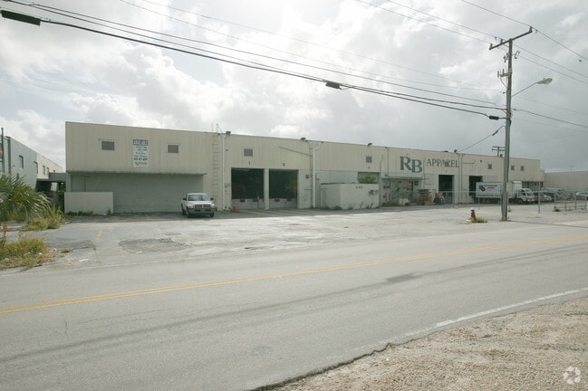
Property Record
440 W 20Th St, Hialeah, FL 33010


NEARBY LISTINGS FOR SALE OR LEASE
Property Detail
440 W 20Th St
Miami-Miami Beach-Kendall, FL
Bings Red Rd Terminals
04-3013-034-0020
BINGS RED RD TERMINALS PB 65-13 W20FT OF LOT 1 & ALL LOT 2 & E30FT OF LOT 3 BLK 1 LOT SIZE 74702 SQUARE FEET OR 9877-2543
Foodprocessing
Miami/Dade
AH
Florida
12086C0283L
1,2,3
2024
1.72 AC
2025
Hialeah
000712
South Florida
51,887 SF
DEMOGRAPHICS near 440 W 20Th St
1 Mile
3 Mile
5 Mile
2024 Total Population
24,754
156,004
450,045
2029 Population
23,862
150,624
438,418
Pop Growth 2024-2029
(3.60%)
(3.45%)
(2.58%)
Average Age
45
45
42
2024 Total Households
8,661
52,293
153,399
HH Growth 2024-2029
(4.20%)
(3.86%)
(2.94%)
Median Household Inc
$34,178
$43,470
$43,386
Avg Household Size
2.70
2.80
2.80
2024 Avg HH Vehicles
1.00
2.00
2.00
Median Home Value
$374,932
$342,353
$321,734
Median Year Built
1963
1966
1973
Nearby Places
Map Layers
Map Styles
 Street
 Aerial
- Restaurants
- Banks
- Shops
- Fitness
- Groceries
PUBLIC TRANSPORTATION
TRANSIT/SUBWAY
Okeechobee (Metrorail Green Line - Miami-Dade Transit (Metrorail/Metromover))
DRIVE
WALK
Distance
Okeechobee (Metrorail Green Line - Miami-Dade Transit (Metrorail/Metromover))
3 min
13 min
0.7 mi
COMMUTER RAIL
Okeechobee (Metrorail Green Line - Miami-Dade Transit (Metrorail/Metromover))
DRIVE
WALK
Distance
Okeechobee (Metrorail Green Line - Miami-Dade Transit (Metrorail/Metromover))
3 min
13 min
0.7 mi
Hialeah (Metrorail Green Line - Miami-Dade Transit (Metrorail/Metromover))
DRIVE
WALK
Distance
Hialeah (Metrorail Green Line - Miami-Dade Transit (Metrorail/Metromover))
3 min
20 min
1.1 mi
AIRPORT
Miami International
DRIVE
WALK
Distance
Miami International
16 min
6.0 mi
Fort Lauderdale/Hollywood International
DRIVE
WALK
Distance
Fort Lauderdale/Hollywood International
38 min
22.6 mi
SALE & LEASE HISTORY
LISTING DATE
SALE/LEASE

Feb 10, 2025
For Lease
Nearby Properties
Address
Land Use
TOTAL SIZE
Lot Size
Zoning
Address
Land Use
TOTAL SIZE
Lot Size
Zoning
7.62 AC
7200
Address
Land Use
TOTAL SIZE
Lot Size
Zoning
582,921 SF
4.51 AC
6119
Address
Land Use
TOTAL SIZE
Lot Size
Zoning
418,532 SF
17.95 AC
7300
Address
Land Use
TOTAL SIZE
Lot Size
Zoning
328,554 SF
668.26 AC
8900
Address
Land Use
TOTAL SIZE
Lot Size
Zoning
1,700 SF
7.24 AC
7100
Address
Land Use
TOTAL SIZE
Lot Size
Zoning
301,593 SF
16 AC
7100
Address
Land Use
TOTAL SIZE
Lot Size
Zoning
453,404 SF
469.53 AC
7300
Address
Land Use
TOTAL SIZE
Lot Size
Zoning
451,817 SF
6400
Address
Land Use
TOTAL SIZE
Lot Size
Zoning
322,084 SF
6.60 AC
7100
Address
Land Use
TOTAL SIZE
Lot Size
Zoning
344,465 SF
5.03 AC
6400
Address
Land Use
TOTAL SIZE
Lot Size
Zoning
648,867 SF
33.08 AC
7100
Address
Land Use
TOTAL SIZE
Lot Size
Zoning
387,903 SF
4.49 AC
6119
Address
Land Use
TOTAL SIZE
Lot Size
Zoning
330,528 SF
4.46 AC
6119
Address
Land Use
TOTAL SIZE
Lot Size
Zoning
207,475 SF
51.47 AC
7100
Address
Land Use
TOTAL SIZE
Lot Size
Zoning
328,942 SF
16.15 AC
7600
Address
Land Use
TOTAL SIZE
Lot Size
Zoning
225,137 SF
80.89 AC
7600
Address
Land Use
TOTAL SIZE
Lot Size
Zoning
510,373 SF
154.10 AC
8900
Address
Land Use
TOTAL SIZE
Lot Size
Zoning
419,656 SF
8.61 AC
6400
Address
Land Use
TOTAL SIZE
Lot Size
Zoning
530,479 SF
10.13 AC
6400
Address
Land Use
TOTAL SIZE
Lot Size
Zoning
445,429 SF
4.45 AC
6400
Address
Land Use
TOTAL SIZE
Lot Size
Zoning
177,893 SF
15.02 AC
7100
Address
Land Use
TOTAL SIZE
Lot Size
Zoning
252,698 SF
13.22 AC
7100
Address
Land Use
TOTAL SIZE
Lot Size
Zoning
293,962 SF
9.99 AC
4400
Address
Land Use
TOTAL SIZE
Lot Size
Zoning
249,486 SF
11.84 AC
7100
Address
Land Use
TOTAL SIZE
Lot Size
Zoning
196,118 SF
11.06 AC
7100
Address
Land Use
TOTAL SIZE
Lot Size
Zoning
478,031 SF
1.72 AC
6600
Address
Land Use
TOTAL SIZE
Lot Size
Zoning
221,731 SF
11.17 AC
7100
Address
Land Use
TOTAL SIZE
Lot Size
Zoning
260,794 SF
12.50 AC
7100
Address
Land Use
TOTAL SIZE
Lot Size
Zoning
314,441 SF
16.99 AC
7600
Address
Land Use
TOTAL SIZE
Lot Size
Zoning
366,063 SF
57.35 AC
7100
The World's #1 Commercial Real Estate Marketplace
Connect with us
© 2025 CoStar Group
The information above has been obtained from sources believed reliable. While we do not doubt its accuracy we have not verified it and make no guarantee, warranty or representation about it. It is your responsibility to independently confirm its accuracy and completeness. Any projections, opinions, assumptions, or estimates used are for example only and do not represent the current or future performance of the property. The value of this transaction to you depends on tax and other factors which should be evaluated by your tax, financial, and legal advisors. You and your advisors should conduct a careful, independent investigation of the property to determine to your satisfaction the suitability of the property for your needs.