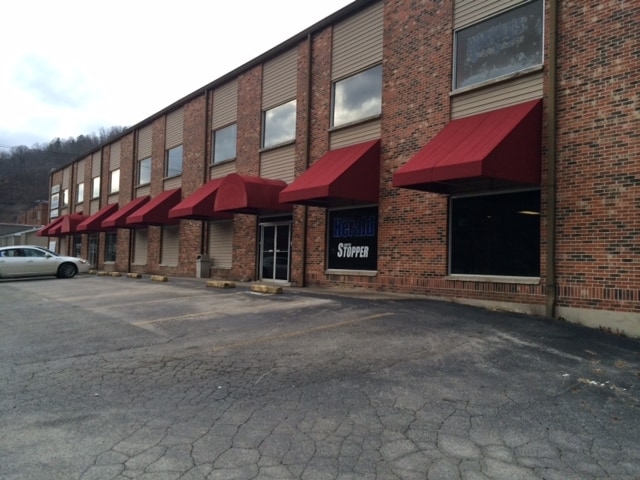
Property Record
439 High St, Hazard, KY 41701


NEARBY LISTINGS FOR SALE OR LEASE
Property Detail
439 High St
Commercialnec
DB 436 PG 672 07-25-24
AE
Perry
21193C0302E
Kentucky
2023
1.95 AC
2025
Kentucky East Area
970602
Other Market Areas
49,220 SF
102-11-11-002.00
DEMOGRAPHICS near 439 High St
1 Mile
3 Mile
5 Mile
2024 Total Population
3,807
9,473
14,068
2029 Population
3,803
9,293
13,648
Pop Growth 2024-2029
(0.11%)
(1.90%)
(2.99%)
Average Age
40
41
41
2024 Total Households
1,660
3,944
5,718
HH Growth 2024-2029
0.00%
(1.77%)
(2.89%)
Median Household Inc
$50,709
$48,136
$42,266
Avg Household Size
2.20
2.30
2.30
2024 Avg HH Vehicles
2.00
2.00
2.00
Median Home Value
$121,446
$97,967
$97,229
Median Year Built
1968
1979
1980
Nearby Places
Map Layers
Map Styles
 Street
 Aerial
- Restaurants
- Banks
- Shops
- Fitness
- Groceries
SALE & LEASE HISTORY
LISTING DATE
SALE/LEASE

Sep 25, 2016
For Lease
Sep 24, 2016
For Sale
Mar 17, 2017
For Lease
Mar 17, 2017
For Sale
Nearby Properties
Address
Land Use
TOTAL SIZE
Lot Size
Zoning
Address
Land Use
TOTAL SIZE
Lot Size
Zoning
31.07 AC
Address
Land Use
TOTAL SIZE
Lot Size
Zoning
22 AC
Address
Land Use
TOTAL SIZE
Lot Size
Zoning
0.11 AC
Address
Land Use
TOTAL SIZE
Lot Size
Zoning
16,725 SF
R
Address
Land Use
TOTAL SIZE
Lot Size
Zoning
15,750 SF
Address
Land Use
TOTAL SIZE
Lot Size
Zoning
Address
Land Use
TOTAL SIZE
Lot Size
Zoning
24,482 SF
18.30 AC
Address
Land Use
TOTAL SIZE
Lot Size
Zoning
32,390 SF
5.99 AC
Address
Land Use
TOTAL SIZE
Lot Size
Zoning
41,874 SF
1.40 AC
R
Address
Land Use
TOTAL SIZE
Lot Size
Zoning
1,100 SF
0.89 AC
Address
Land Use
TOTAL SIZE
Lot Size
Zoning
2,068 SF
6 AC
Address
Land Use
TOTAL SIZE
Lot Size
Zoning
60,285 SF
3.66 AC
Address
Land Use
TOTAL SIZE
Lot Size
Zoning
38,496 SF
0.42 AC
Address
Land Use
TOTAL SIZE
Lot Size
Zoning
84.25 AC
Address
Land Use
TOTAL SIZE
Lot Size
Zoning
19,730 SF
4 AC
Address
Land Use
TOTAL SIZE
Lot Size
Zoning
7.43 AC
Address
Land Use
TOTAL SIZE
Lot Size
Zoning
12,238 SF
8 AC
Address
Land Use
TOTAL SIZE
Lot Size
Zoning
33,618 SF
16 AC
Address
Land Use
TOTAL SIZE
Lot Size
Zoning
9,500 SF
0.80 AC
Address
Land Use
TOTAL SIZE
Lot Size
Zoning
2.45 AC
Address
Land Use
TOTAL SIZE
Lot Size
Zoning
Address
Land Use
TOTAL SIZE
Lot Size
Zoning
70,000 SF
1.16 AC
Address
Land Use
TOTAL SIZE
Lot Size
Zoning
Address
Land Use
TOTAL SIZE
Lot Size
Zoning
8,835 SF
5.51 AC
Address
Land Use
TOTAL SIZE
Lot Size
Zoning
6,292 SF
0.26 AC
Address
Land Use
TOTAL SIZE
Lot Size
Zoning
10,028 SF
Address
Land Use
TOTAL SIZE
Lot Size
Zoning
19,967 SF
3.30 AC
R
Address
Land Use
TOTAL SIZE
Lot Size
Zoning
27,329 SF
Address
Land Use
TOTAL SIZE
Lot Size
Zoning
50,000 SF
The World's #1 Commercial Real Estate Marketplace
Connect with us
© 2025 CoStar Group
The information above has been obtained from sources believed reliable. While we do not doubt its accuracy we have not verified it and make no guarantee, warranty or representation about it. It is your responsibility to independently confirm its accuracy and completeness. Any projections, opinions, assumptions, or estimates used are for example only and do not represent the current or future performance of the property. The value of this transaction to you depends on tax and other factors which should be evaluated by your tax, financial, and legal advisors. You and your advisors should conduct a careful, independent investigation of the property to determine to your satisfaction the suitability of the property for your needs.