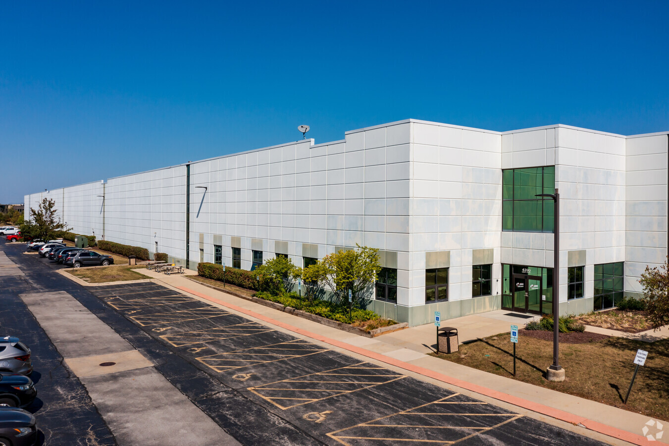
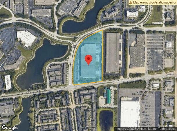
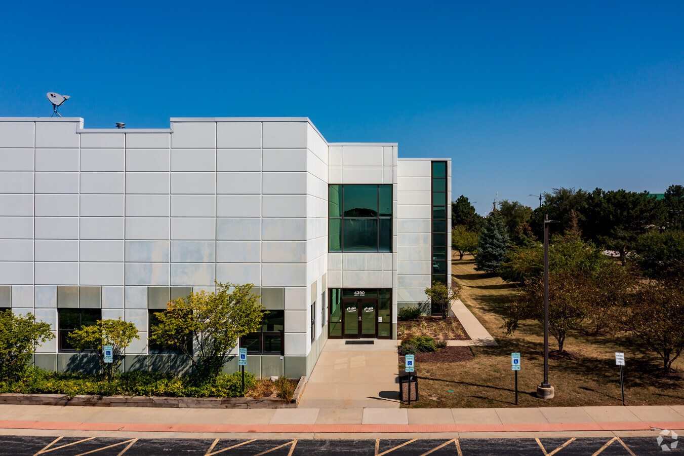
Property Record
4390 Liberty St, Aurora, IL 60504
NEARBY LISTINGS FOR SALE OR LEASE
Property Detail
4390 Liberty St
Chicago-Naperville-Elgin, IL-IN-WI
Meridian Liberty Sub
07-16-402-009
MERIDIAN LIBERTY SUB ALL
Industrialgeneral
DuPage
X
Illinois
17043C0139J
2
2023
11.85 AC
2023
I-88 West
846507
Chicago
196,476 SF
DEMOGRAPHICS near 4390 Liberty St
1 Mile
3 Mile
5 Mile
2024 Total Population
7,479
84,843
240,210
2029 Population
7,503
84,037
237,553
Pop Growth 2024-2029
+ 0.32%
(0.95%)
(1.11%)
Average Age
33
38
38
2024 Total Households
3,012
32,323
85,295
HH Growth 2024-2029
+ 0.13%
(0.97%)
(1.12%)
Median Household Inc
$106,718
$111,025
$107,546
Avg Household Size
2.50
2.60
2.70
2024 Avg HH Vehicles
1.00
2.00
2.00
Median Home Value
$302,488
$357,883
$350,614
Median Year Built
2002
1992
1989
Nearby Places
- Restaurants
- Banks
- Shops
- Fitness
- Groceries
PUBLIC TRANSPORTATION
COMMUTER RAIL
Route 59 Station (Burlington Northern-Santa Fe Railway Line - Northeast Illinois Regional Commuter Railroad (Metra))
DRIVE
WALK
Distance
Route 59 Station (Burlington Northern-Santa Fe Railway Line - Northeast Illinois Regional Commuter Railroad (Metra))
5 min
19 min
1.0 mi
Naperville Station (Burlington Northern-Santa Fe Railway Line - Northeast Illinois Regional Commuter Railroad (Metra))
DRIVE
WALK
Distance
Naperville Station (Burlington Northern-Santa Fe Railway Line - Northeast Illinois Regional Commuter Railroad (Metra))
11 min
4.7 mi
AIRPORT
Chicago Midway International
DRIVE
WALK
Distance
Chicago Midway International
47 min
28.1 mi
Chicago O'Hare International
DRIVE
WALK
Distance
Chicago O'Hare International
47 min
31.7 mi
Freight Ports
Port Milwaukee
DRIVE
WALK
Distance
Port Milwaukee
128 min
103.4 mi
Nearby Properties
Address
Land Use
TOTAL SIZE
Lot Size
Zoning
Address
Land Use
TOTAL SIZE
Lot Size
Zoning
28.52 AC
R
Address
Land Use
TOTAL SIZE
Lot Size
Zoning
29.20 AC
C
Address
Land Use
TOTAL SIZE
Lot Size
Zoning
47.26 AC
Address
Land Use
TOTAL SIZE
Lot Size
Zoning
Address
Land Use
TOTAL SIZE
Lot Size
Zoning
31.66 AC
C
Address
Land Use
TOTAL SIZE
Lot Size
Zoning
19.92 AC
C
Address
Land Use
TOTAL SIZE
Lot Size
Zoning
17.70 AC
Address
Land Use
TOTAL SIZE
Lot Size
Zoning
683,677 SF
25.63 AC
Address
Land Use
TOTAL SIZE
Lot Size
Zoning
797,399 SF
52.38 AC
C
Address
Land Use
TOTAL SIZE
Lot Size
Zoning
272,400 SF
20.94 AC
C
Address
Land Use
TOTAL SIZE
Lot Size
Zoning
20.97 AC
R
Address
Land Use
TOTAL SIZE
Lot Size
Zoning
829,087 SF
35.83 AC
C
Address
Land Use
TOTAL SIZE
Lot Size
Zoning
25 AC
M
Address
Land Use
TOTAL SIZE
Lot Size
Zoning
283,844 SF
16.06 AC
M
Address
Land Use
TOTAL SIZE
Lot Size
Zoning
17.84 AC
M
Address
Land Use
TOTAL SIZE
Lot Size
Zoning
721,600 SF
34.74 AC
I
Address
Land Use
TOTAL SIZE
Lot Size
Zoning
16.15 AC
M
Address
Land Use
TOTAL SIZE
Lot Size
Zoning
15.61 AC
M
Address
Land Use
TOTAL SIZE
Lot Size
Zoning
27.67 AC
Address
Land Use
TOTAL SIZE
Lot Size
Zoning
289,890 SF
21.27 AC
C
Address
Land Use
TOTAL SIZE
Lot Size
Zoning
649,717 SF
27.79 AC
I
Address
Land Use
TOTAL SIZE
Lot Size
Zoning
31.08 AC
Address
Land Use
TOTAL SIZE
Lot Size
Zoning
11.02 AC
M
Address
Land Use
TOTAL SIZE
Lot Size
Zoning
594,880 SF
29.15 AC
I
Address
Land Use
TOTAL SIZE
Lot Size
Zoning
16.86 AC
C
Address
Land Use
TOTAL SIZE
Lot Size
Zoning
12.70 AC
Address
Land Use
TOTAL SIZE
Lot Size
Zoning
6.59 AC
Address
Land Use
TOTAL SIZE
Lot Size
Zoning
286,400 SF
9.50 AC
Address
Land Use
TOTAL SIZE
Lot Size
Zoning
522,457 SF
29.33 AC
I
Address
Land Use
TOTAL SIZE
Lot Size
Zoning
9.83 AC
C
The World's #1 Commercial Real Estate Marketplace
Connect with us
© 2025 CoStar Group
The information above has been obtained from sources believed reliable. While we do not doubt its accuracy we have not verified it and make no guarantee, warranty or representation about it. It is your responsibility to independently confirm its accuracy and completeness. Any projections, opinions, assumptions, or estimates used are for example only and do not represent the current or future performance of the property. The value of this transaction to you depends on tax and other factors which should be evaluated by your tax, financial, and legal advisors. You and your advisors should conduct a careful, independent investigation of the property to determine to your satisfaction the suitability of the property for your needs.