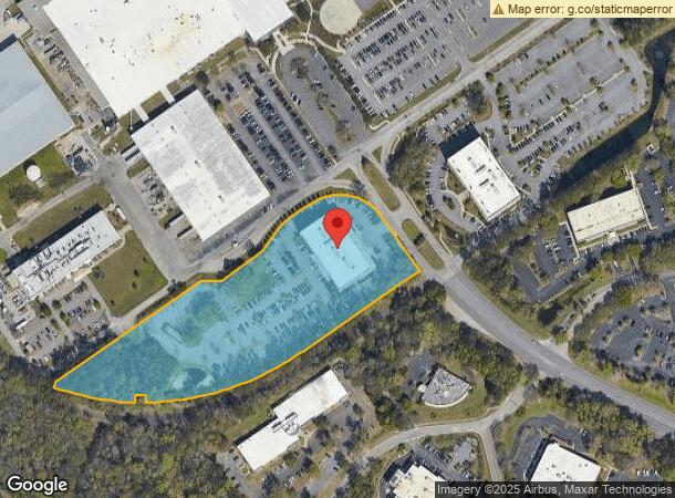
Property Record
4401 Leeds Ave, North Charleston, SC 29405
NEARBY LISTINGS FOR SALE OR LEASE
Property Detail
4401 Leeds Ave
Charleston-North Charleston, SC
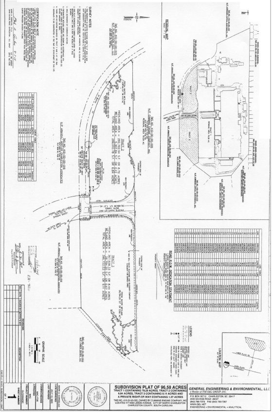
Subdivision Plat Of 96.58 Acres Tract 1
410-00-00-079
LEGAL DESCRIPTION MAPPLATB L12 MAPPLATP 0154 TRACT 2
Officebuilding
Charleston
AE
South Carolina
45019C0484K
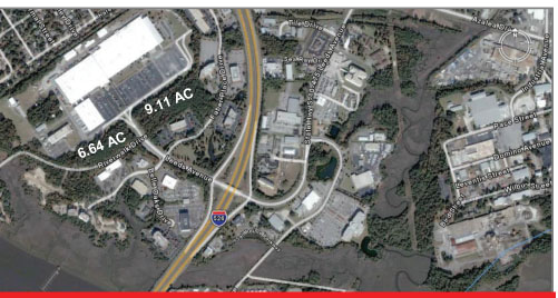
6.88 AC
2023
North Charleston
2023
Charleston/N Charleston
003900
DEMOGRAPHICS near 4401 Leeds Ave
1 Mile
3 Mile
5 Mile
2024 Total Population
1,989
55,545
140,066
2029 Population
2,106
59,279
150,229
Pop Growth 2024-2029
+ 5.88%
+ 6.72%
+ 7.26%
Average Age
46
40
39
2024 Total Households
859
23,971
59,480
HH Growth 2024-2029
+ 5.70%
+ 6.55%
+ 7.07%
Median Household Inc
$53,106
$57,714
$60,595
Avg Household Size
2.10
2.20
2.20
2024 Avg HH Vehicles
2.00
2.00
2.00
Median Home Value
$245,762
$270,553
$287,363
Median Year Built
1973
1979
1980
Nearby Places
- Restaurants
- Banks
- Shops
- Fitness
- Groceries
PUBLIC TRANSPORTATION
COMMUTER RAIL
Charleston Amtrak Station (Palmetto - Amtrak, Silver Meteor - Amtrak)
DRIVE
WALK
Distance
Charleston Amtrak Station (Palmetto - Amtrak, Silver Meteor - Amtrak)
8 min
4.4 mi
AIRPORT
Charleston AFB/International
DRIVE
WALK
Distance
Charleston AFB/International
11 min
7.0 mi
Freight Ports
Veterans Terminal
DRIVE
WALK
Distance
Veterans Terminal
12 min
5.7 mi
Nearby Properties
Address
Land Use
TOTAL SIZE
Lot Size
Zoning
Address
Land Use
TOTAL SIZE
Lot Size
Zoning
68,655 SF
9.48 AC
Address
Land Use
TOTAL SIZE
Lot Size
Zoning
36,587 SF
17.75 AC
Address
Land Use
TOTAL SIZE
Lot Size
Zoning
4,740 SF
12.17 AC
Address
Land Use
TOTAL SIZE
Lot Size
Zoning
17,271 SF
3.65 AC
Address
Land Use
TOTAL SIZE
Lot Size
Zoning
6,036 SF
8.79 AC
Address
Land Use
TOTAL SIZE
Lot Size
Zoning
19,992 SF
11.98 AC
Address
Land Use
TOTAL SIZE
Lot Size
Zoning
5.54 AC
Address
Land Use
TOTAL SIZE
Lot Size
Zoning
42,500 SF
3.62 AC
Address
Land Use
TOTAL SIZE
Lot Size
Zoning
1,303 SF
4.77 AC
Address
Land Use
TOTAL SIZE
Lot Size
Zoning
3,192 SF
34.47 AC
Address
Land Use
TOTAL SIZE
Lot Size
Zoning
30,064 SF
33.86 AC
Address
Land Use
TOTAL SIZE
Lot Size
Zoning
16,917 SF
2.40 AC
Address
Land Use
TOTAL SIZE
Lot Size
Zoning
50,356 SF
5.19 AC
Address
Land Use
TOTAL SIZE
Lot Size
Zoning
6,531 SF
3.11 AC
Address
Land Use
TOTAL SIZE
Lot Size
Zoning
25.97 AC
Address
Land Use
TOTAL SIZE
Lot Size
Zoning
86,024 SF
9.69 AC
Address
Land Use
TOTAL SIZE
Lot Size
Zoning
26,010 SF
4.32 AC
Address
Land Use
TOTAL SIZE
Lot Size
Zoning
896 SF
6.09 AC
Address
Land Use
TOTAL SIZE
Lot Size
Zoning
11,300 SF
25.42 AC
Address
Land Use
TOTAL SIZE
Lot Size
Zoning
1,717 SF
40.95 AC
Address
Land Use
TOTAL SIZE
Lot Size
Zoning
Address
Land Use
TOTAL SIZE
Lot Size
Zoning
Address
Land Use
TOTAL SIZE
Lot Size
Zoning
Address
Land Use
TOTAL SIZE
Lot Size
Zoning
28,580 SF
7.65 AC
Address
Land Use
TOTAL SIZE
Lot Size
Zoning
9,778 SF
11.90 AC
Address
Land Use
TOTAL SIZE
Lot Size
Zoning
Address
Land Use
TOTAL SIZE
Lot Size
Zoning
11,840 SF
9.66 AC
Address
Land Use
TOTAL SIZE
Lot Size
Zoning
223,815 SF
5.73 AC
Address
Land Use
TOTAL SIZE
Lot Size
Zoning
20,839 SF
3.72 AC
Address
Land Use
TOTAL SIZE
Lot Size
Zoning
24,752 SF
9.11 AC
The World's #1 Commercial Real Estate Marketplace
Connect with us
© 2025 CoStar Group
The information above has been obtained from sources believed reliable. While we do not doubt its accuracy we have not verified it and make no guarantee, warranty or representation about it. It is your responsibility to independently confirm its accuracy and completeness. Any projections, opinions, assumptions, or estimates used are for example only and do not represent the current or future performance of the property. The value of this transaction to you depends on tax and other factors which should be evaluated by your tax, financial, and legal advisors. You and your advisors should conduct a careful, independent investigation of the property to determine to your satisfaction the suitability of the property for your needs.