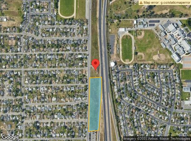
Property Record
4401 Powerline Rd, Olivehurst, CA 95961


NEARBY LISTINGS FOR SALE OR LEASE
Property Detail
4401 Powerline Rd
014-160-062-000
P-2 PM 04-36 84/13-14
Commercialacreage
Yuba
X
California
06115C0410D
3.64 AC
2024
Yuba County
2023
Sacramento
040600
Yuba City, CA
DEMOGRAPHICS near 4401 Powerline Rd
1 Mile
3 Mile
5 Mile
2024 Total Population
8,884
30,213
65,152
2029 Population
9,834
33,576
70,241
Pop Growth 2024-2029
+ 10.69%
+ 11.13%
+ 7.81%
Average Age
36
35
35
2024 Total Households
2,713
9,094
19,940
HH Growth 2024-2029
+ 11.06%
+ 11.57%
+ 8.19%
Median Household Inc
$57,475
$68,700
$66,165
Avg Household Size
3.20
3.20
3.10
2024 Avg HH Vehicles
2.00
2.00
2.00
Median Home Value
$246,732
$307,374
$323,625
Median Year Built
1978
1995
1991
Nearby Places
- Restaurants
- Banks
- Shops
- Fitness
- Groceries
PUBLIC TRANSPORTATION
AIRPORT
Sacramento International
DRIVE
WALK
Distance
Sacramento International
41 min
33.0 mi
Freight Ports
Port of Stockton
DRIVE
WALK
Distance
Port of Stockton
94 min
81.4 mi
Nearby Properties
Address
Land Use
TOTAL SIZE
Lot Size
Zoning
Address
Land Use
TOTAL SIZE
Lot Size
Zoning
107,749 SF
9.33 AC
C
Address
Land Use
TOTAL SIZE
Lot Size
Zoning
30.13 AC
AI
Address
Land Use
TOTAL SIZE
Lot Size
Zoning
19,950 SF
7.66 AC
M-1
Address
Land Use
TOTAL SIZE
Lot Size
Zoning
63,320 SF
3.88 AC
R-03
Address
Land Use
TOTAL SIZE
Lot Size
Zoning
4.79 AC
R-2
Address
Land Use
TOTAL SIZE
Lot Size
Zoning
21,746 SF
2.18 AC
Address
Land Use
TOTAL SIZE
Lot Size
Zoning
100,000 SF
11.78 AC
M-1
Address
Land Use
TOTAL SIZE
Lot Size
Zoning
1.22 AC
CMX
Address
Land Use
TOTAL SIZE
Lot Size
Zoning
124,835 SF
5.69 AC
C
Address
Land Use
TOTAL SIZE
Lot Size
Zoning
Address
Land Use
TOTAL SIZE
Lot Size
Zoning
9,152 SF
1.40 AC
RRE
Address
Land Use
TOTAL SIZE
Lot Size
Zoning
77,696 SF
4 AC
R-02
Address
Land Use
TOTAL SIZE
Lot Size
Zoning
61,497 SF
15 AC
M-1
Address
Land Use
TOTAL SIZE
Lot Size
Zoning
6,200 SF
1 AC
C
Address
Land Use
TOTAL SIZE
Lot Size
Zoning
95,980 SF
5.19 AC
AE-80
Address
Land Use
TOTAL SIZE
Lot Size
Zoning
8,883 SF
45.03 AC
M-1
Address
Land Use
TOTAL SIZE
Lot Size
Zoning
116,660 SF
10 AC
M1
Address
Land Use
TOTAL SIZE
Lot Size
Zoning
22,948 SF
10.82 AC
M-1
Address
Land Use
TOTAL SIZE
Lot Size
Zoning
71.26 AC
M-1
Address
Land Use
TOTAL SIZE
Lot Size
Zoning
3,440 SF
104.04 AC
M-1
Address
Land Use
TOTAL SIZE
Lot Size
Zoning
127.77 AC
AE-40
Address
Land Use
TOTAL SIZE
Lot Size
Zoning
44,322 SF
7.23 AC
M-1
Address
Land Use
TOTAL SIZE
Lot Size
Zoning
68,060 SF
6 AC
M-1
Address
Land Use
TOTAL SIZE
Lot Size
Zoning
58,150 SF
3.40 AC
RRE
Address
Land Use
TOTAL SIZE
Lot Size
Zoning
7,500 SF
6.24 AC
M-1
Address
Land Use
TOTAL SIZE
Lot Size
Zoning
4,800 SF
1.48 AC
C
Address
Land Use
TOTAL SIZE
Lot Size
Zoning
207.05 AC
Address
Land Use
TOTAL SIZE
Lot Size
Zoning
65,000 SF
12.85 AC
M-1
The World's #1 Commercial Real Estate Marketplace
Connect with us
© 2025 CoStar Group
The information above has been obtained from sources believed reliable. While we do not doubt its accuracy we have not verified it and make no guarantee, warranty or representation about it. It is your responsibility to independently confirm its accuracy and completeness. Any projections, opinions, assumptions, or estimates used are for example only and do not represent the current or future performance of the property. The value of this transaction to you depends on tax and other factors which should be evaluated by your tax, financial, and legal advisors. You and your advisors should conduct a careful, independent investigation of the property to determine to your satisfaction the suitability of the property for your needs.