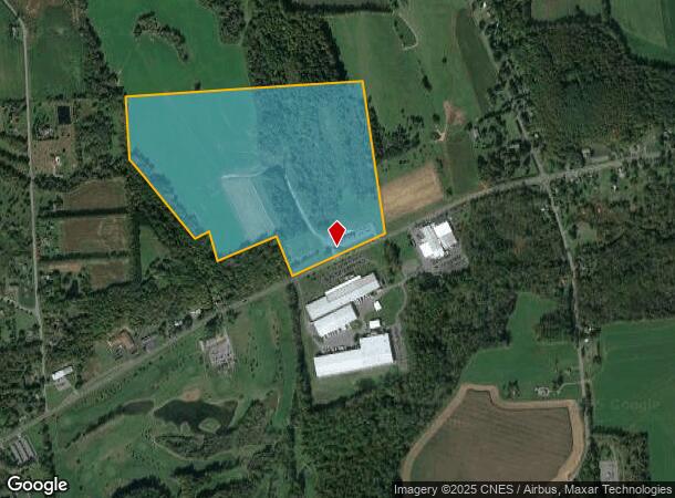
Property Record
441 State Route 5, Weedsport, NY 13166
NEARBY LISTINGS FOR SALE OR LEASE
Property Detail
441 State Route 5
312889-040-000-0002-001-000-0000
FLS 81 & 82 0390214
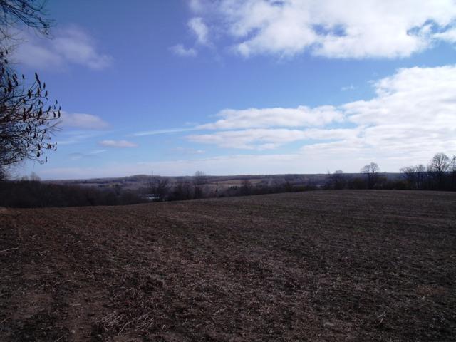
Restaurantbuilding
Onondaga
X
New York
36067C0163F
14.001
2024
5.53 AC
2023
W Outer Onondaga County
040400
Syracuse
5,436 SF
Syracuse, NY
DEMOGRAPHICS near 441 State Route 5
1 Mile
3 Mile
5 Mile
2024 Total Population
289
5,517
11,053
2029 Population
277
5,367
10,779
Pop Growth 2024-2029
(4.15%)
(2.72%)
(2.48%)
Average Age
46
45
45
2024 Total Households
127
2,360
4,568
HH Growth 2024-2029
(4.72%)
(2.97%)
(2.69%)
Median Household Inc
$59,999
$64,036
$67,534
Avg Household Size
2.30
2.30
2.30
2024 Avg HH Vehicles
2.00
2.00
2.00
Median Home Value
$197,142
$162,641
$166,486
Median Year Built
1967
1970
1969
Nearby Places
- Restaurants
- Banks
- Shops
- Fitness
- Groceries
PUBLIC TRANSPORTATION
AIRPORT
Syracuse Hancock International
DRIVE
WALK
Distance
Syracuse Hancock International
33 min
23.9 mi
Freight Ports
Albany, NY Port
DRIVE
WALK
Distance
Albany, NY Port
197 min
163.3 mi
Nearby Properties
Address
Land Use
TOTAL SIZE
Lot Size
Zoning
Address
Land Use
TOTAL SIZE
Lot Size
Zoning
305,558 SF
28.34 AC
9
Address
Land Use
TOTAL SIZE
Lot Size
Zoning
430,685 SF
152.45 AC
IRO
Address
Land Use
TOTAL SIZE
Lot Size
Zoning
107,558 SF
57.12 AC
08 - GOVER
Address
Land Use
TOTAL SIZE
Lot Size
Zoning
185,026 SF
16.72 AC
9
Address
Land Use
TOTAL SIZE
Lot Size
Zoning
Address
Land Use
TOTAL SIZE
Lot Size
Zoning
52,922 SF
16.06 AC
07 - MIXED
Address
Land Use
TOTAL SIZE
Lot Size
Zoning
97,390 SF
31.92 AC
9
Address
Land Use
TOTAL SIZE
Lot Size
Zoning
Address
Land Use
TOTAL SIZE
Lot Size
Zoning
Address
Land Use
TOTAL SIZE
Lot Size
Zoning
60,794 SF
39.61 AC
02 - SINGL
Address
Land Use
TOTAL SIZE
Lot Size
Zoning
10.90 AC
08 - GOVER
Address
Land Use
TOTAL SIZE
Lot Size
Zoning
10.90 AC
08 - GOVER
Address
Land Use
TOTAL SIZE
Lot Size
Zoning
5,740 SF
2.36 AC
05 - COMME
Address
Land Use
TOTAL SIZE
Lot Size
Zoning
93.44 AC
08 - GOVER
Address
Land Use
TOTAL SIZE
Lot Size
Zoning
924 SF
11.39 AC
05 - COMME
Address
Land Use
TOTAL SIZE
Lot Size
Zoning
Address
Land Use
TOTAL SIZE
Lot Size
Zoning
35.03 AC
06 - INDUS
Address
Land Use
TOTAL SIZE
Lot Size
Zoning
5,440 SF
10.45 AC
06 - INDUS
Address
Land Use
TOTAL SIZE
Lot Size
Zoning
3,960 SF
21.70 AC
14
Address
Land Use
TOTAL SIZE
Lot Size
Zoning
12,810 SF
8.32 AC
06 - INDUS
Address
Land Use
TOTAL SIZE
Lot Size
Zoning
39.18 AC
08 - GOVER
Address
Land Use
TOTAL SIZE
Lot Size
Zoning
31.64 AC
08 - GOVER
Address
Land Use
TOTAL SIZE
Lot Size
Zoning
4,668 SF
157.53 AC
04 - FARM
Address
Land Use
TOTAL SIZE
Lot Size
Zoning
21,622 SF
5 AC
05 - COMME
Address
Land Use
TOTAL SIZE
Lot Size
Zoning
17,600 SF
65 AC
C
Address
Land Use
TOTAL SIZE
Lot Size
Zoning
10,976 SF
2.14 AC
05 - COMME
Address
Land Use
TOTAL SIZE
Lot Size
Zoning
Address
Land Use
TOTAL SIZE
Lot Size
Zoning
Address
Land Use
TOTAL SIZE
Lot Size
Zoning
11,295 SF
4.46 AC
04 - FARM
Address
Land Use
TOTAL SIZE
Lot Size
Zoning
02 - SINGL
The World's #1 Commercial Real Estate Marketplace
Connect with us
© 2025 CoStar Group
The information above has been obtained from sources believed reliable. While we do not doubt its accuracy we have not verified it and make no guarantee, warranty or representation about it. It is your responsibility to independently confirm its accuracy and completeness. Any projections, opinions, assumptions, or estimates used are for example only and do not represent the current or future performance of the property. The value of this transaction to you depends on tax and other factors which should be evaluated by your tax, financial, and legal advisors. You and your advisors should conduct a careful, independent investigation of the property to determine to your satisfaction the suitability of the property for your needs.