Property Record
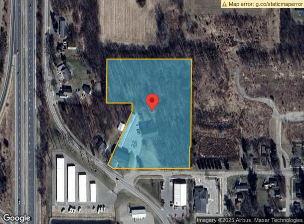
4425 Hull Rd, Leslie, MI 49251
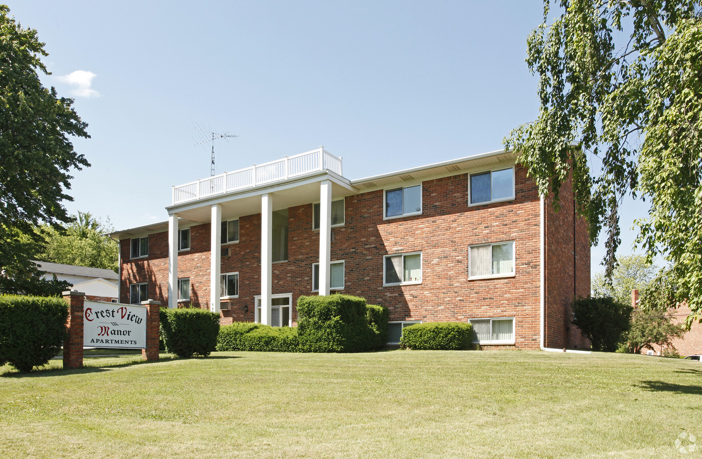
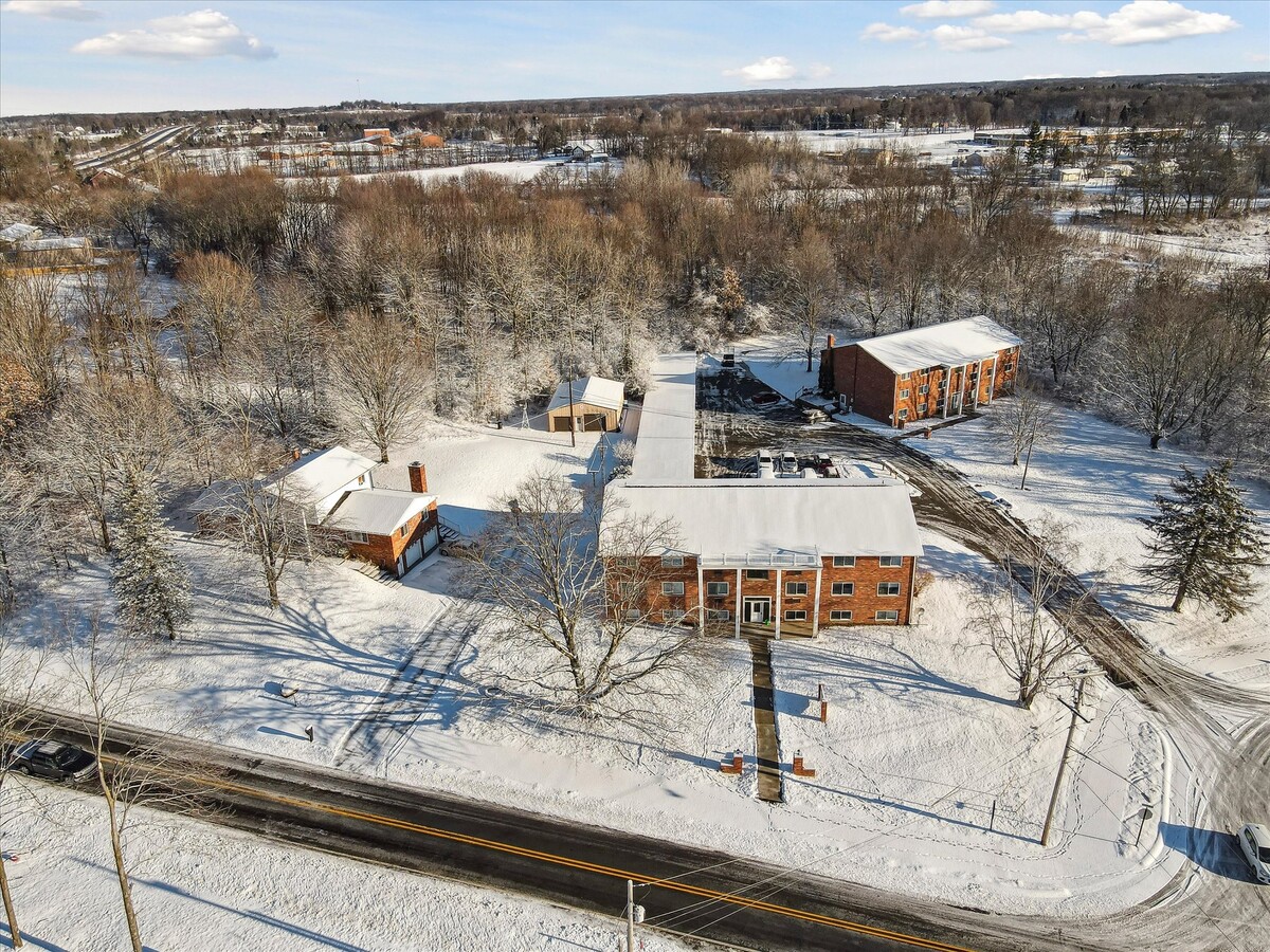

This Property Is For Sale
NEARBY LISTINGS FOR SALE OR LEASE
-
-
View all Leslie listings for sale on LoopNet.com
Property Detail
4425 Hull Rd
Lansing-East Lansing, MI
Potters Add
17-14-21-351-018
COM AT THE SW COR OF SEC 21; TH N 00 DEG 14' 20 W 1327.04 FT ALG W LINE OF SEC 21; TH S89 DEG 56' 25" E 352 FT ALG N LINE OF
Multifamilydwelling
Ingham
X
Michigan
26065C0375D
28
2023
6.38 AC
2024
Outer Ingham County
0061004008
West Michigan
12,096 SF
DEMOGRAPHICS near 4425 Hull Rd
1 Mile
3 Mile
5 Mile
2024 Total Population
2,039
3,623
7,949
2029 Population
2,007
3,572
7,820
Pop Growth 2024-2029
(1.57%)
(1.41%)
(1.62%)
Average Age
39
40
41
2024 Total Households
805
1,412
3,031
HH Growth 2024-2029
(1.74%)
(1.56%)
(1.72%)
Median Household Inc
$69,934
$76,509
$78,333
Avg Household Size
2.50
2.50
2.60
2024 Avg HH Vehicles
2.00
2.00
2.00
Median Home Value
$138,269
$154,975
$176,983
Median Year Built
1961
1969
1974
Nearby Places
- Restaurants
- Banks
- Shops
- Fitness
- Groceries
PUBLIC TRANSPORTATION
AIRPORT
Capital Region International
DRIVE
WALK
Distance
Capital Region International
35 min
27.5 mi
Freight Ports
Port of Toledo
DRIVE
WALK
Distance
Port of Toledo
121 min
92.9 mi
Nearby Properties
Address
Land Use
TOTAL SIZE
Lot Size
Zoning
Address
Land Use
TOTAL SIZE
Lot Size
Zoning
116,428 SF
11.59 AC
M1 IND
Address
Land Use
TOTAL SIZE
Lot Size
Zoning
27,365 SF
4.76 AC
B2 HWY
Address
Land Use
TOTAL SIZE
Lot Size
Zoning
5,183 SF
2.55 AC
B2 HWY
Address
Land Use
TOTAL SIZE
Lot Size
Zoning
27,365 SF
5.43 AC
B2 HWY
Address
Land Use
TOTAL SIZE
Lot Size
Zoning
667 AC
RC
Address
Land Use
TOTAL SIZE
Lot Size
Zoning
318.56 AC
Address
Land Use
TOTAL SIZE
Lot Size
Zoning
5,183 SF
1.98 AC
R1A LO
Address
Land Use
TOTAL SIZE
Lot Size
Zoning
445.28 AC
RC
Address
Land Use
TOTAL SIZE
Lot Size
Zoning
6,880 SF
4.77 AC
RM1 MUL
Address
Land Use
TOTAL SIZE
Lot Size
Zoning
21.20 AC
RM1 MUL
Address
Land Use
TOTAL SIZE
Lot Size
Zoning
17,328 SF
2.74 AC
RM1 MUL
Address
Land Use
TOTAL SIZE
Lot Size
Zoning
8,000 SF
3.80 AC
B2 HWY
Address
Land Use
TOTAL SIZE
Lot Size
Zoning
12,000 SF
3 AC
M1 IND
Address
Land Use
TOTAL SIZE
Lot Size
Zoning
155.04 AC
A1
Address
Land Use
TOTAL SIZE
Lot Size
Zoning
26,480 SF
3.59 AC
M1 IND
Address
Land Use
TOTAL SIZE
Lot Size
Zoning
6,022 SF
0.42 AC
B1 GEN
Address
Land Use
TOTAL SIZE
Lot Size
Zoning
181.50 AC
A-1
Address
Land Use
TOTAL SIZE
Lot Size
Zoning
9,600 SF
4.29 AC
B2 HWY
Address
Land Use
TOTAL SIZE
Lot Size
Zoning
135.57 AC
Address
Land Use
TOTAL SIZE
Lot Size
Zoning
8,220 SF
2.45 AC
M1 IND
Address
Land Use
TOTAL SIZE
Lot Size
Zoning
160 AC
Address
Land Use
TOTAL SIZE
Lot Size
Zoning
20,000 SF
5.71 AC
M1 IND
Address
Land Use
TOTAL SIZE
Lot Size
Zoning
9,600 SF
1.21 AC
B2 HWY
Address
Land Use
TOTAL SIZE
Lot Size
Zoning
3,218 SF
1.64 AC
B2 HWY
Address
Land Use
TOTAL SIZE
Lot Size
Zoning
Address
Land Use
TOTAL SIZE
Lot Size
Zoning
25,213 SF
4.85 AC
COM
Address
Land Use
TOTAL SIZE
Lot Size
Zoning
124.95 AC
A-1
Address
Land Use
TOTAL SIZE
Lot Size
Zoning
124 AC
A-1
Address
Land Use
TOTAL SIZE
Lot Size
Zoning
126 AC
A-1
The World's #1 Commercial Real Estate Marketplace
Connect with us
© 2025 CoStar Group
The information above has been obtained from sources believed reliable. While we do not doubt its accuracy we have not verified it and make no guarantee, warranty or representation about it. It is your responsibility to independently confirm its accuracy and completeness. Any projections, opinions, assumptions, or estimates used are for example only and do not represent the current or future performance of the property. The value of this transaction to you depends on tax and other factors which should be evaluated by your tax, financial, and legal advisors. You and your advisors should conduct a careful, independent investigation of the property to determine to your satisfaction the suitability of the property for your needs.