Property Record
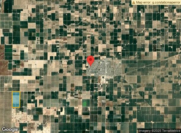
442 S Siskiyou Ave, Kerman, CA 93630

NEARBY LISTINGS FOR SALE OR LEASE
Property Detail
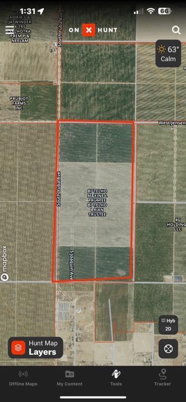
442 S Siskiyou Ave
020-030-35S
SUR RTS 312.39 AC W1/2 SEC 19 T14R17
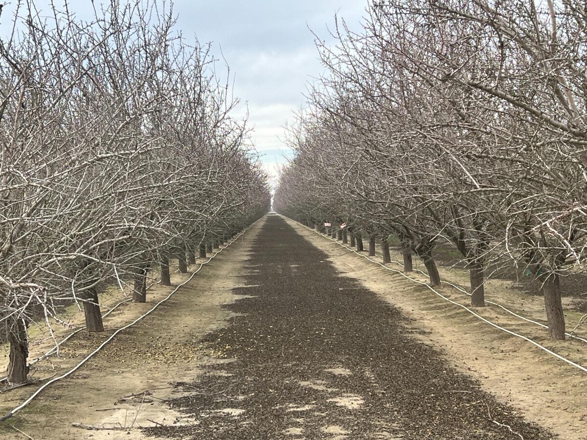
Orchard
Fresno
X
California
06019C2050H
312.39 AC
2023
W Outlying Fresno County
2023
Fresno
004004
Fresno, CA
DEMOGRAPHICS near 442 S Siskiyou Ave
1 Mile
3 Mile
5 Mile
2024 Total Population
54
739
2,246
2029 Population
52
711
2,187
Pop Growth 2024-2029
(3.70%)
(3.79%)
(2.63%)
Average Age
35
35
34
2024 Total Households
13
176
588
HH Growth 2024-2029
(7.69%)
(3.98%)
(2.89%)
Median Household Inc
$133,333
$99,582
$98,086
Avg Household Size
3.80
3.70
3.60
2024 Avg HH Vehicles
3.00
3.00
3.00
Median Home Value
$625,000
$397,367
$370,901
Median Year Built
1997
1995
2000
Nearby Places
- Restaurants
- Banks
- Shops
- Fitness
- Groceries
PUBLIC TRANSPORTATION
AIRPORT
Fresno Yosemite International
DRIVE
WALK
Distance
Fresno Yosemite International
31 min
22.0 mi
Freight Ports
Port of Stockton
DRIVE
WALK
Distance
Port of Stockton
151 min
122.6 mi
SALE & LEASE HISTORY
LISTING DATE
SALE/LEASE

Dec 29, 2023
For Sale
Nearby Properties
Address
Land Use
TOTAL SIZE
Lot Size
Zoning
Address
Land Use
TOTAL SIZE
Lot Size
Zoning
477,340 SF
21.45 AC
Address
Land Use
TOTAL SIZE
Lot Size
Zoning
151,227 SF
17.22 AC
C6
Address
Land Use
TOTAL SIZE
Lot Size
Zoning
29,746 SF
39.10 AC
AE20
Address
Land Use
TOTAL SIZE
Lot Size
Zoning
65,017 SF
4.38 AC
R2
Address
Land Use
TOTAL SIZE
Lot Size
Zoning
63,187 SF
3.90 AC
R3
Address
Land Use
TOTAL SIZE
Lot Size
Zoning
63,187 SF
3.87 AC
R3
Address
Land Use
TOTAL SIZE
Lot Size
Zoning
92,979 SF
5.73 AC
R1
Address
Land Use
TOTAL SIZE
Lot Size
Zoning
82,656 SF
6.76 AC
R2
Address
Land Use
TOTAL SIZE
Lot Size
Zoning
90,082 SF
9.12 AC
C2
Address
Land Use
TOTAL SIZE
Lot Size
Zoning
70,786 SF
5.46 AC
SDR2
Address
Land Use
TOTAL SIZE
Lot Size
Zoning
28.36 AC
M2
Address
Land Use
TOTAL SIZE
Lot Size
Zoning
69,820 SF
19.72 AC
Address
Land Use
TOTAL SIZE
Lot Size
Zoning
16,834 SF
0.96 AC
CG
Address
Land Use
TOTAL SIZE
Lot Size
Zoning
1,154 SF
91.23 AC
AE20
Address
Land Use
TOTAL SIZE
Lot Size
Zoning
18,340 SF
1.21 AC
CG
Address
Land Use
TOTAL SIZE
Lot Size
Zoning
179.07 AC
AE20
Address
Land Use
TOTAL SIZE
Lot Size
Zoning
62,637 SF
13.62 AC
M1
Address
Land Use
TOTAL SIZE
Lot Size
Zoning
50,000 SF
12.52 AC
M2
Address
Land Use
TOTAL SIZE
Lot Size
Zoning
13,225 SF
1.67 AC
C5
Address
Land Use
TOTAL SIZE
Lot Size
Zoning
166,410 SF
9.80 AC
M2
Address
Land Use
TOTAL SIZE
Lot Size
Zoning
35,160 SF
3.45 AC
RM
Address
Land Use
TOTAL SIZE
Lot Size
Zoning
1,189 SF
29.71 AC
AE20
Address
Land Use
TOTAL SIZE
Lot Size
Zoning
99.62 AC
Address
Land Use
TOTAL SIZE
Lot Size
Zoning
31,484 SF
3.03 AC
R2
Address
Land Use
TOTAL SIZE
Lot Size
Zoning
1.02 AC
C5
Address
Land Use
TOTAL SIZE
Lot Size
Zoning
4,416 SF
80 AC
AE20
Address
Land Use
TOTAL SIZE
Lot Size
Zoning
10,186 SF
8.19 AC
R1
Address
Land Use
TOTAL SIZE
Lot Size
Zoning
14,375 SF
19.72 AC
AE20
Address
Land Use
TOTAL SIZE
Lot Size
Zoning
22,075 SF
2.46 AC
R3
The World's #1 Commercial Real Estate Marketplace
Connect with us
© 2025 CoStar Group
The information above has been obtained from sources believed reliable. While we do not doubt its accuracy we have not verified it and make no guarantee, warranty or representation about it. It is your responsibility to independently confirm its accuracy and completeness. Any projections, opinions, assumptions, or estimates used are for example only and do not represent the current or future performance of the property. The value of this transaction to you depends on tax and other factors which should be evaluated by your tax, financial, and legal advisors. You and your advisors should conduct a careful, independent investigation of the property to determine to your satisfaction the suitability of the property for your needs.