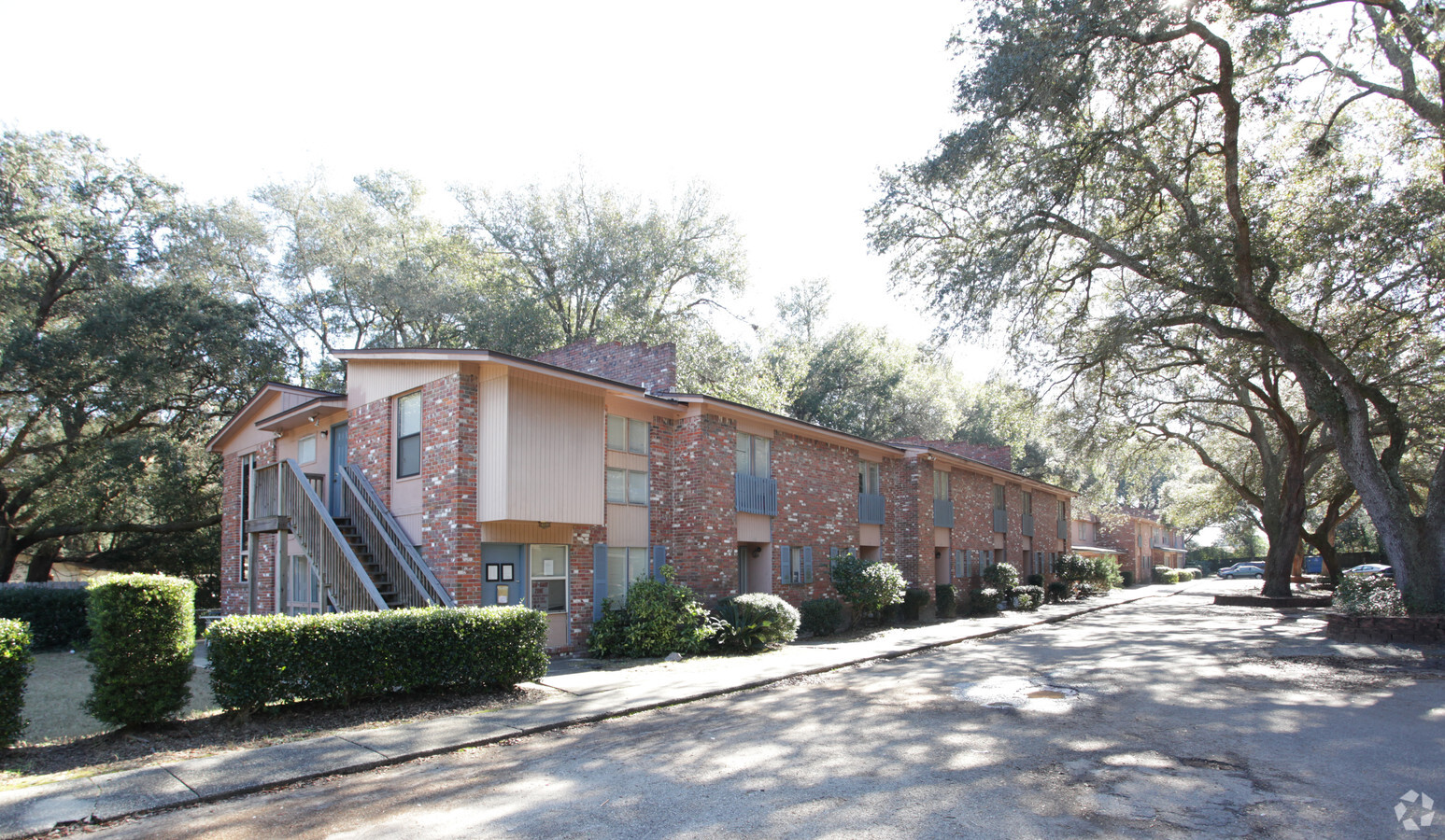
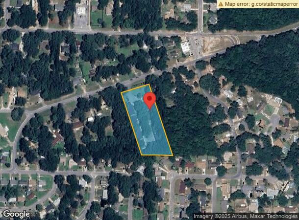
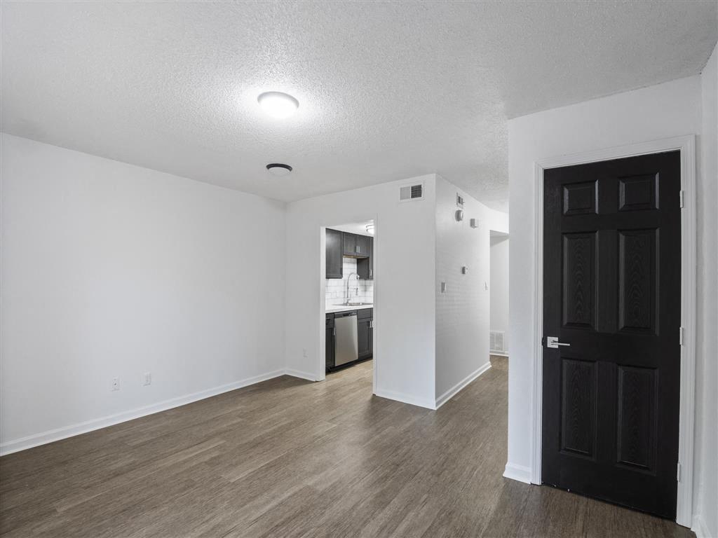
Property Record
4435 Marlane Dr, Pensacola, FL 32526
NEARBY LISTINGS FOR SALE OR LEASE
Property Detail
4435 Marlane Dr
Pensacola-Ferry Pass-Brent, FL
Cerny Heights
01-2S-31-6000-001-036
LTS 36 & 37 CERNY HEIGHTS PB 2 P 4 OR 8365 P 1876
Multifamilydwelling
Escambia
X
Florida
12033C0360G
1
2023
2.33 AC
2024
West Pensacola
003307
Pensacola
37,525 SF
DEMOGRAPHICS near 4435 Marlane Dr
1 Mile
3 Mile
5 Mile
2024 Total Population
7,409
55,676
121,703
2029 Population
7,473
56,386
124,406
Pop Growth 2024-2029
+ 0.86%
+ 1.28%
+ 2.22%
Average Age
39
39
38
2024 Total Households
2,861
21,760
45,989
HH Growth 2024-2029
+ 0.94%
+ 1.21%
+ 2.24%
Median Household Inc
$51,010
$48,759
$43,277
Avg Household Size
2.50
2.50
2.40
2024 Avg HH Vehicles
2.00
2.00
2.00
Median Home Value
$132,679
$138,590
$142,844
Median Year Built
1975
1977
1976
Nearby Places
- Restaurants
- Banks
- Shops
- Fitness
- Groceries
PUBLIC TRANSPORTATION
AIRPORT
Pensacola International
DRIVE
WALK
Distance
Pensacola International
19 min
8.9 mi
Freight Ports
Port of Mobile
DRIVE
WALK
Distance
Port of Mobile
64 min
53.6 mi
Nearby Properties
Address
Land Use
TOTAL SIZE
Lot Size
Zoning
Address
Land Use
TOTAL SIZE
Lot Size
Zoning
1,350,030 SF
80 AC
REC
Address
Land Use
TOTAL SIZE
Lot Size
Zoning
250,232 SF
19.24 AC
HDR
Address
Land Use
TOTAL SIZE
Lot Size
Zoning
178,038 SF
11.03 AC
COM
Address
Land Use
TOTAL SIZE
Lot Size
Zoning
141,728 SF
8.59 AC
COM
Address
Land Use
TOTAL SIZE
Lot Size
Zoning
158,233 SF
9.15 AC
HDMU
Address
Land Use
TOTAL SIZE
Lot Size
Zoning
83,923 SF
6.70 AC
HC/LI
Address
Land Use
TOTAL SIZE
Lot Size
Zoning
129,518 SF
6.44 AC
HDMU
Address
Land Use
TOTAL SIZE
Lot Size
Zoning
116,020 SF
4.71 AC
MDR
Address
Land Use
TOTAL SIZE
Lot Size
Zoning
197,958 SF
26.08 AC
COM
Address
Land Use
TOTAL SIZE
Lot Size
Zoning
129,532 SF
10.84 AC
COM
Address
Land Use
TOTAL SIZE
Lot Size
Zoning
103,671 SF
13.96 AC
HDMU
Address
Land Use
TOTAL SIZE
Lot Size
Zoning
138,048 SF
22.64 AC
HC/LI
Address
Land Use
TOTAL SIZE
Lot Size
Zoning
124,146 SF
5.79 AC
HDMU
Address
Land Use
TOTAL SIZE
Lot Size
Zoning
223,987 SF
36.60 AC
MDR
Address
Land Use
TOTAL SIZE
Lot Size
Zoning
371,425 SF
24.78 AC
HC/LI
Address
Land Use
TOTAL SIZE
Lot Size
Zoning
81,874 SF
7.09 AC
HDMU
Address
Land Use
TOTAL SIZE
Lot Size
Zoning
64,870 SF
5.35 AC
HDMU
Address
Land Use
TOTAL SIZE
Lot Size
Zoning
3,926 SF
57.46 AC
HDMU
Address
Land Use
TOTAL SIZE
Lot Size
Zoning
84,005 SF
7.93 AC
COM
Address
Land Use
TOTAL SIZE
Lot Size
Zoning
65,355 SF
6.27 AC
COM
Address
Land Use
TOTAL SIZE
Lot Size
Zoning
105,225 SF
2.72 AC
HC/LI
Address
Land Use
TOTAL SIZE
Lot Size
Zoning
163,774 SF
28.55 AC
HDR
Address
Land Use
TOTAL SIZE
Lot Size
Zoning
98,372 SF
16.95 AC
COM
Address
Land Use
TOTAL SIZE
Lot Size
Zoning
57,501 SF
7.47 AC
HDR
Address
Land Use
TOTAL SIZE
Lot Size
Zoning
46,512 SF
3.99 AC
HDMU
Address
Land Use
TOTAL SIZE
Lot Size
Zoning
54,312 SF
6.32 AC
HDMU
Address
Land Use
TOTAL SIZE
Lot Size
Zoning
48,922 SF
3.25 AC
COM
Address
Land Use
TOTAL SIZE
Lot Size
Zoning
78,951 SF
3.50 AC
COM
Address
Land Use
TOTAL SIZE
Lot Size
Zoning
80,600 SF
0.83 AC
HC/LI
Address
Land Use
TOTAL SIZE
Lot Size
Zoning
51,259 SF
6.46 AC
COM
The World's #1 Commercial Real Estate Marketplace
Connect with us
© 2025 CoStar Group
The information above has been obtained from sources believed reliable. While we do not doubt its accuracy we have not verified it and make no guarantee, warranty or representation about it. It is your responsibility to independently confirm its accuracy and completeness. Any projections, opinions, assumptions, or estimates used are for example only and do not represent the current or future performance of the property. The value of this transaction to you depends on tax and other factors which should be evaluated by your tax, financial, and legal advisors. You and your advisors should conduct a careful, independent investigation of the property to determine to your satisfaction the suitability of the property for your needs.