Property Record
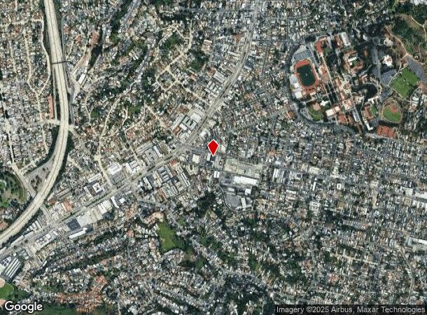
4442 York Blvd, Los Angeles, CA 90041


NEARBY LISTINGS FOR SALE OR LEASE
Property Detail
4442 York Blvd
Los Angeles-Long Beach-Glendale, CA
3631
5474-020-011
TRACT NO 3631 SE 70 FT OF NE 130 FT OF LOT/SEC 136
Autorepair
Los Angeles
X
California
06037C1626F
136
2024
0.21 AC
2024
Glendale
186201
Los Angeles
808 SF
DEMOGRAPHICS near 4442 York Blvd
1 Mile
3 Mile
5 Mile
2024 Total Population
28,255
249,305
616,411
2029 Population
27,282
240,588
596,106
Pop Growth 2024-2029
(3.44%)
(3.50%)
(3.29%)
Average Age
41
41
41
2024 Total Households
9,984
93,455
236,192
HH Growth 2024-2029
(3.75%)
(3.75%)
(3.52%)
Median Household Inc
$99,723
$82,345
$81,335
Avg Household Size
2.60
2.60
2.50
2024 Avg HH Vehicles
2.00
2.00
2.00
Median Home Value
$868,527
$888,882
$937,140
Median Year Built
1953
1957
1958
Nearby Places
- Restaurants
- Banks
- Shops
- Fitness
- Groceries
PUBLIC TRANSPORTATION
COMMUTER RAIL
Glendale (Antelope Valley Line - Southern California Regional Rail Authority (Metrolink), Ventura County Line - Southern California Regional Rail Authority (Metrolink))
DRIVE
WALK
Distance
Glendale (Antelope Valley Line - Southern California Regional Rail Authority (Metrolink), Ventura County Line - Southern California Regional Rail Authority (Metrolink))
5 min
3.0 mi
Union Station (91 Line - Southern California Regional Rail Authority (Metrolink), Antelope Valley Line - Southern California Regional Rail Authority (Metrolink), Orange County Line - Southern California Regional Rail Authority (Metrolink), Riverside Line - Southern California Regional Rail Authority (Metrolink), San Bernardino Line - Southern California Regional Rail Authority (Metrolink), Ventura County Line - Southern California Regional Rail Authority (Metrolink))
DRIVE
WALK
Distance
Union Station (91 Line - Southern California Regional Rail Authority (Metrolink), Antelope Valley Line - Southern California Regional Rail Authority (Metrolink), Orange County Line - Southern California Regional Rail Authority (Metrolink), Riverside Line - Southern California Regional Rail Authority (Metrolink), San Bernardino Line - Southern California Regional Rail Authority (Metrolink), Ventura County Line - Southern California Regional Rail Authority (Metrolink))
13 min
6.2 mi
AIRPORT
Bob Hope
DRIVE
WALK
Distance
Bob Hope
20 min
13.8 mi
Los Angeles International
DRIVE
WALK
Distance
Los Angeles International
34 min
21.2 mi
Long Beach (Daugherty Field)
DRIVE
WALK
Distance
Long Beach (Daugherty Field)
39 min
27.8 mi
Freight Ports
Port of Long Beach
DRIVE
WALK
Distance
Port of Long Beach
41 min
30.6 mi
SALE & LEASE HISTORY
LISTING DATE
SALE/LEASE

May 10, 2024
For Lease
Jan 10, 2024
For Lease
Nearby Properties
Address
Land Use
TOTAL SIZE
Lot Size
Zoning
Address
Land Use
TOTAL SIZE
Lot Size
Zoning
272,288 SF
24.26 AC
GLC3-C2-R4
Address
Land Use
TOTAL SIZE
Lot Size
Zoning
590,292 SF
8.21 AC
GLC3*
Address
Land Use
TOTAL SIZE
Lot Size
Zoning
477,885 SF
2.52 AC
GLC3*
Address
Land Use
TOTAL SIZE
Lot Size
Zoning
251,317 SF
114.56 AC
LAR1
Address
Land Use
TOTAL SIZE
Lot Size
Zoning
985,517 SF
4.08 AC
GLC3
Address
Land Use
TOTAL SIZE
Lot Size
Zoning
349,519 SF
2.16 AC
GLM1*
Address
Land Use
TOTAL SIZE
Lot Size
Zoning
317,292 SF
36.67 AC
LAM3
Address
Land Use
TOTAL SIZE
Lot Size
Zoning
245,031 SF
2.21 AC
GLM2
Address
Land Use
TOTAL SIZE
Lot Size
Zoning
457,694 SF
1.42 AC
GLC3*
Address
Land Use
TOTAL SIZE
Lot Size
Zoning
122,988 SF
3.32 AC
GLC3*
Address
Land Use
TOTAL SIZE
Lot Size
Zoning
766,497 SF
2.10 AC
GLC2*
Address
Land Use
TOTAL SIZE
Lot Size
Zoning
220,624 SF
1.50 AC
GLC3-C2*
Address
Land Use
TOTAL SIZE
Lot Size
Zoning
638,414 SF
2.52 AC
GLC3-C2*
Address
Land Use
TOTAL SIZE
Lot Size
Zoning
214,087 SF
1.65 AC
GLC3*
Address
Land Use
TOTAL SIZE
Lot Size
Zoning
189,663 SF
1.36 AC
GLC2*
Address
Land Use
TOTAL SIZE
Lot Size
Zoning
212,943 SF
1.41 AC
GLC3-R4*
Address
Land Use
TOTAL SIZE
Lot Size
Zoning
302,119 SF
1.41 AC
GLC2
Address
Land Use
TOTAL SIZE
Lot Size
Zoning
154,216 SF
0.81 AC
GLC3*
Address
Land Use
TOTAL SIZE
Lot Size
Zoning
178,932 SF
0.88 AC
GLC3*
Address
Land Use
TOTAL SIZE
Lot Size
Zoning
1,119,154 SF
LAC4
Address
Land Use
TOTAL SIZE
Lot Size
Zoning
58,941 SF
1.35 AC
GLC3*
Address
Land Use
TOTAL SIZE
Lot Size
Zoning
145,740 SF
0.76 AC
GLC3YY
Address
Land Use
TOTAL SIZE
Lot Size
Zoning
222,940 SF
2.48 AC
LAC2
Address
Land Use
TOTAL SIZE
Lot Size
Zoning
329,802 SF
1.05 AC
GLC3*
Address
Land Use
TOTAL SIZE
Lot Size
Zoning
81,932 SF
0.70 AC
GLC3*
Address
Land Use
TOTAL SIZE
Lot Size
Zoning
314,760 SF
3.77 AC
GLC3
Address
Land Use
TOTAL SIZE
Lot Size
Zoning
109,912 SF
0.42 AC
GLC3*
Address
Land Use
TOTAL SIZE
Lot Size
Zoning
174,561 SF
1.07 AC
GLC3*
Address
Land Use
TOTAL SIZE
Lot Size
Zoning
119,455 SF
5.04 AC
LACM
Address
Land Use
TOTAL SIZE
Lot Size
Zoning
93,090 SF
5.27 AC
GLM2*
The World's #1 Commercial Real Estate Marketplace
Connect with us
© 2025 CoStar Group
The information above has been obtained from sources believed reliable. While we do not doubt its accuracy we have not verified it and make no guarantee, warranty or representation about it. It is your responsibility to independently confirm its accuracy and completeness. Any projections, opinions, assumptions, or estimates used are for example only and do not represent the current or future performance of the property. The value of this transaction to you depends on tax and other factors which should be evaluated by your tax, financial, and legal advisors. You and your advisors should conduct a careful, independent investigation of the property to determine to your satisfaction the suitability of the property for your needs.