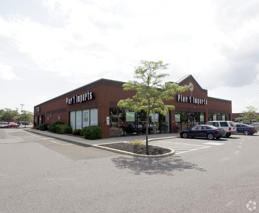
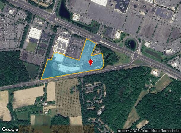
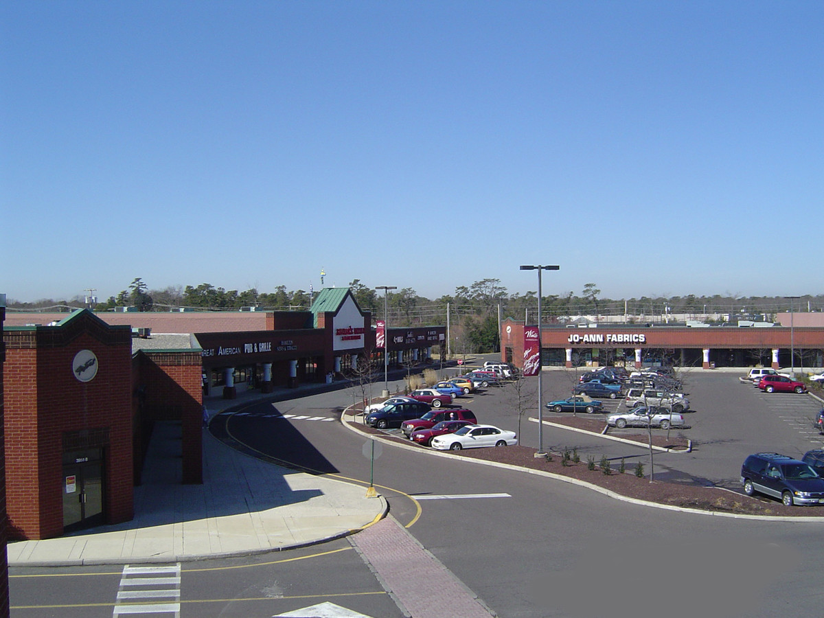
Property Record
4450 Black Horse Pike, Mays Landing, NJ 08330
NEARBY LISTINGS FOR SALE OR LEASE
-
-
View all Mays Landing listings for lease on LoopNet.com
Property Detail
4450 Black Horse Pike
Atlantic City-Hammonton, NJ
ALSO LOTS 17.02 17.03 & 17.04
12-01134-0000-00017-01
Atlantic
Regionalshoppingcenterormallwithanchorstore
New Jersey
X
17.1
34001C0285F
10.83 AC
2024
Atlantic City/Hammonton
2024
Philadelphia
011404
DEMOGRAPHICS near 4450 Black Horse Pike
1 Mile
3 Mile
5 Mile
2024 Total Population
5,145
20,551
45,607
2029 Population
5,082
20,191
44,695
Pop Growth 2024-2029
(1.22%)
(1.75%)
(2.00%)
Average Age
36
39
40
2024 Total Households
2,181
7,331
16,048
HH Growth 2024-2029
(1.83%)
(2.35%)
(2.67%)
Median Household Inc
$54,697
$75,878
$76,689
Avg Household Size
2.40
2.70
2.70
2024 Avg HH Vehicles
2.00
2.00
2.00
Median Home Value
$184,713
$229,923
$233,167
Median Year Built
1986
1994
1989
Nearby Places
- Restaurants
- Banks
- Shops
- Fitness
- Groceries
PUBLIC TRANSPORTATION
COMMUTER RAIL
Egg Harbor City (Atlantic City Line - NJ Transit Commuter Rail (NJ Transit))
DRIVE
WALK
Distance
Egg Harbor City (Atlantic City Line - NJ Transit Commuter Rail (NJ Transit))
13 min
8.8 mi
AIRPORT
Atlantic City International
DRIVE
WALK
Distance
Atlantic City International
30 min
7.7 mi
Freight Ports
Broadway Terminal - Pier 5
DRIVE
WALK
Distance
Broadway Terminal - Pier 5
57 min
44.9 mi
SALE & LEASE HISTORY
LISTING DATE
SALE/LEASE

Jan 23, 2018
For Lease
Nearby Properties
Address
Land Use
TOTAL SIZE
Lot Size
Zoning
Address
Land Use
TOTAL SIZE
Lot Size
Zoning
75.97 AC
DC
Address
Land Use
TOTAL SIZE
Lot Size
Zoning
52.37 AC
GA-I
Address
Land Use
TOTAL SIZE
Lot Size
Zoning
48.59 AC
IBP
Address
Land Use
TOTAL SIZE
Lot Size
Zoning
43.93 AC
RG1
Address
Land Use
TOTAL SIZE
Lot Size
Zoning
31.46 AC
DC
Address
Land Use
TOTAL SIZE
Lot Size
Zoning
32.32 AC
RG1
Address
Land Use
TOTAL SIZE
Lot Size
Zoning
78.84 AC
GA-M
Address
Land Use
TOTAL SIZE
Lot Size
Zoning
19.70 AC
IBP
Address
Land Use
TOTAL SIZE
Lot Size
Zoning
360 SF
23.28 AC
GA-I
Address
Land Use
TOTAL SIZE
Lot Size
Zoning
53.17 AC
IBP
Address
Land Use
TOTAL SIZE
Lot Size
Zoning
312.70 AC
GA-M
Address
Land Use
TOTAL SIZE
Lot Size
Zoning
28,284 SF
27.87 AC
RG5
Address
Land Use
TOTAL SIZE
Lot Size
Zoning
31.17 AC
GA-M
Address
Land Use
TOTAL SIZE
Lot Size
Zoning
28.50 AC
IBP
Address
Land Use
TOTAL SIZE
Lot Size
Zoning
36.97 AC
DC
Address
Land Use
TOTAL SIZE
Lot Size
Zoning
75,248 SF
20.85 AC
IBP
Address
Land Use
TOTAL SIZE
Lot Size
Zoning
28.75 AC
HB
Address
Land Use
TOTAL SIZE
Lot Size
Zoning
11,572 SF
19.68 AC
DC
Address
Land Use
TOTAL SIZE
Lot Size
Zoning
24.65 AC
PO1
Address
Land Use
TOTAL SIZE
Lot Size
Zoning
45.45 AC
IBP
Address
Land Use
TOTAL SIZE
Lot Size
Zoning
9.25 AC
DC
Address
Land Use
TOTAL SIZE
Lot Size
Zoning
484.98 AC
Address
Land Use
TOTAL SIZE
Lot Size
Zoning
13.50 AC
GA-I
Address
Land Use
TOTAL SIZE
Lot Size
Zoning
16.24 AC
HB
Address
Land Use
TOTAL SIZE
Lot Size
Zoning
10.30 AC
GA-I
Address
Land Use
TOTAL SIZE
Lot Size
Zoning
1,522 SF
4.86 AC
PO1
Address
Land Use
TOTAL SIZE
Lot Size
Zoning
11.60 AC
GA-I
Address
Land Use
TOTAL SIZE
Lot Size
Zoning
0.70 AC
PO1
Address
Land Use
TOTAL SIZE
Lot Size
Zoning
25.80 AC
DC
The World's #1 Commercial Real Estate Marketplace
Connect with us
© 2025 CoStar Group
The information above has been obtained from sources believed reliable. While we do not doubt its accuracy we have not verified it and make no guarantee, warranty or representation about it. It is your responsibility to independently confirm its accuracy and completeness. Any projections, opinions, assumptions, or estimates used are for example only and do not represent the current or future performance of the property. The value of this transaction to you depends on tax and other factors which should be evaluated by your tax, financial, and legal advisors. You and your advisors should conduct a careful, independent investigation of the property to determine to your satisfaction the suitability of the property for your needs.