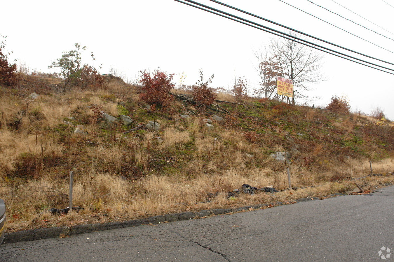
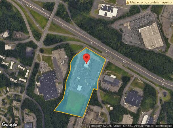
Property Record
450 Captain Neville Dr, Waterbury, CT 06705
NEARBY LISTINGS FOR SALE OR LEASE
Property Detail
450 Captain Neville Dr
WATE-000449-000490-000031
New Haven
Commercialnec
Connecticut
X
31
09009C0136H
18.41 AC
2024
Waterbury
2024
Westchester/So Connecticut
352800
New Haven-Milford, CT
DEMOGRAPHICS near 450 Captain Neville Dr
1 Mile
3 Mile
5 Mile
2024 Total Population
7,353
49,247
151,802
2029 Population
7,329
49,029
151,160
Pop Growth 2024-2029
(0.33%)
(0.44%)
(0.42%)
Average Age
40
40
39
2024 Total Households
3,097
19,332
58,434
HH Growth 2024-2029
(0.39%)
(0.49%)
(0.45%)
Median Household Inc
$66,304
$63,941
$61,867
Avg Household Size
2.30
2.50
2.50
2024 Avg HH Vehicles
2.00
2.00
2.00
Median Home Value
$206,013
$203,903
$222,153
Median Year Built
1972
1964
1962
Nearby Places
- Restaurants
- Banks
- Shops
- Fitness
- Groceries
PUBLIC TRANSPORTATION
COMMUTER RAIL
Waterbury Station (New Haven Line - Metro-North Commuter Railroad Company (Metro-North))
DRIVE
WALK
Distance
Waterbury Station (New Haven Line - Metro-North Commuter Railroad Company (Metro-North))
10 min
5.1 mi
Naugatuck Station (New Haven Line - Metro-North Commuter Railroad Company (Metro-North))
DRIVE
WALK
Distance
Naugatuck Station (New Haven Line - Metro-North Commuter Railroad Company (Metro-North))
15 min
7.8 mi
AIRPORT
Tweed/New Haven
DRIVE
WALK
Distance
Tweed/New Haven
40 min
25.0 mi
Freight Ports
Port of New Haven
DRIVE
WALK
Distance
Port of New Haven
36 min
22.7 mi
SALE & LEASE HISTORY
LISTING DATE
SALE/LEASE

Sep 25, 2016
For Lease
Nearby Properties
Address
Land Use
TOTAL SIZE
Lot Size
Zoning
Address
Land Use
TOTAL SIZE
Lot Size
Zoning
77.50 AC
RS
Address
Land Use
TOTAL SIZE
Lot Size
Zoning
88,350 SF
9.50 AC
RS
Address
Land Use
TOTAL SIZE
Lot Size
Zoning
118,884 SF
13.40 AC
RL
Address
Land Use
TOTAL SIZE
Lot Size
Zoning
97,386 SF
53.20 AC
RS
Address
Land Use
TOTAL SIZE
Lot Size
Zoning
44.31 AC
CA
Address
Land Use
TOTAL SIZE
Lot Size
Zoning
73,961 SF
27.36 AC
I-2
Address
Land Use
TOTAL SIZE
Lot Size
Zoning
5.13 AC
RM
Address
Land Use
TOTAL SIZE
Lot Size
Zoning
12.49 AC
CA
Address
Land Use
TOTAL SIZE
Lot Size
Zoning
18.01 AC
CA
Address
Land Use
TOTAL SIZE
Lot Size
Zoning
31.75 AC
CA
Address
Land Use
TOTAL SIZE
Lot Size
Zoning
10.51 AC
RL
Address
Land Use
TOTAL SIZE
Lot Size
Zoning
22.27 AC
RM
Address
Land Use
TOTAL SIZE
Lot Size
Zoning
20.35 AC
RM
Address
Land Use
TOTAL SIZE
Lot Size
Zoning
25,844 SF
22.20 AC
R-80
Address
Land Use
TOTAL SIZE
Lot Size
Zoning
15.39 AC
RM
Address
Land Use
TOTAL SIZE
Lot Size
Zoning
152,704 SF
17.09 AC
CA
Address
Land Use
TOTAL SIZE
Lot Size
Zoning
81,501 SF
19 AC
R-30
Address
Land Use
TOTAL SIZE
Lot Size
Zoning
5.10 AC
RM
Address
Land Use
TOTAL SIZE
Lot Size
Zoning
115,996 SF
19.57 AC
CA
Address
Land Use
TOTAL SIZE
Lot Size
Zoning
281,623 SF
39.24 AC
I-2
Address
Land Use
TOTAL SIZE
Lot Size
Zoning
13.97 AC
RM
Address
Land Use
TOTAL SIZE
Lot Size
Zoning
154,629 SF
18.76 AC
CA
Address
Land Use
TOTAL SIZE
Lot Size
Zoning
59,531 SF
2.70 AC
CA
Address
Land Use
TOTAL SIZE
Lot Size
Zoning
6.39 AC
RM
Address
Land Use
TOTAL SIZE
Lot Size
Zoning
61,173 SF
3.60 AC
RL
Address
Land Use
TOTAL SIZE
Lot Size
Zoning
90,198 SF
21.32 AC
CA
Address
Land Use
TOTAL SIZE
Lot Size
Zoning
35,200 SF
8.55 AC
B
Address
Land Use
TOTAL SIZE
Lot Size
Zoning
172,891 SF
75 AC
I-2
Address
Land Use
TOTAL SIZE
Lot Size
Zoning
45,768 SF
2.59 AC
RL
Address
Land Use
TOTAL SIZE
Lot Size
Zoning
62,889 SF
10.97 AC
CA
The World's #1 Commercial Real Estate Marketplace
Connect with us
© 2025 CoStar Group
The information above has been obtained from sources believed reliable. While we do not doubt its accuracy we have not verified it and make no guarantee, warranty or representation about it. It is your responsibility to independently confirm its accuracy and completeness. Any projections, opinions, assumptions, or estimates used are for example only and do not represent the current or future performance of the property. The value of this transaction to you depends on tax and other factors which should be evaluated by your tax, financial, and legal advisors. You and your advisors should conduct a careful, independent investigation of the property to determine to your satisfaction the suitability of the property for your needs.