Property Record
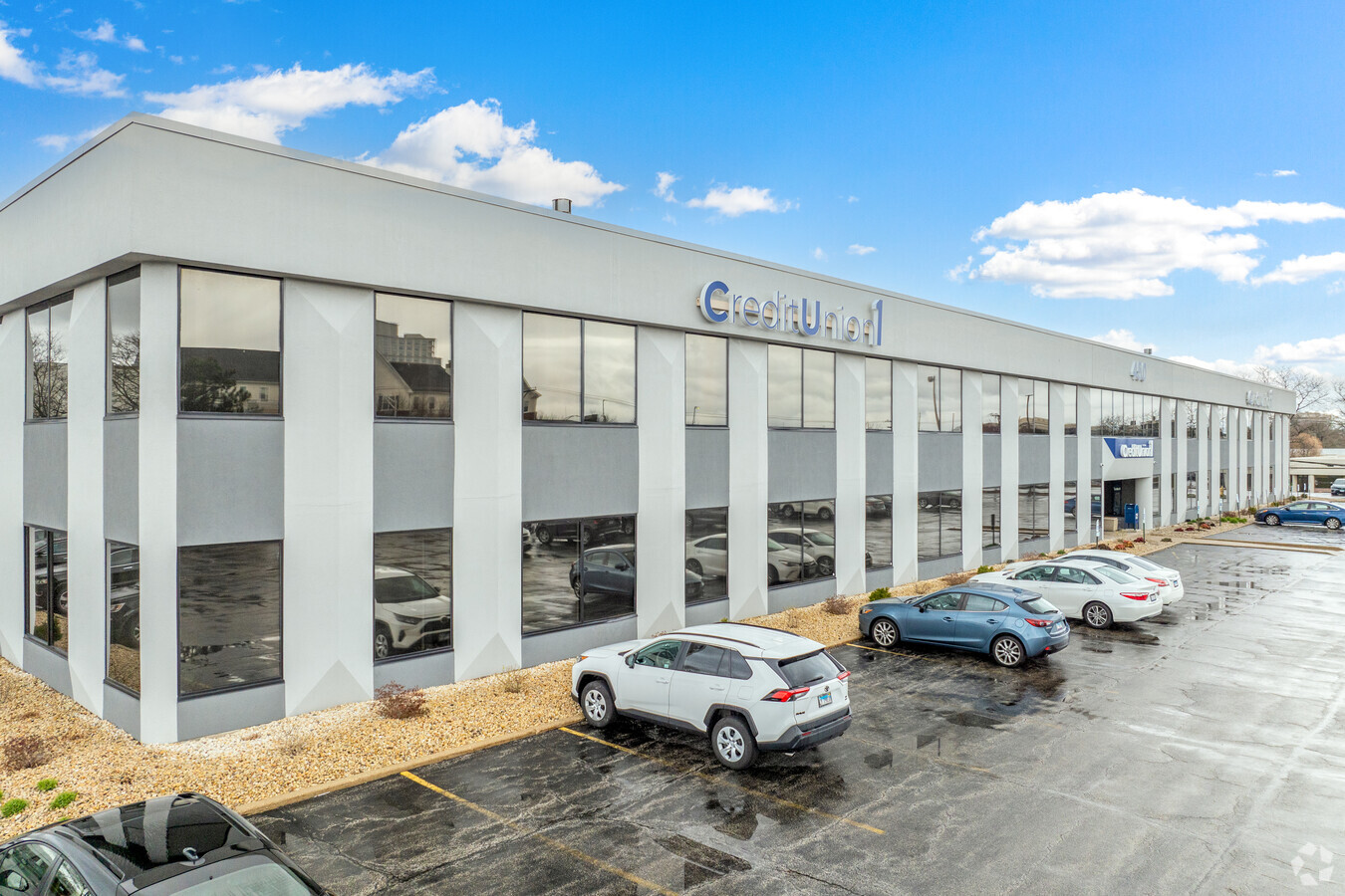
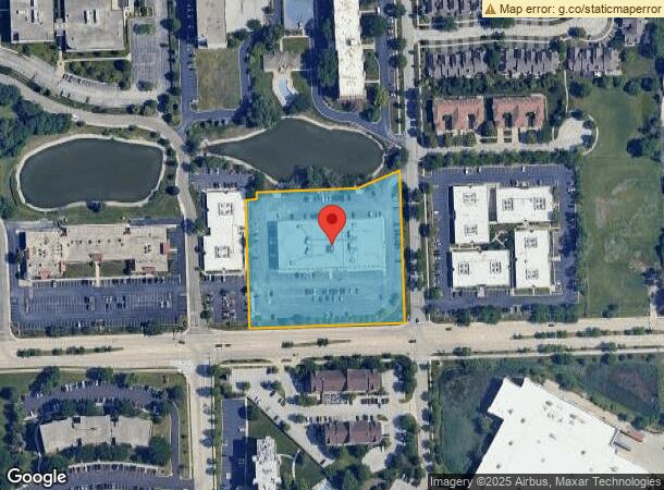
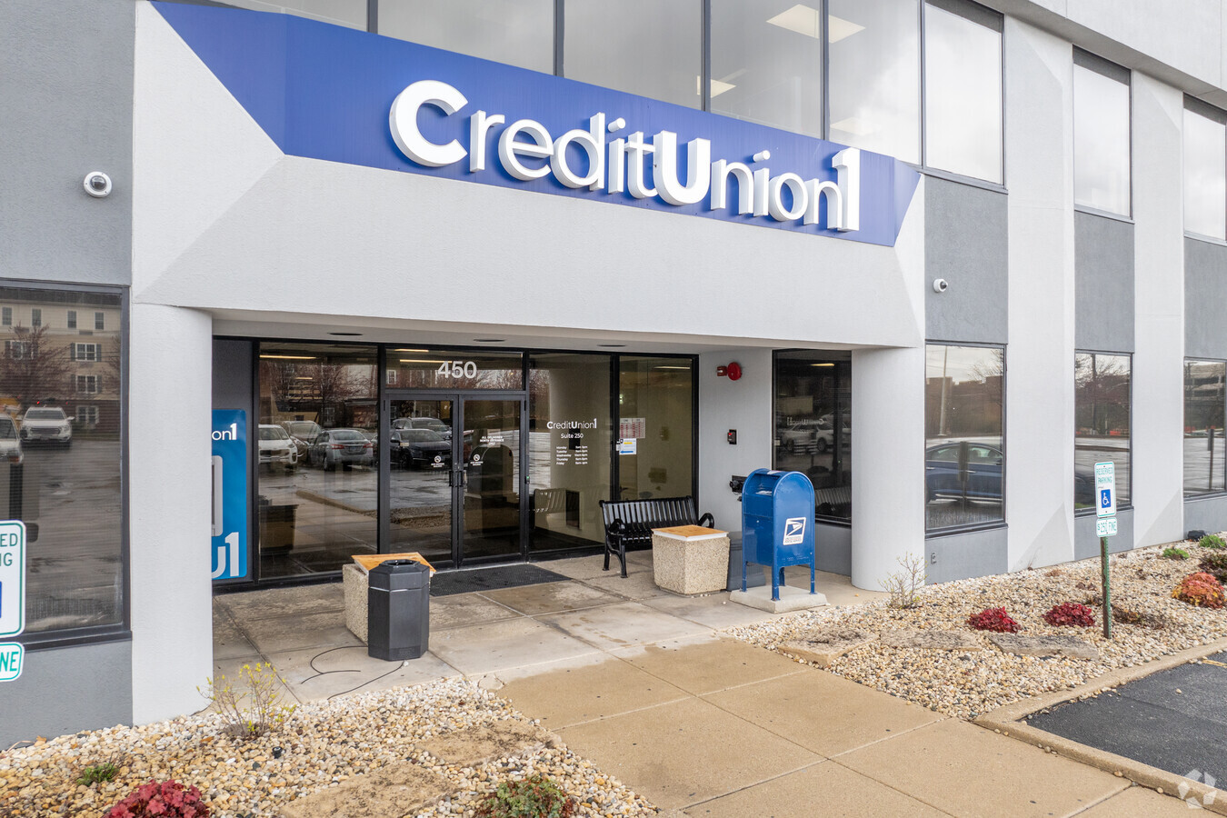
450 E 22Nd St, Lombard, IL 60148
Current Lease Availabilities
NEARBY LISTINGS FOR SALE OR LEASE
Property Detail
450 E 22Nd St
Chicago-Naperville-Elgin, IL-IN-WI
Jay C Bennett Sr Co Clk St Regis Assmt P
06-20-307-018
JAY C BENNETT SR CO CLK ST REGIS ASSMT PLT NO 2 ALL
Commercialnec
DuPage
X
Illinois
17043C0157J
1
2023
3.49 AC
2023
Eastern East/West Corr
844309
Chicago
68,388 SF
DEMOGRAPHICS near 450 E 22Nd St
1 Mile
3 Mile
5 Mile
2024 Total Population
10,627
93,133
267,268
2029 Population
10,579
92,423
264,522
Pop Growth 2024-2029
(0.45%)
(0.76%)
(1.03%)
Average Age
43
42
41
2024 Total Households
5,245
37,213
102,739
HH Growth 2024-2029
(0.29%)
(0.74%)
(1.08%)
Median Household Inc
$73,234
$95,147
$104,804
Avg Household Size
2.00
2.40
2.50
2024 Avg HH Vehicles
2.00
2.00
2.00
Median Home Value
$274,975
$345,958
$394,460
Median Year Built
1993
1971
1970
Nearby Places
- Restaurants
- Banks
- Shops
- Fitness
- Groceries
PUBLIC TRANSPORTATION
COMMUTER RAIL
Lombard Station (Union Pacific West Line - Northeast Illinois Regional Commuter Railroad (Metra))
DRIVE
WALK
Distance
Lombard Station (Union Pacific West Line - Northeast Illinois Regional Commuter Railroad (Metra))
7 min
3.5 mi
Downers Grove Main Street Station (Burlington Northern-Santa Fe Railway Line - Northeast Illinois Regional Commuter Railroad (Metra))
DRIVE
WALK
Distance
Downers Grove Main Street Station (Burlington Northern-Santa Fe Railway Line - Northeast Illinois Regional Commuter Railroad (Metra))
9 min
3.9 mi
AIRPORT
Chicago Midway International
DRIVE
WALK
Distance
Chicago Midway International
29 min
16.5 mi
Chicago O'Hare International
DRIVE
WALK
Distance
Chicago O'Hare International
30 min
18.3 mi
Freight Ports
Port Milwaukee
DRIVE
WALK
Distance
Port Milwaukee
111 min
90.0 mi
Nearby Properties
Address
Land Use
TOTAL SIZE
Lot Size
Zoning
Address
Land Use
TOTAL SIZE
Lot Size
Zoning
588,603 SF
11.92 AC
C
Address
Land Use
TOTAL SIZE
Lot Size
Zoning
345,161 SF
23.37 AC
C
Address
Land Use
TOTAL SIZE
Lot Size
Zoning
Address
Land Use
TOTAL SIZE
Lot Size
Zoning
4.69 AC
Address
Land Use
TOTAL SIZE
Lot Size
Zoning
834,293 SF
40.24 AC
M
Address
Land Use
TOTAL SIZE
Lot Size
Zoning
534,583 SF
16.04 AC
C
Address
Land Use
TOTAL SIZE
Lot Size
Zoning
368,004 SF
5.95 AC
C
Address
Land Use
TOTAL SIZE
Lot Size
Zoning
376,629 SF
16.26 AC
C
Address
Land Use
TOTAL SIZE
Lot Size
Zoning
403,248 SF
24.98 AC
M
Address
Land Use
TOTAL SIZE
Lot Size
Zoning
12.21 AC
Address
Land Use
TOTAL SIZE
Lot Size
Zoning
268,057 SF
5.03 AC
C
Address
Land Use
TOTAL SIZE
Lot Size
Zoning
740,508 SF
9.82 AC
C
Address
Land Use
TOTAL SIZE
Lot Size
Zoning
442,326 SF
12.47 AC
C
Address
Land Use
TOTAL SIZE
Lot Size
Zoning
338,664 SF
11.42 AC
M
Address
Land Use
TOTAL SIZE
Lot Size
Zoning
192,397 SF
20.01 AC
C
Address
Land Use
TOTAL SIZE
Lot Size
Zoning
313,920 SF
13.18 AC
M
Address
Land Use
TOTAL SIZE
Lot Size
Zoning
552,111 SF
4.48 AC
C
Address
Land Use
TOTAL SIZE
Lot Size
Zoning
7.58 AC
Address
Land Use
TOTAL SIZE
Lot Size
Zoning
440,000 SF
5.32 AC
C
Address
Land Use
TOTAL SIZE
Lot Size
Zoning
438,818 SF
5.90 AC
Address
Land Use
TOTAL SIZE
Lot Size
Zoning
299,435 SF
11.16 AC
C
Address
Land Use
TOTAL SIZE
Lot Size
Zoning
227,285 SF
1.75 AC
Address
Land Use
TOTAL SIZE
Lot Size
Zoning
319,650 SF
20.12 AC
M
Address
Land Use
TOTAL SIZE
Lot Size
Zoning
200,237 SF
2.98 AC
C
Address
Land Use
TOTAL SIZE
Lot Size
Zoning
82,535 SF
19.83 AC
C
Address
Land Use
TOTAL SIZE
Lot Size
Zoning
239,756 SF
13.43 AC
M
Address
Land Use
TOTAL SIZE
Lot Size
Zoning
317,925 SF
7.10 AC
M
Address
Land Use
TOTAL SIZE
Lot Size
Zoning
312,210 SF
9.74 AC
C
Address
Land Use
TOTAL SIZE
Lot Size
Zoning
390,000 SF
12.46 AC
C
Address
Land Use
TOTAL SIZE
Lot Size
Zoning
304,092 SF
3.67 AC
C
The World's #1 Commercial Real Estate Marketplace
Connect with us
© 2025 CoStar Group
The information above has been obtained from sources believed reliable. While we do not doubt its accuracy we have not verified it and make no guarantee, warranty or representation about it. It is your responsibility to independently confirm its accuracy and completeness. Any projections, opinions, assumptions, or estimates used are for example only and do not represent the current or future performance of the property. The value of this transaction to you depends on tax and other factors which should be evaluated by your tax, financial, and legal advisors. You and your advisors should conduct a careful, independent investigation of the property to determine to your satisfaction the suitability of the property for your needs.