Property Record
4500 W West Village Pl Se, Smyrna, GA 30080


NEARBY LISTINGS FOR SALE OR LEASE
Property Detail
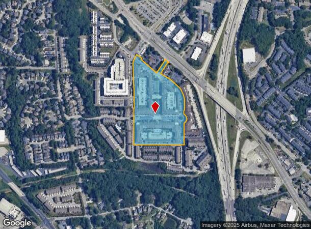
4500 W West Village Pl Se
Apartment
Cobb
X
Georgia
13121C0228F
13.83 AC
2024
Cumberland/Galleria
2024
Atlanta
031215
Atlanta-Sandy Springs-Roswell, GA
726,155 SF
17-0749-0-061-0
DEMOGRAPHICS near 4500 W West Village Pl Se
1 Mile
3 Mile
5 Mile
2024 Total Population
15,048
80,063
205,675
2029 Population
15,401
81,986
210,428
Pop Growth 2024-2029
+ 2.35%
+ 2.40%
+ 2.31%
Average Age
39
38
37
2024 Total Households
7,651
37,694
93,065
HH Growth 2024-2029
+ 2.37%
+ 2.44%
+ 2.30%
Median Household Inc
$115,365
$104,629
$90,326
Avg Household Size
1.90
2.10
2.20
2024 Avg HH Vehicles
2.00
2.00
2.00
Median Home Value
$446,929
$428,210
$389,454
Median Year Built
2000
1995
1989
Nearby Places
- Restaurants
- Banks
- Shops
- Fitness
- Groceries
PUBLIC TRANSPORTATION
COMMUTER RAIL
Atlanta (Crescent - Amtrak)
DRIVE
WALK
Distance
Atlanta (Crescent - Amtrak)
17 min
7.6 mi
AIRPORT
Hartsfield - Jackson Atlanta International
DRIVE
WALK
Distance
Hartsfield - Jackson Atlanta International
31 min
21.1 mi
Freight Ports
Georgia Ports - Savannah
DRIVE
WALK
Distance
Georgia Ports - Savannah
293 min
260.5 mi
Nearby Properties
Address
Land Use
TOTAL SIZE
Lot Size
Zoning
Address
Land Use
TOTAL SIZE
Lot Size
Zoning
3,929,999 SF
32.70 AC
OHR
Address
Land Use
TOTAL SIZE
Lot Size
Zoning
649,754 SF
20.73 AC
PSC/CRC
Address
Land Use
TOTAL SIZE
Lot Size
Zoning
394,294 SF
21.56 AC
OHR
Address
Land Use
TOTAL SIZE
Lot Size
Zoning
560,836 SF
60.28 AC
RM-8
Address
Land Use
TOTAL SIZE
Lot Size
Zoning
914,424 SF
56.61 AC
OI
Address
Land Use
TOTAL SIZE
Lot Size
Zoning
5.36 AC
RRC
Address
Land Use
TOTAL SIZE
Lot Size
Zoning
483,147 SF
29.70 AC
RM-16
Address
Land Use
TOTAL SIZE
Lot Size
Zoning
347,150 SF
19.98 AC
RM-16
Address
Land Use
TOTAL SIZE
Lot Size
Zoning
468,079 SF
31.79 AC
RMR
Address
Land Use
TOTAL SIZE
Lot Size
Zoning
417,453 SF
21.94 AC
RMR
Address
Land Use
TOTAL SIZE
Lot Size
Zoning
452,107 SF
37.95 AC
RM-12
Address
Land Use
TOTAL SIZE
Lot Size
Zoning
424,402 SF
34.46 AC
RM-12
Address
Land Use
TOTAL SIZE
Lot Size
Zoning
2,131 SF
3.57 AC
UVC/WS
Address
Land Use
TOTAL SIZE
Lot Size
Zoning
329,385 SF
15.29 AC
RHR
Address
Land Use
TOTAL SIZE
Lot Size
Zoning
477,544 SF
4.61 AC
MU
Address
Land Use
TOTAL SIZE
Lot Size
Zoning
439,167 SF
41.13 AC
RM-12
Address
Land Use
TOTAL SIZE
Lot Size
Zoning
482,870 SF
23.48 AC
RM-12
Address
Land Use
TOTAL SIZE
Lot Size
Zoning
467,671 SF
4.82 AC
C1
Address
Land Use
TOTAL SIZE
Lot Size
Zoning
480,544 SF
2.36 AC
RRC
Address
Land Use
TOTAL SIZE
Lot Size
Zoning
2.51 AC
Address
Land Use
TOTAL SIZE
Lot Size
Zoning
374,698 SF
30.72 AC
RM-12
Address
Land Use
TOTAL SIZE
Lot Size
Zoning
115 AC
I2
Address
Land Use
TOTAL SIZE
Lot Size
Zoning
451,481 SF
4.02 AC
UVC/WS
Address
Land Use
TOTAL SIZE
Lot Size
Zoning
651,741 SF
3.66 AC
OI
Address
Land Use
TOTAL SIZE
Lot Size
Zoning
263,676 SF
15.70 AC
RM-12
Address
Land Use
TOTAL SIZE
Lot Size
Zoning
403,687 SF
42.37 AC
RM-12
Address
Land Use
TOTAL SIZE
Lot Size
Zoning
967,515 SF
6.81 AC
OI
Address
Land Use
TOTAL SIZE
Lot Size
Zoning
504,744 SF
44.36 AC
RM-12
Address
Land Use
TOTAL SIZE
Lot Size
Zoning
3.25 AC
MU
The World's #1 Commercial Real Estate Marketplace
Connect with us
© 2025 CoStar Group
The information above has been obtained from sources believed reliable. While we do not doubt its accuracy we have not verified it and make no guarantee, warranty or representation about it. It is your responsibility to independently confirm its accuracy and completeness. Any projections, opinions, assumptions, or estimates used are for example only and do not represent the current or future performance of the property. The value of this transaction to you depends on tax and other factors which should be evaluated by your tax, financial, and legal advisors. You and your advisors should conduct a careful, independent investigation of the property to determine to your satisfaction the suitability of the property for your needs.