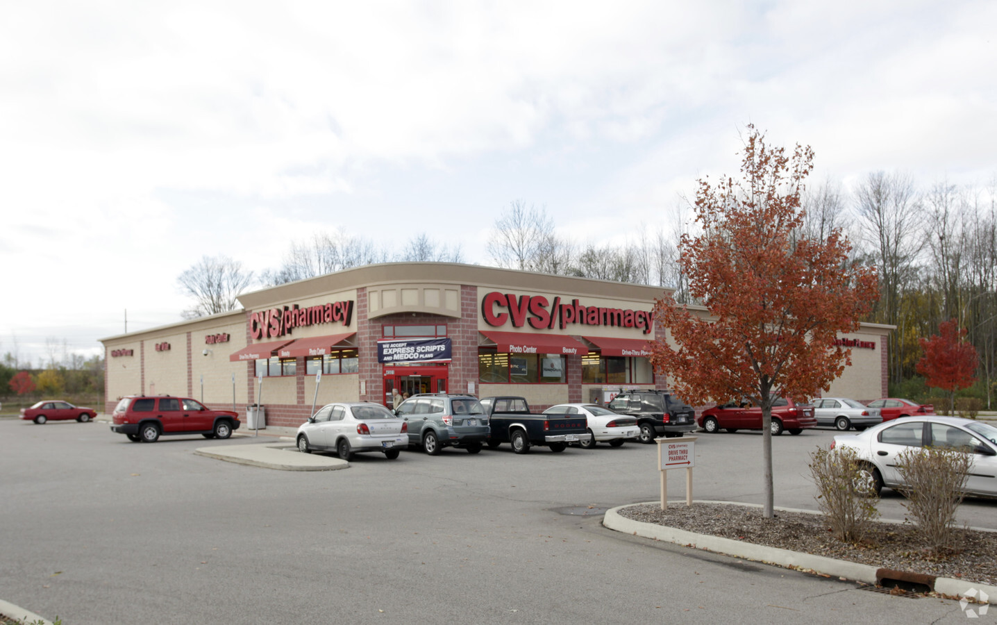
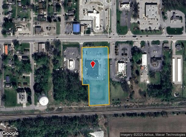
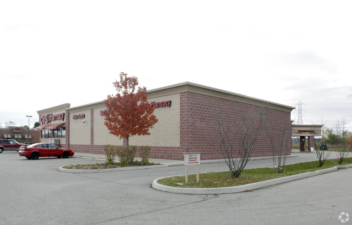
Property Record
4501 Lincolnway E, Mishawaka, IN 46544
NEARBY LISTINGS FOR SALE OR LEASE
Property Detail
4501 Lincolnway E
South Bend-Mishawaka, IN-MI
Oakland First Add
71-10-18-179-011.000-023
LOT 1 OAKLAND FIRST ADD 1ST RP NP # 5206 7/28/09
Storebuilding
St Joseph
X
Indiana
18141C0236E
1
2022
2.95 AC
2023
Mishawaka
010500
South Bend/Mishawaka
14,908 SF
DEMOGRAPHICS near 4501 Lincolnway E
1 Mile
3 Mile
5 Mile
2024 Total Population
4,722
29,995
84,837
2029 Population
4,662
29,622
84,238
Pop Growth 2024-2029
(1.27%)
(1.24%)
(0.71%)
Average Age
40
40
39
2024 Total Households
1,899
11,682
35,274
HH Growth 2024-2029
(1.37%)
(1.33%)
(0.65%)
Median Household Inc
$70,663
$71,028
$60,166
Avg Household Size
2.40
2.50
2.30
2024 Avg HH Vehicles
2.00
2.00
2.00
Median Home Value
$172,105
$169,761
$161,123
Median Year Built
1972
1972
1973
Nearby Places
- Restaurants
- Banks
- Shops
- Fitness
- Groceries
PUBLIC TRANSPORTATION
COMMUTER RAIL
Elkhart Amtrak Station (Capitol Limited - Amtrak, Lake Shore Limited - Amtrak)
DRIVE
WALK
Distance
Elkhart Amtrak Station (Capitol Limited - Amtrak, Lake Shore Limited - Amtrak)
13 min
7.6 mi
AIRPORT
South Bend International
DRIVE
WALK
Distance
South Bend International
31 min
14.3 mi
Freight Ports
Port Milwaukee
DRIVE
WALK
Distance
Port Milwaukee
228 min
190.3 mi
Nearby Properties
Address
Land Use
TOTAL SIZE
Lot Size
Zoning
Address
Land Use
TOTAL SIZE
Lot Size
Zoning
653,141 SF
32.18 AC
Address
Land Use
TOTAL SIZE
Lot Size
Zoning
36,851 SF
22.72 AC
Address
Land Use
TOTAL SIZE
Lot Size
Zoning
623,232 SF
74.18 AC
Address
Land Use
TOTAL SIZE
Lot Size
Zoning
389,851 SF
23.89 AC
Address
Land Use
TOTAL SIZE
Lot Size
Zoning
270,962 SF
27.20 AC
Address
Land Use
TOTAL SIZE
Lot Size
Zoning
120,513 SF
7.92 AC
Address
Land Use
TOTAL SIZE
Lot Size
Zoning
261,621 SF
23.42 AC
Address
Land Use
TOTAL SIZE
Lot Size
Zoning
66,953 SF
8.59 AC
Address
Land Use
TOTAL SIZE
Lot Size
Zoning
35,066 SF
3.16 AC
Address
Land Use
TOTAL SIZE
Lot Size
Zoning
198,582 SF
10.37 AC
Address
Land Use
TOTAL SIZE
Lot Size
Zoning
295,683 SF
21.32 AC
Address
Land Use
TOTAL SIZE
Lot Size
Zoning
226,496 SF
25.73 AC
Address
Land Use
TOTAL SIZE
Lot Size
Zoning
57,293 SF
15 AC
Address
Land Use
TOTAL SIZE
Lot Size
Zoning
149,944 SF
16.81 AC
Address
Land Use
TOTAL SIZE
Lot Size
Zoning
113,605 SF
10.33 AC
Address
Land Use
TOTAL SIZE
Lot Size
Zoning
61,599 SF
6.66 AC
Address
Land Use
TOTAL SIZE
Lot Size
Zoning
47,240 SF
6.66 AC
Address
Land Use
TOTAL SIZE
Lot Size
Zoning
49,623 SF
4.04 AC
Address
Land Use
TOTAL SIZE
Lot Size
Zoning
30,470 SF
20 AC
Address
Land Use
TOTAL SIZE
Lot Size
Zoning
42,500 SF
1.93 AC
Address
Land Use
TOTAL SIZE
Lot Size
Zoning
18.87 AC
Address
Land Use
TOTAL SIZE
Lot Size
Zoning
146,084 SF
10.73 AC
Address
Land Use
TOTAL SIZE
Lot Size
Zoning
8,400 SF
106 AC
Address
Land Use
TOTAL SIZE
Lot Size
Zoning
30,344 SF
7.94 AC
Address
Land Use
TOTAL SIZE
Lot Size
Zoning
41,680 SF
3.62 AC
Address
Land Use
TOTAL SIZE
Lot Size
Zoning
61,384 SF
5.62 AC
Address
Land Use
TOTAL SIZE
Lot Size
Zoning
75,000 SF
5.10 AC
Address
Land Use
TOTAL SIZE
Lot Size
Zoning
68,550 SF
10.37 AC
Address
Land Use
TOTAL SIZE
Lot Size
Zoning
32,756 SF
4.93 AC
Address
Land Use
TOTAL SIZE
Lot Size
Zoning
68,772 SF
7 AC
The World's #1 Commercial Real Estate Marketplace
Connect with us
© 2025 CoStar Group
The information above has been obtained from sources believed reliable. While we do not doubt its accuracy we have not verified it and make no guarantee, warranty or representation about it. It is your responsibility to independently confirm its accuracy and completeness. Any projections, opinions, assumptions, or estimates used are for example only and do not represent the current or future performance of the property. The value of this transaction to you depends on tax and other factors which should be evaluated by your tax, financial, and legal advisors. You and your advisors should conduct a careful, independent investigation of the property to determine to your satisfaction the suitability of the property for your needs.