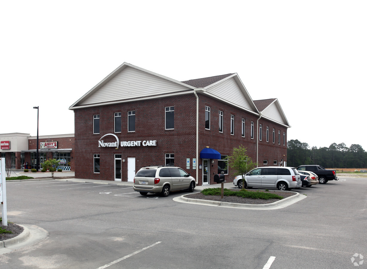
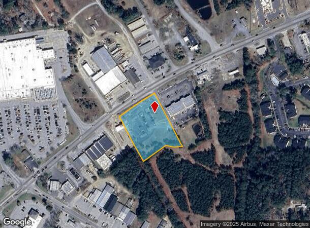
Property Record
4503 Main St, Shallotte, NC 28470
NEARBY LISTINGS FOR SALE OR LEASE
-
-
View all Shallotte listings for lease on LoopNet.com
Property Detail
4503 Main St
Myrtle Beach-Conway-North Myrtle Beach, SC-NC
Recombination Map
1820013901
L-2 2.04 ACRES PL 28/119 US HWY 17 BUS
Medicalbuilding
Brunswick
X
North Carolina
3720109800K
2
2023
2.04 AC
2024
West Brunswick
020404
Wilmington
9,588 SF
DEMOGRAPHICS near 4503 Main St
1 Mile
3 Mile
5 Mile
2024 Total Population
1,682
7,060
16,425
2029 Population
2,150
9,026
21,288
Pop Growth 2024-2029
+ 27.82%
+ 27.85%
+ 29.61%
Average Age
42
44
45
2024 Total Households
680
2,904
6,976
HH Growth 2024-2029
+ 27.65%
+ 27.69%
+ 29.59%
Median Household Inc
$52,941
$54,934
$48,694
Avg Household Size
2.30
2.30
2.30
2024 Avg HH Vehicles
2.00
2.00
2.00
Median Home Value
$185,713
$221,242
$186,070
Median Year Built
1997
1994
1993
Nearby Places
- Restaurants
- Banks
- Shops
- Fitness
- Groceries
SALE & LEASE HISTORY
LISTING DATE
SALE/LEASE

May 11, 2022
For Lease
Nearby Properties
Address
Land Use
TOTAL SIZE
Lot Size
Zoning
Address
Land Use
TOTAL SIZE
Lot Size
Zoning
188,832 SF
54.14 AC
HB
Address
Land Use
TOTAL SIZE
Lot Size
Zoning
117,289 SF
60.11 AC
HB
Address
Land Use
TOTAL SIZE
Lot Size
Zoning
152,873 SF
22.53 AC
HB
Address
Land Use
TOTAL SIZE
Lot Size
Zoning
63,093 SF
19.15 AC
HB
Address
Land Use
TOTAL SIZE
Lot Size
Zoning
2,090 SF
11.18 AC
HB
Address
Land Use
TOTAL SIZE
Lot Size
Zoning
6,596 SF
9 AC
MF14
Address
Land Use
TOTAL SIZE
Lot Size
Zoning
156,048 SF
19.88 AC
HB
Address
Land Use
TOTAL SIZE
Lot Size
Zoning
135,622 SF
16.65 AC
HB
Address
Land Use
TOTAL SIZE
Lot Size
Zoning
8,240 SF
5.59 AC
R10
Address
Land Use
TOTAL SIZE
Lot Size
Zoning
33,954 SF
4.40 AC
HB
Address
Land Use
TOTAL SIZE
Lot Size
Zoning
8,010 SF
4.55 AC
R10
Address
Land Use
TOTAL SIZE
Lot Size
Zoning
108,500 SF
11.59 AC
HB
Address
Land Use
TOTAL SIZE
Lot Size
Zoning
48,536 SF
7.70 AC
HB
Address
Land Use
TOTAL SIZE
Lot Size
Zoning
8,112 SF
2.15 AC
HB
Address
Land Use
TOTAL SIZE
Lot Size
Zoning
27,598 SF
1.91 AC
HB
Address
Land Use
TOTAL SIZE
Lot Size
Zoning
24,646 SF
10.25 AC
HB
Address
Land Use
TOTAL SIZE
Lot Size
Zoning
42,817 SF
4.61 AC
MF10
Address
Land Use
TOTAL SIZE
Lot Size
Zoning
26,036 SF
10.75 AC
R15
Address
Land Use
TOTAL SIZE
Lot Size
Zoning
31,476 SF
3.26 AC
HB
Address
Land Use
TOTAL SIZE
Lot Size
Zoning
12,338 SF
3.19 AC
CB
Address
Land Use
TOTAL SIZE
Lot Size
Zoning
40,599 SF
15 AC
HB
Address
Land Use
TOTAL SIZE
Lot Size
Zoning
11,908 SF
5.67 AC
R15
Address
Land Use
TOTAL SIZE
Lot Size
Zoning
45,000 SF
3.64 AC
HB
Address
Land Use
TOTAL SIZE
Lot Size
Zoning
36,883 SF
56.98 AC
MF10
Address
Land Use
TOTAL SIZE
Lot Size
Zoning
9,136 SF
5 AC
HB
Address
Land Use
TOTAL SIZE
Lot Size
Zoning
24,084 SF
1.85 AC
B2
Address
Land Use
TOTAL SIZE
Lot Size
Zoning
28.49 AC
HB
Address
Land Use
TOTAL SIZE
Lot Size
Zoning
29,804 SF
3.16 AC
HB
Address
Land Use
TOTAL SIZE
Lot Size
Zoning
14,736 SF
1.85 AC
HB
Address
Land Use
TOTAL SIZE
Lot Size
Zoning
13,072 SF
10.39 AC
SHHB
The World's #1 Commercial Real Estate Marketplace
Connect with us
© 2025 CoStar Group
The information above has been obtained from sources believed reliable. While we do not doubt its accuracy we have not verified it and make no guarantee, warranty or representation about it. It is your responsibility to independently confirm its accuracy and completeness. Any projections, opinions, assumptions, or estimates used are for example only and do not represent the current or future performance of the property. The value of this transaction to you depends on tax and other factors which should be evaluated by your tax, financial, and legal advisors. You and your advisors should conduct a careful, independent investigation of the property to determine to your satisfaction the suitability of the property for your needs.