Property Record
4503 Mccourt Rd, Altoona, AL 35952
NEARBY LISTINGS FOR SALE OR LEASE
Property Detail
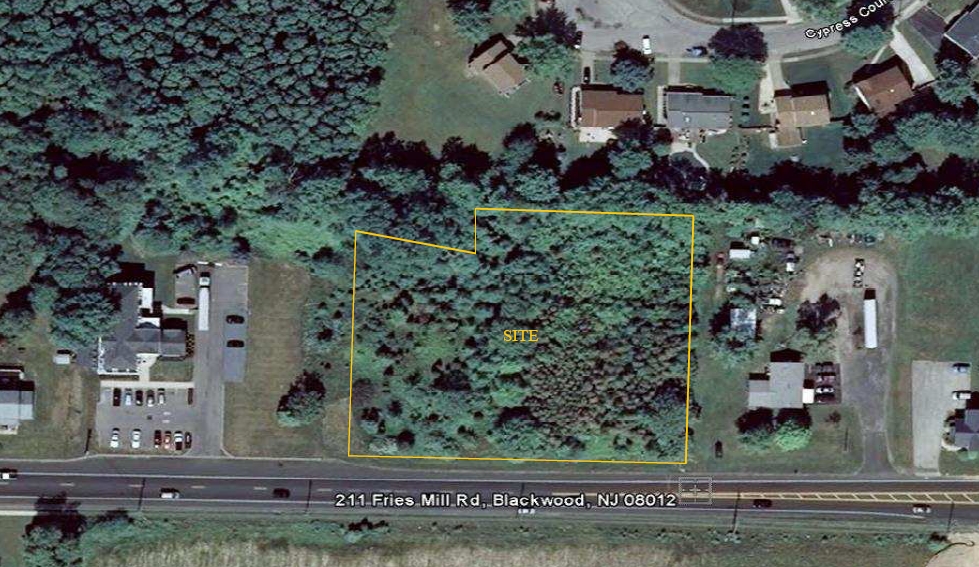
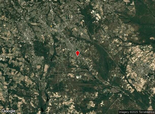
4503 Mccourt Rd
Philadelphia-Camden-Wilmington, PA-NJ-DE-MD
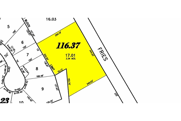
SUB OF 17 & 16.04
18-00116-37-00017-01
Gloucester
Vacantlandnec
New Jersey
X
17.1
34015C0206E
1.85 AC
2023
Gloucester County
2024
Philadelphia
501606
DEMOGRAPHICS near 4503 Mccourt Rd
1 Mile
3 Mile
5 Mile
2024 Total Population
7,611
58,397
165,779
2029 Population
7,859
59,825
169,449
Pop Growth 2024-2029
+ 3.26%
+ 2.45%
+ 2.21%
Average Age
42
41
40
2024 Total Households
2,879
20,977
59,031
HH Growth 2024-2029
+ 3.40%
+ 2.58%
+ 2.33%
Median Household Inc
$88,780
$111,125
$93,591
Avg Household Size
2.60
2.70
2.60
2024 Avg HH Vehicles
2.00
2.00
2.00
Median Home Value
$299,738
$269,199
$254,429
Median Year Built
1984
1983
1982
Nearby Places
- Restaurants
- Banks
- Shops
- Fitness
- Groceries
PUBLIC TRANSPORTATION
AIRPORT
Philadelphia International
DRIVE
WALK
Distance
Philadelphia International
47 min
29.7 mi
Atlantic City International
DRIVE
WALK
Distance
Atlantic City International
62 min
33.0 mi
Freight Ports
Broadway Terminal - Pier 5
DRIVE
WALK
Distance
Broadway Terminal - Pier 5
31 min
21.2 mi
Nearby Properties
Address
Land Use
TOTAL SIZE
Lot Size
Zoning
Address
Land Use
TOTAL SIZE
Lot Size
Zoning
46.45 AC
RGMR
Address
Land Use
TOTAL SIZE
Lot Size
Zoning
74.69 AC
RGMR
Address
Land Use
TOTAL SIZE
Lot Size
Zoning
Address
Land Use
TOTAL SIZE
Lot Size
Zoning
25.89 AC
RGPR
Address
Land Use
TOTAL SIZE
Lot Size
Zoning
19.53 AC
R2
Address
Land Use
TOTAL SIZE
Lot Size
Zoning
1 SF
19.71 AC
CC
Address
Land Use
TOTAL SIZE
Lot Size
Zoning
9.76 AC
R2
Address
Land Use
TOTAL SIZE
Lot Size
Zoning
29.50 AC
FD10
Address
Land Use
TOTAL SIZE
Lot Size
Zoning
7.69 AC
RG30
Address
Land Use
TOTAL SIZE
Lot Size
Zoning
10.98 AC
RGPR
Address
Land Use
TOTAL SIZE
Lot Size
Zoning
11.46 AC
RGPR
Address
Land Use
TOTAL SIZE
Lot Size
Zoning
2.80 AC
RG30
Address
Land Use
TOTAL SIZE
Lot Size
Zoning
12.20 AC
CC
Address
Land Use
TOTAL SIZE
Lot Size
Zoning
0.92 AC
RGTC
Address
Land Use
TOTAL SIZE
Lot Size
Zoning
4.06 AC
RG40
Address
Land Use
TOTAL SIZE
Lot Size
Zoning
Address
Land Use
TOTAL SIZE
Lot Size
Zoning
5.30 AC
RGPR
Address
Land Use
TOTAL SIZE
Lot Size
Zoning
13.48 AC
RGPR
Address
Land Use
TOTAL SIZE
Lot Size
Zoning
2.13 AC
RGTC
Address
Land Use
TOTAL SIZE
Lot Size
Zoning
26.73 AC
BP
Address
Land Use
TOTAL SIZE
Lot Size
Zoning
Address
Land Use
TOTAL SIZE
Lot Size
Zoning
10.62 AC
FD10
Address
Land Use
TOTAL SIZE
Lot Size
Zoning
7.51 AC
RGPR
Address
Land Use
TOTAL SIZE
Lot Size
Zoning
6.85 AC
R2
Address
Land Use
TOTAL SIZE
Lot Size
Zoning
9,981 SF
2.11 AC
CC
Address
Land Use
TOTAL SIZE
Lot Size
Zoning
2.45 AC
CC
Address
Land Use
TOTAL SIZE
Lot Size
Zoning
28.53 AC
RGNC
Address
Land Use
TOTAL SIZE
Lot Size
Zoning
2.30 AC
RG40
Address
Land Use
TOTAL SIZE
Lot Size
Zoning
6.97 AC
CC
Address
Land Use
TOTAL SIZE
Lot Size
Zoning
4,883 SF
18.55 AC
AG
The World's #1 Commercial Real Estate Marketplace
Connect with us
© 2025 CoStar Group
The information above has been obtained from sources believed reliable. While we do not doubt its accuracy we have not verified it and make no guarantee, warranty or representation about it. It is your responsibility to independently confirm its accuracy and completeness. Any projections, opinions, assumptions, or estimates used are for example only and do not represent the current or future performance of the property. The value of this transaction to you depends on tax and other factors which should be evaluated by your tax, financial, and legal advisors. You and your advisors should conduct a careful, independent investigation of the property to determine to your satisfaction the suitability of the property for your needs.